 |
|
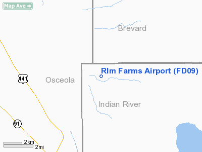
Location
& QuickFacts
|
FAA Information Effective: |
2007-01-18 |
|
Airport
Identifier: |
FD09 |
|
Airport
Status: |
Operational |
|
Longitude/Latitude: |
080-51-32.2170W/27-48-36.0960N
-80.858949/27.810027 (Estimated) |
|
Elevation: |
75 ft / 22.86 m (Estimated) |
|
Land: |
0 acres |
|
From
nearest city: |
7 nautical miles E of Kenansville, FL |
|
Location: |
Indian River County, FL |
|
Magnetic Variation: |
03W (1985) |
Owner
& Manager
|
Ownership: |
Privately owned |
|
Owner: |
Rlm Farms, Inc |
|
Address: |
Po Box 397
Belle Glade, FL 33430 |
|
Manager: |
James Hopper |
|
Address: |
Po Box 397
Kenansville, FL 33430 |
|
Phone number: |
407-724-9094 |
Airport
Operations and Facilities
|
Airport Use: |
Private |
|
Wind
indicator: |
Yes |
|
Segmented
Circle: |
No |
|
Control
Tower: |
No |
|
Sectional
chart: |
Miami |
|
Region: |
ASO - Southern |
|
Boundary
ARTCC: |
ZMA - Miami |
|
Tie-in
FSS: |
PIE - Saint Petersburg |
|
FSS
Toll Free: |
1-800-WX-BRIEF |
|
Runway
Information
Runway N/S
|
Dimension: |
3000 x 60 ft / 914.4 x 18.3 m |
|
Surface: |
TURF, |
|
|
Runway N |
Runway S |
|
Traffic
Pattern: |
Left |
Left |
|
Radio Navigation
Aids
|
ID |
Type |
Name |
Ch |
Freq |
Var |
Dist |
|
SQT |
NDB |
Satellite |
|
257.00 |
03W |
19.3 nm |
|
VEP |
NDB |
Vero Beach |
|
392.00 |
04W |
25.0 nm |
|
FPR |
NDB |
Fort Pierce |
|
275.00 |
04W |
32.3 nm |
|
COI |
NDB |
Merritt Island |
|
247.00 |
05W |
33.2 nm |
|
ISM |
NDB |
Kissimmee |
|
329.00 |
05W |
42.0 nm |
|
GGL |
NDB |
Geiger Lake |
|
375.00 |
05W |
47.1 nm |
|
COF |
TACAN |
Patrick |
097X |
|
04W |
28.9 nm |
|
TTS |
TACAN |
Kennedy Space Center |
059Y |
|
00E |
49.8 nm |
|
MLB |
VOR/DME |
Melbourne |
037X |
110.00 |
02W |
21.4 nm |
|
VRB |
VORTAC |
Vero Beach |
120X |
117.30 |
04W |
21.2 nm |
|
VRB |
VOT |
Vero Beach |
|
111.00 |
|
25.3 nm |
Remarks
Based
Aircraft
|
Aircraft
based on field: |
1 |
|
Multi
Engine Airplanes: |
1 |
Rlm Farms Airport
Address:
Indian River County, FL
Tel:
407-724-9094
Images
and information placed above are from
http://www.airport-data.com/airport/FD09/
We
thank them for the data!
| General
Info |
| Country |
United
States |
| State |
FLORIDA
|
| FAA ID |
FD09
|
| Latitude |
27-48-36.096N
|
| Longitude |
080-51-32.217W
|
| Elevation |
75 feet
|
| Near City |
KENANSVILLE
|
We don't guarantee the information is fresh and accurate. The data may
be wrong or outdated.
For more up-to-date information please refer to other sources.
|
|


