 |
|
|
|
|
|
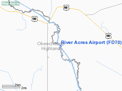
Location
& QuickFacts
|
FAA Information Effective: |
2007-01-18 |
|
Airport
Identifier: |
FD70 |
|
Airport
Status: |
Operational |
|
Longitude/Latitude: |
081-01-43.2340W/27-19-31.1550N
-81.028676/27.325321 (Estimated) |
|
Elevation: |
30 ft / 9.14 m (Estimated) |
|
Land: |
0 acres |
|
From
nearest city: |
11 nautical miles NW of Okeechobee, FL |
|
Location: |
Okeechobee County, FL |
|
Magnetic Variation: |
03W (1985) |
Owner
& Manager
|
Ownership: |
Privately owned |
|
Owner: |
R. A. Airport, Inc
ROBERT J. HALL, TREAS & V.P.; PEGGY J. HALL, SECY, 863-763-6715. |
|
Address: |
19840 Nw 94th Dr
Okeechobee, FL 34972 |
|
Phone
number: |
863-763-6715 |
|
Manager: |
George Williams |
|
Address: |
19840 Nw 94th Dr
Okeechobee, FL 34972 |
|
Phone number: |
863-467-0038 |
Airport
Operations and Facilities
|
Airport Use: |
Private |
|
Wind
indicator: |
Yes
WIND TETRAHEDRON N END; WINDSOCK. |
|
Segmented
Circle: |
No |
|
Control
Tower: |
No |
|
Lighting
Schedule: |
RDO-CTL
ACTVT LIRL RY 15/33 - 122.900. |
|
Sectional
chart: |
Miami |
|
Region: |
ASO - Southern |
|
Boundary
ARTCC: |
ZMA - Miami |
|
Tie-in
FSS: |
PIE - Saint Petersburg |
|
FSS
Toll Free: |
1-800-WX-BRIEF |
|
Runway Information
Runway 15/33
|
Dimension: |
3875 x 66 ft / 1181.1 x 20.1 m |
|
Surface: |
TURF, |
|
Edge
Lights: |
Low |
|
|
Runway 15 |
Runway 33 |
|
Traffic
Pattern: |
Left |
Left |
|
Radio Navigation
Aids
|
ID |
Type |
Name |
Ch |
Freq |
Var |
Dist |
|
FPR |
NDB |
Fort Pierce |
|
275.00 |
04W |
36.3 nm |
|
VEP |
NDB |
Vero Beach |
|
392.00 |
04W |
38.3 nm |
|
UTX |
NDB |
United |
|
405.00 |
03W |
44.8 nm |
|
CHN |
NDB |
Wauchula |
|
261.00 |
04W |
46.9 nm |
|
SQT |
NDB |
Satellite |
|
257.00 |
03W |
49.7 nm |
|
LBV |
VORTAC |
La Belle |
041X |
110.40 |
01E |
35.6 nm |
|
VRB |
VORTAC |
Vero Beach |
120X |
117.30 |
04W |
35.7 nm |
|
PHK |
VORTAC |
Pahokee |
101X |
115.40 |
00E |
37.3 nm |
|
VRB |
VOT |
Vero Beach |
|
111.00 |
|
38.2 nm |
Remarks
River Acres Airport
Address:
Okeechobee County, FL
Tel:
863-763-6715,
863-467-0038
Images
and information placed above are from
http://www.airport-data.com/airport/FD70/
We
thank them for the data!
| General
Info |
| Country |
United
States |
| State |
FLORIDA
|
| FAA ID |
FD70
|
| Latitude |
27-19-31.155N
|
| Longitude |
081-01-43.234W
|
| Elevation |
30 feet
|
| Near City |
OKEECHOBEE
|
We don't guarantee the information is fresh and accurate. The data may
be wrong or outdated.
For more up-to-date information please refer to other sources.
|
|


