 |
|
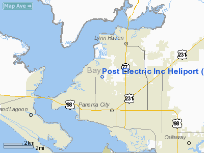
Post Electric Incorporated Heliport |
Location & QuickFacts
|
FAA
Information Effective: |
2007-01-18 |
|
Airport Identifier: |
FA20 |
|
Airport Status: |
Operational |
|
Longitude/Latitude: |
085-40-32.7420W/30-12-28.7230N
-85.675762/30.207979 (Estimated) |
|
Elevation: |
10
ft / 3.05 m (Estimated) |
|
Land: |
0
acres |
|
From nearest
city: |
1 nautical miles NE of Panama City, FL |
|
Location: |
Bay County, FL |
|
Magnetic
Variation: |
01W (1990) |
Owner & Manager
|
Ownership: |
Privately
owned |
|
Owner: |
W.c.
Rogers |
|
Address: |
3221 West Hwy 390
Panama City, FL 32405 |
|
Phone number: |
904-763-7546 |
|
Manager: |
W.c.
Rogers |
|
Address: |
3221 West Hwy 390
Panama City, FL 32405 |
|
Phone
number: |
904-763-7546 |
Airport Operations
and Facilities
|
Airport
Use: |
Private |
|
Wind indicator: |
Yes |
|
Segmented
Circle: |
No |
|
Control Tower: |
No |
|
Sectional
chart: |
New
Orleans |
|
Region: |
ASO
- Southern |
|
Boundary
ARTCC: |
ZJX
- Jacksonville |
|
Tie-in FSS: |
GNV
- Gainesville |
|
FSS on Airport: |
No |
|
FSS Phone: |
850-377-3291 |
|
FSS Toll
Free: |
1-800-WX-BRIEF |
|
Runway Information
Helipad H1
|
Dimension: |
20 x 20 ft / 6.1
x 6.1 m |
|
Surface: |
CONC,
|
|
|
Runway H1 |
Runway |
|
Traffic Pattern: |
Left |
Left |
|
Radio Navigation Aids
|
ID |
Type |
Name |
Ch |
Freq |
Var |
Dist |
|
BKK |
NDB |
Tri
County |
|
275.00 |
02W |
38.9
nm |
|
DTS |
NDB |
Destin |
|
254.00 |
01W |
43.1
nm |
|
AAF |
NDB |
Apalachicola |
|
349.00 |
02W |
44.6
nm |
|
SMY |
NDB |
Soyya |
|
329.00 |
02W |
46.2
nm |
|
PAM |
TACAN |
Tyndall |
124X |
|
00W |
9.7
nm |
|
DWG |
TACAN |
Warrington |
002X |
|
00E |
46.7
nm |
|
FYL |
VOR |
Tri
County |
|
108.40 |
08W |
38.3
nm |
|
PFN |
VORTAC |
Panama City |
090X |
114.30 |
00W |
0.6
nm |
|
MAI |
VORTAC |
Marianna |
087X |
114.00 |
00E |
45.0
nm |
Remarks
- VFR;
PRIVATE USE; OPNS CONDUCTED FM 110 DEG TO 320 DEG; AREA IS MKD; WIND
INDICATOR IS MAINTAINED.
Based Aircraft
|
Aircraft
based on field: |
1 |
|
Helicopters: |
1 |
Post Electric Incorporated Heliport
Address:
Bay County, FL
Tel:
904-763-7546
Images
and information placed above are from
http://www.airport-data.com/airport/FA20/
We
thank them for the data!
| General
Info |
| Country |
United
States |
| State |
FLORIDA
|
| FAA ID |
FA20
|
| Latitude |
30-12-28.723N
|
| Longitude |
085-40-32.742W
|
| Elevation |
10 feet
|
| Near City |
PANAMA
CITY |
We don't guarantee the information is fresh and accurate. The data may
be wrong or outdated.
For more up-to-date information please refer to other sources.
|
|


