 |
|
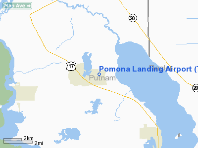
Location
& QuickFacts
|
FAA Information Effective: |
2007-01-18 |
|
Airport
Identifier: |
78FL |
|
Airport
Status: |
Operational |
|
Longitude/Latitude: |
081-34-42.2700W/29-30-07.8900N
-81.578408/29.502192 (Estimated) |
|
Elevation: |
50 ft / 15.24 m (Estimated) |
|
Land: |
0 acres |
|
From
nearest city: |
1 nautical miles W of Pomona Park, FL |
|
Location: |
Putnam County, FL |
|
Magnetic Variation: |
04W (1995) |
Owner
& Manager
|
Ownership: |
Privately owned |
|
Owner: |
Serenity Farms Properties Llc |
|
Address: |
119 Pomona Landing Road
Pomona Park, FL 32181 |
|
Phone
number: |
386-546-4466 |
|
Manager: |
R. Warren |
|
Address: |
119 Pomona Landing Road
Pomona Park, FL 32181 |
|
Phone number: |
386-546-4466 |
Airport
Operations and Facilities
|
Airport Use: |
Private |
|
Wind
indicator: |
Yes |
|
Segmented
Circle: |
No |
|
Control
Tower: |
No |
|
Sectional
chart: |
Jacksonville |
|
Region: |
ASO - Southern |
|
Boundary
ARTCC: |
ZJX - Jacksonville |
|
Tie-in
FSS: |
GNV - Gainesville |
|
FSS
Phone: |
850-377-3291 |
|
FSS
Toll Free: |
1-800-WX-BRIEF |
|
Runway Information
Runway 02/20
|
Dimension: |
2760 x 100 ft / 841.2 x 30.5 m |
|
Surface: |
TURF, |
|
|
Runway 02 |
Runway 20 |
|
Traffic
Pattern: |
Left |
Left |
|
Displaced
threshold: |
800.00 ft |
800.00 ft |
|
Obstruction: |
40 ft trees, 100.0 ft from runway |
40 ft trees, 80.0 ft from runway |
|
Radio Navigation
Aids
|
ID |
Type |
Name |
Ch |
Freq |
Var |
Dist |
|
IAK |
NDB |
Palatka |
|
243.00 |
05W |
15.2 nm |
|
DED |
NDB |
Deland/dcmsnd |
|
201.00 |
05W |
30.6 nm |
|
GN |
NDB |
Wynds |
|
269.00 |
04W |
32.6 nm |
|
LEE |
NDB |
Leesburg |
|
335.00 |
04W |
42.8 nm |
|
EVB |
NDB |
New Smyrna Beach |
|
417.00 |
04W |
42.9 nm |
|
SFB |
NDB |
Sanford |
|
408.00 |
05W |
46.6 nm |
|
HEG |
NDB |
Herlong |
|
332.00 |
02W |
48.1 nm |
|
NIP |
TACAN |
Jacksonville |
19X |
|
04W |
44.3 nm |
|
NZC |
TACAN |
Cecil/dcmsnd |
088X |
|
04W |
45.8 nm |
|
VQQ |
VOR |
Cecil |
|
117.90 |
03W |
45.7 nm |
|
SGJ |
VOR/DME |
St Augustine |
031X |
109.40 |
06W |
30.2 nm |
|
OMN |
VORTAC |
Ormond Beach |
073X |
112.60 |
00E |
27.2 nm |
|
GNV |
VORTAC |
Gators |
109X |
116.20 |
04W |
38.1 nm |
|
OCF |
VORTAC |
Ocala |
084X |
113.70 |
00E |
39.2 nm |
|
DAB |
VOT |
Daytona Beach |
|
111.00 |
|
33.5 nm |
Remarks
Based
Aircraft
|
Aircraft
based on field: |
4 |
|
Single
Engine Airplanes: |
2 |
|
Ultralights: |
2 |
Pomona Landing Airport
Address:
Putnam County, FL
Tel:
386-546-4466
Images
and information placed above are from
http://www.airport-data.com/airport/78FL/
We
thank them for the data!
| General
Info |
| Country |
United
States |
| State |
FLORIDA
|
| FAA ID |
78FL
|
| Latitude |
29-30-07.890N
|
| Longitude |
081-34-42.270W
|
| Elevation |
50 feet
|
| Near City |
POMONA
PARK |
We don't guarantee the information is fresh and accurate. The data may
be wrong or outdated.
For more up-to-date information please refer to other sources.
|
|


