 |
|
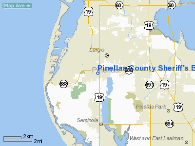
Pinellas County Sheriff's Building Heliport |
Location
& QuickFacts
|
FAA Information Effective: |
2007-01-18 |
|
Airport
Identifier: |
FA06 |
|
Airport
Status: |
Operational |
|
Longitude/Latitude: |
082-47-21.3680W/27-53-29.0810N
-82.789269/27.891411 (Estimated) |
|
Elevation: |
76 ft / 23.16 m (Estimated) |
|
Land: |
0 acres |
|
From
nearest city: |
0 nautical miles N of Largo, FL |
|
Location: |
Pinellas County, FL |
|
Magnetic Variation: |
02W (1990) |
Owner
& Manager
|
Ownership: |
Privately owned |
|
Owner: |
Pinellas County Sheriff's Dept |
|
Address: |
250 Ulmerton Road West
Largo, FL 34648 |
|
Manager: |
Charles Tarrou |
|
Address: |
4640 General Howard Drive
Clearwater, FL 33762 |
|
Phone number: |
727-464-6101 |
Airport
Operations and Facilities
|
Airport Use: |
Private |
|
Segmented
Circle: |
No |
|
Control
Tower: |
No |
|
Sectional
chart: |
Miami |
|
Region: |
ASO - Southern |
|
Boundary
ARTCC: |
ZMA - Miami |
|
Tie-in
FSS: |
MIA - Miami |
|
FSS
Phone: |
305-233-2600 |
|
FSS
Toll Free: |
1-800-WX-BRIEF |
|
Runway Information
Helipad H1
|
Dimension: |
50 x 40 ft / 15.2 x 12.2 m |
|
Surface: |
CONC,
ROOFTOP. |
|
|
Runway H1 |
Runway |
|
Traffic
Pattern: |
Left |
Left |
|
Radio Navigation
Aids
|
ID |
Type |
Name |
Ch |
Freq |
Var |
Dist |
|
AM |
NDB |
Picny |
|
388.00 |
02W |
13.1 nm |
|
TPF |
NDB |
Knight |
|
270.00 |
02W |
17.8 nm |
|
PCM |
NDB |
Plant City |
|
346.00 |
02W |
34.2 nm |
|
RHZ |
NDB |
Zephyrhills |
|
253.00 |
03W |
39.1 nm |
|
MCF |
TACAN |
Macdill |
047X |
|
04W |
14.8 nm |
|
PIE |
VORTAC |
St Petersburg |
111X |
116.40 |
01E |
5.7 nm |
|
SRQ |
VORTAC |
Sarasota |
099X |
115.20 |
02W |
32.2 nm |
|
LAL |
VORTAC |
Lakeland |
107X |
116.00 |
01E |
41.6 nm |
|
TPA |
VOT |
Tampa Intl |
|
111.00 |
|
14.5 nm |
Remarks
- PRVDD
VFR/PVT USE; AND CTC IS MADE WITH ST. PETERSBURG FSDO FOR FINAL EVALUATION
OF SPECIFIC INGRESS/EGRESS ROUTES.
Based
Aircraft
|
Aircraft
based on field: |
1 |
|
Helicopters: |
1 |
Pinellas County Sheriff's Building Heliport
Address:
Pinellas County, FL
Tel:
727-464-6101
Images
and information placed above are from
http://www.airport-data.com/airport/FA06/
We
thank them for the data!
| General
Info |
| Country |
United
States |
| State |
FLORIDA
|
| FAA ID |
FA06
|
| Latitude |
27-53-29.081N
|
| Longitude |
082-47-21.368W
|
| Elevation |
76 feet
|
| Near City |
LARGO
|
We don't guarantee the information is fresh and accurate. The data may
be wrong or outdated.
For more up-to-date information please refer to other sources.
|
|


