 |
|
|
|
|
|
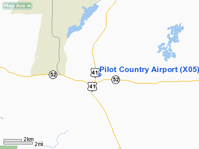
Location
& QuickFacts
|
FAA Information Effective: |
2007-01-18 |
|
Airport
Identifier: |
X05 |
|
Airport
Status: |
Operational |
|
Longitude/Latitude: |
082-29-47.3450W/28-19-49.0180N
-82.496485/28.330283 (Estimated) |
|
Elevation: |
80 ft / 24.38 m (Surveyed) |
|
Land: |
27 acres |
|
From
nearest city: |
13 nautical miles S of Brooksville, FL |
|
Location: |
Pasco County, FL |
|
Magnetic Variation: |
02W (1985) |
Owner
& Manager
|
Ownership: |
Privately owned |
|
Owner: |
Dewey Gallops |
|
Address: |
11500 Pilot Country Dr
Springhill, FL 34610 |
|
Phone
number: |
813-996-7887 |
|
Manager: |
Dewey Gallops |
|
Address: |
11500 Pilot Country Dr
Springhill, FL 34610 |
|
Phone number: |
813-996-7887 |
Airport
Operations and Facilities
|
Airport Use: |
Open to public |
|
Wind
indicator: |
Yes |
|
Segmented
Circle: |
No |
|
Control
Tower: |
No |
|
Lighting
Schedule: |
DUSK-DAWN |
|
Beacon
Color: |
Clear-Green (lighted land airport) |
|
Landing
fee charge: |
No |
|
Sectional
chart: |
Jacksonville |
|
Region: |
ASO - Southern |
|
Boundary
ARTCC: |
ZJX - Jacksonville |
|
Responsible
ARTCC: |
ZMA - Miami |
|
Tie-in
FSS: |
PIE - Saint Petersburg |
|
FSS
on Airport: |
No |
|
FSS
Toll Free: |
1-800-WX-BRIEF |
|
NOTAMs
Facility: |
PIE (NOTAM-d service avaliable) |
Airport
Communications
|
CTAF: |
122.800 |
|
Unicom: |
122.800 |
Airport
Services
|
Fuel available: |
100LL |
|
Airframe Repair: |
MAJOR |
|
Power Plant Repair: |
MINOR |
|
Bottled
Oxygen: |
NONE |
|
Bulk
Oxygen: |
NONE |
|
Runway Information
Runway 18/36
|
Dimension: |
3700 x 75 ft / 1127.8 x 22.9 m |
|
Surface: |
ASPH, Good Condition |
|
Edge
Lights: |
Low |
|
|
Runway 18 |
Runway 36 |
|
Traffic
Pattern: |
Left |
Left |
|
Markings: |
Numbers only, Poor Condition
& 36 MARKINGS FADED. |
Numbers only, Poor Condition |
|
Displaced
threshold: |
300.00 ft |
900.00 ft |
|
Obstruction: |
62 ft trees, 1425.0 ft from runway, 19:1 slope
to clear
RY 18 APCH RATIO 27:1 TO DSPLCD THLD.
6 FT FENCE 50 FT FM THR. |
10 ft road, 200.0 ft from runway
10 FT BRUSH 110 FT E OF RY CNTRLN FIRST THIRD OF RY 36; 10
FT BRUSH 110 FT WEST OF RWY CENTLN MIDFIELD. FUEL TANK 110
FT E OF RY 36 CNTRLN FIRST 150 FT.
RY 36 APCH RATIO FM TREES TO DSPLCD THLD 20:1.
5
FT BERM AT RWY END. |
|
Radio Navigation
Aids
|
ID |
Type |
Name |
Ch |
Freq |
Var |
Dist |
|
RHZ |
NDB |
Zephyrhills |
|
253.00 |
03W |
19.0 nm |
|
TPF |
NDB |
Knight |
|
270.00 |
02W |
25.5 nm |
|
PCM |
NDB |
Plant City |
|
346.00 |
02W |
26.7 nm |
|
AM |
NDB |
Picny |
|
388.00 |
02W |
28.3 nm |
|
LEE |
NDB |
Leesburg |
|
335.00 |
04W |
46.7 nm |
|
MCF |
TACAN |
Macdill |
047X |
|
04W |
28.2 nm |
|
PIE |
VORTAC |
St Petersburg |
111X |
116.40 |
01E |
27.3 nm |
|
LAL |
VORTAC |
Lakeland |
107X |
116.00 |
01E |
32.9 nm |
|
TPA |
VOT |
Tampa Intl |
|
111.00 |
|
21.5 nm |
Remarks
- FBO
PHONE (813) 996-7887.
- VFR
WX CONDS ONLY.
Based Aircraft
|
Aircraft
based on field: |
50 |
|
Single
Engine Airplanes: |
43 |
|
Multi
Engine Airplanes: |
7 |
Operational Statistics
Time Period: 1998-06-11
- 1999-06-10
|
Aircraft
Operations: |
281/Week |
|
General
Aviation Local: |
50.0% |
|
General
Aviation Itinerant: |
50.0% |
Pilot Country Airport
Address:
Pasco County, FL
Tel:
813-996-7887
Images
and information placed above are from
http://www.airport-data.com/airport/X05/
We
thank them for the data!
| General
Info |
| Country |
United
States |
| State |
FLORIDA
|
| FAA ID |
X05
|
| Latitude |
28-19-49.018N
|
| Longitude |
082-29-47.345W
|
| Elevation |
80 feet
|
| Near City |
BROOKSVILLE
|
We don't guarantee the information is fresh and accurate. The data may
be wrong or outdated.
For more up-to-date information please refer to other sources.
|
|


