 |
|
|
|
Location
& QuickFacts
|
FAA Information Effective: |
2007-01-18 |
|
Airport
Identifier: |
FL66 |
|
Airport
Status: |
Operational |
|
Longitude/Latitude: |
082-29-58.3880W/29-33-34.8830N
-82.499552/29.559690 (Estimated) |
|
Elevation: |
75 ft / 22.86 m (Estimated) |
|
Land: |
0 acres |
|
From
nearest city: |
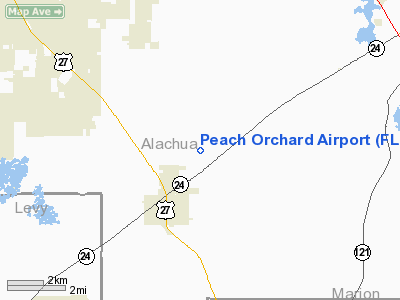
3 nautical miles NE of Archer, FL |
|
Location: |
Alachua County, FL |
|
Magnetic Variation: |
02W (1985) |
Owner
& Manager
|
Ownership: |
Privately owned |
|
Owner: |
Ray D. Helpling |
|
Address: |
14208 S.w. Archer Road
Archer, FL 32618 |
|
Phone
number: |
904-495-2153 |
|
Manager: |
Ray D. Helpling |
|
Address: |
14208 S.w. Archer Road
Archer, FL 32618 |
|
Phone number: |
904-495-2153 |
Airport
Operations and Facilities
|
Airport Use: |
Private |
|
Wind indicator: |
Yes |
|
Segmented Circle: |
No |
|
Control Tower: |
No |
|
Landing fee charge: |
No |
|
Sectional chart: |
Jacksonville |
|
Region: |
ASO - Southern |
|
Boundary ARTCC: |
ZJX - Jacksonville |
|
Tie-in FSS: |
GNV - Gainesville |
|
FSS on Airport: |
No |
|
FSS Phone: |
850-377-3291 |
|
FSS Toll Free: |
1-800-WX-BRIEF |
Airport
Services
|
Airframe Repair: |
NONE |
|
Power Plant Repair: |
NONE |
|
Runway Information
Runway 18/36
|
Dimension: |
2240 x 150 ft / 682.8 x 45.7 m |
|
Surface: |
TURF, |
|
|
Runway 18 |
Runway 36 |
|
Traffic
Pattern: |
Left |
Left |
|
Obstruction: |
65 ft pline, 1500.0 ft from runway |
|
|
Radio Navigation
Aids
|
ID |
Type |
Name |
Ch |
Freq |
Var |
Dist |
|
GN |
NDB |
Wynds |
|
269.00 |
04W |
18.4 nm |
|
IAK |
NDB |
Palatka |
|
243.00 |
05W |
36.4 nm |
|
LCQ |
NDB |
Lake City |
|
204.00 |
03W |
37.8 nm |
|
GNV |
VORTAC |
Gators |
109X |
116.20 |
04W |
14.3 nm |
|
OCF |
VORTAC |
Ocala |
084X |
113.70 |
00E |
27.1 nm |
|
CTY |
VORTAC |
Cross City |
057X |
112.00 |
02W |
28.8 nm |
Remarks
- LARGE
PWR TRANSN LINE 1/2 MI W OF RWY RUNS NW-SE AND ACROSS APCH TO RWY 36
2500FT FM THR.
- VFR
ONLY; PVT USE.
Based Aircraft
|
Aircraft
based on field: |
5 |
|
Single
Engine Airplanes: |
5 |
Peach Orchard Airport
Address:
Alachua County, FL
Tel:
904-495-2153
Images
and information placed above are from
http://www.airport-data.com/airport/FL66/
We
thank them for the data!
| General
Info |
| Country |
United
States |
| State |
FLORIDA
|
| FAA ID |
FL66
|
| Latitude |
29-33-34.883N
|
| Longitude |
082-29-58.388W
|
| Elevation |
75 feet
|
| Near City |
ARCHER
|
We don't guarantee the information is fresh and accurate. The data may
be wrong or outdated.
For more up-to-date information please refer to other sources.
|
|


