|
 |
|
||||
|
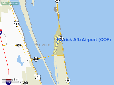
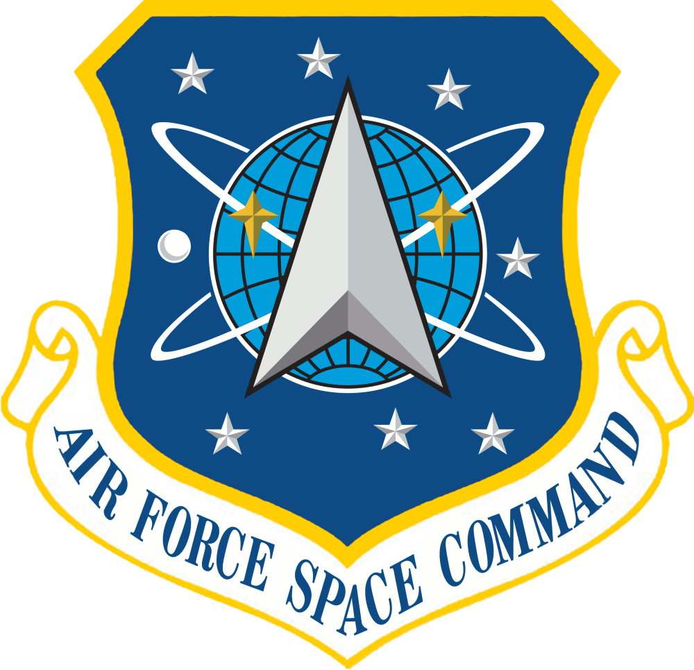
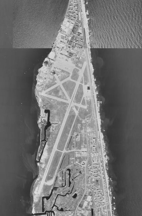
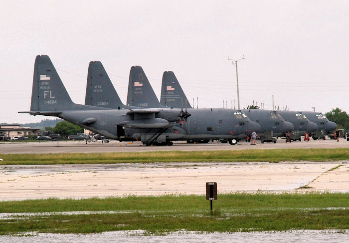
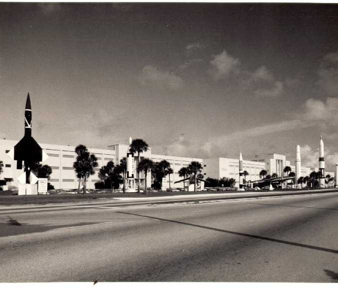
Patrick Air Force Base (IATA: COF, ICAO: KCOF, FAA LID: COF) is a United States Air Force Base located between Satellite Beach and Cocoa Beach, in Brevard County, Florida, United States. It was named in honor of Major General Mason Patrick. An Air Force Space Command (AFSPC) base, it is home to the 45th Space Wing. Additional tenant activities include the 920th Rescue Wing, the Air Force Technical Applications Center and the Defense Equal Opportunity Management Institute (DEOMI). Total employment is 10,400. There are 13,099 military, dependents, civilian employees and contractors on base. Current operationsThe host wing for Patrick AFB is the 45th Space Wing (45 SW), whose officers and airmen manage all launches of unmanned rockets at Cape Canaveral Air Force Station (CCAFS). These rockets include satellites for the US military, the National Reconnaissance Office, and the National Security Agency, as well as scientific payload launches in support of NASA, weather satellite launches in support of NOAA, payloads in support of international customers such as the European Space Agency, and commercial payloads for various corporate communications entities. Units and individuals from the 45 SW have also deployed abroad during wartime, most notably during Operations Enduring Freedom and Iraqi Freedom Also headquartered at Patrick Air Force Base is the Air Force Technical Applications Center (AFTAC). AFTAC is the sole Department of Defense agency operating and maintaining a global network of nuclear event detection sensors. The 920th Rescue Wing (920 RQW), part of Air Force Reserve Command, is also headquartered at Patrick AFB. An Air Combat Command (ACC)-gained combat search and rescue organization, the 920 RQW is the only rescue wing in the Air Force Reserve, operating the HC-130P/N "King" variant of the C-130 Hercules and HH-60G Pave Hawk helicopter, ready for worldwide deployment. The wing is also a major player in civilian rescue operations, most notably is its role in manned spaceflight support to NASA, providing Eastern Range monitoring and search and rescue support for Space Shuttle launches from Kennedy Space Center (KSC). Additional operations have also included searching the Caribbean for downed aircraft, as well as retrieving critically ill sailors and passengers from ships hundreds of miles out in the Atlantic, often at night and/or in bad weather. Because the USAF HH-60G can refuel in flight from the USAF HC-130, MC-130, or USMC KC-130, it possesses a much greater range and mission radius versus similar military helicopters. The 920 RQW is also a full participant in the Air Force's current Air and Space Expeditionary Task Force (AETF) operating concept. Under this concept, the bulk of the wing deployed to Iraq in 2003 in support of Operation Iraqi Freedom. Subsequent AETF deployments have included Djibouti in 2004 and 2006 and Afghanistan in 2007 in support of Operation Enduring Freedom. Adjacent to the 920 RQW's facilities is the NASA Flight Operations Facility, which provides support for NASA's permanently based UH-1N helicopters supporting Kennedy Space Center and transient NASA fixed-wing aircraft such as the T-38 Talon. The U.S. State Department's Bureau for International Narcotics and Law Enforcement Affairs Air Wing helps foreign countries combat drugs and narcotics criminals. The Bureau operates a fleet of aircraft, primarily former USAF and USMC OV-10 and former USAF C-27 aircraft at Patrick AFB to help detect and interdict the drug trade in Bolivia, Colombia, Peru and Afghanistan. HistoryThe facility which is today Patrick AFB initially started as Naval Air Station Banana River, having been commissioned on October 1, 1940. NAS Banana River supported seaplane patrol operations during World War II and it continued to operate as a Navy support base for two years after the war. The installation was deactivated and placed in a caretaker status on August 1, 1947. The Navy transferred NAS Banana River to the Air Force on September 1, 1948. The station was renamed the Joint Long Range Proving Ground (JLRPG) Base on June 10, 1949. On October 1, 1949, the Joint Long Range Proving Ground Base was transferred from Air Materiel Command to the Air Force Division of the Joint Long Range Proving Ground. In February 2005, the officers club was destroyed by an accidental fire. Operational historyOn May 17, 1950, the base was renamed the "Long Range Proving Ground Base", but three months later was renamed "Patrick Air Force Base", in honor of Major General Mason Patrick. On May 3, 1951, the Long Range Proving Ground Division was assigned to the newly-created Air Research and Development Command (ARDC). The next month the division was redesignated the Air Force Missile Test Center (AFMTC). Cost comparison studies done in the early 1950s pointed out the desirability of letting contractors operate the station. The first range contract was signed with Pan American World Services on December 31, 1953. The Air Force Missile Test Center began transferring property and equipment to Pan American World Services at the end of that year. Pan American operated under contract to the Air Force for the next 34 years (until early October 1988). In 1988, the old range contract was divided into the Range Technical Services (RTS) and the Launch Base Services (LBS) contracts. The RTS contract was awarded to Computer Sciences Raytheon (CSR) in June 1988, and the LBS contract was awarded to Pan American World Services (later known as Johnson Controls) in August 1988.
The Eastern Range supported a variety of missile and manned and unmanned space programs in the 1960s, making it a regular focus of media attention. In the 1960s, a test range office at Patrick AFB with a missile backdrop was used to film scenes for the TV sitcom, I Dream of Jeannie, which was set in nearby Cocoa Beach (no cast was present). But by the mid-1970s, the demise of the Apollo manned space program and the end of land-based ballistic missile development at nearby Cape Canaveral Air Force Station signaled a downturn in fortunes, and on February 1, 1977, the "Air Force Eastern Test Range" organization was deactivated and its functions transferred to Detachment 1 of the Space and Missile Test Center (SAMTEC) until the activation of the Eastern Space and Missile Center in 1979 on October 1, 1979. In 1990, ESMC was transferred from the deactivating Air Force Systems Command (AFSC) to the newly established Air Force Space Command (AFSPC). On November 12, 1991 ESMC was deactivated and the 45th Space Wing (45 SW) assumed its remaining functions. Major commands assigned
Major units assigned
Reference for history summation, major commands assigned and major units assigned BuildingsThe base has the Space Coast Inn for visiting personnel, dormitories for permanent party single enlisted personnel, quarters for families in three separate housing areas, recreational housing on the beach, beach access, combined officers and enlisted clubs, commissary, a large base exchange (BX), library and numerous morale, welfare and recreation (MWR) facilities. There are several chapels including Chapel One, Chapel Two, South Chapel at the South Housing area, and Seaside Chapel (Building 440). There is also a "45th Space Wing Chapel" which travels with the Wing when it is deployed. The Catholic Group is called "St. George Parish" and meets in Chapel One or Two. While the buildings are owned by the Air Force, the Catholic Parish is under the spiritual direction of the Roman Catholic Archdiocese for the Military Services, USA. In 2009, base housing became available for members of the Reserve and Guard, military retirees, and Department of Defense civil service employees and DOD contractors. Media
Surrounding areas
AccessPatrick Air Force Base lies on a barrier island, and is primarily accessed from the mainland by the Pineda Causeway (State Road 404) in Satellite Beach, or Florida State Road A1A which runs the entire length of Patrick AFB. The above content comes from Wikipedia and is published under free licenses – click here to read more.
Runway InformationRunway 02/20
Runway 11/29
Radio Navigation Aids
Remarks
Operational Statistics
Patrick Air Force Base Airport Address: Brevard County, FL Tel: Images
and information placed above are from We thank them for the data!
We don't guarantee the information is fresh and accurate. The data may
be wrong or outdated.
|
|||||||||||||||||||||||||||||||||||||||||||||||||||||||||||||||||||||||||||||||||||||||||||||||||||||||||||||||||||||||||||||||||||||||||||||||||||||||||||||||||||||||||||||||||||||||||||||||||||||||||||||||||||||||||||||||||||||||||||||||||||||||||||||||||||||||||||||||||||||||||||||||||||||||||||||||||||||||||||||||||||||||||||||||||||||||||||||||||||||||||||||||||||||||||||||||||||||||||||

 |
|
Copyright 2004-2026 © by Airports-Worldwide.com, Vyshenskoho st. 36, Lviv 79010, Ukraine Legal Disclaimer |


 Banana River, Merritt Island, Lotus