 |
|
Location
& QuickFacts
|
FAA Information Effective: |
2007-01-18 |
|
Airport
Identifier: |
FL04 |
|
Airport
Status: |
Operational |
|
Longitude/Latitude: |
085-45-24.7530W/30-41-31.6860N
-85.756876/30.692135 (Estimated) |
|
Elevation: |
90 ft / 27.43 m (Estimated) |
|
Land: |
700 acres |
|
From
nearest city: |
6 nautical miles SE of Caryville, FL |
|
Location: |
Washington County, FL |
|
Magnetic Variation: |
00W (1985) |
Owner
& Manager
|
Ownership: |
Privately owned |
|
Owner: |
Richard Nudtsen |
|
Address: |
Rt 1 Box 221 Fa
Caryville, FL 32427 |
|
Manager: |
Richard Nudtsen |
|
Address: |
Rt 1 Box 221 Fa
Caryville, FL 32427 |
Airport
Operations and Facilities
|
Airport Use: |
Private |
|
Segmented
Circle: |
No |
|
Control
Tower: |
No |
|
Sectional
chart: |
New Orleans |
|
Region: |
ASO - Southern |
|
Boundary
ARTCC: |
ZJX - Jacksonville |
|
Tie-in
FSS: |
GNV - Gainesville |
|
FSS
Phone: |
850-377-3291 |
|
FSS
Toll Free: |
1-800-WX-BRIEF |
|
Runway Information
Runway 08/26
|
Dimension: |
5000 x 4000 ft / 1524.0 x 1219.2 m |
|
Surface: |
WATER, |
|
|
Runway 08 |
Runway 26 |
|
Traffic
Pattern: |
Left |
Left |
|
Radio Navigation
Aids
|
ID |
Type |
Name |
Ch |
Freq |
Var |
Dist |
|
BKK |
NDB |
Tri County |
|
275.00 |
02W |
12.5 nm |
|
SMY |
NDB |
Soyya |
|
329.00 |
02W |
29.5 nm |
|
OZ |
NDB |
Ruckr |
|
212.00 |
00E |
32.2 nm |
|
LOR |
NDB |
Lowe |
|
269.00 |
03W |
40.2 nm |
|
BVG |
NDB |
Boll Weevil |
|
352.00 |
03E |
40.5 nm |
|
HYE |
NDB |
Hanchey |
|
221.00 |
00E |
40.9 nm |
|
DTS |
NDB |
Destin |
|
254.00 |
01W |
40.9 nm |
|
JUY |
NDB |
Judd |
|
264.00 |
02W |
49.2 nm |
|
PAM |
TACAN |
Tyndall |
124X |
|
00W |
38.4 nm |
|
DWG |
TACAN |
Warrington |
002X |
|
00E |
41.6 nm |
|
FYL |
VOR |
Tri County |
|
108.40 |
08W |
11.8 nm |
|
EDN |
VOR |
Enterprise |
|
116.60 |
03W |
37.1 nm |
|
HEY |
VOR |
Hanchey |
|
110.60 |
02E |
41.3 nm |
|
UIA |
VOR |
Andalusia |
|
110.20 |
00E |
49.5 nm |
|
OZR |
VOR/DME |
Cairns |
049X |
111.20 |
02E |
34.7 nm |
|
PFN |
VORTAC |
Panama City |
090X |
114.30 |
00W |
28.9 nm |
|
MAI |
VORTAC |
Marianna |
087X |
114.00 |
00E |
33.2 nm |
|
RRS |
VORTAC |
Wiregrass |
053X |
111.60 |
02E |
39.4 nm |
|
CEW |
VORTAC |
Crestview |
106X |
115.90 |
03E |
48.3 nm |
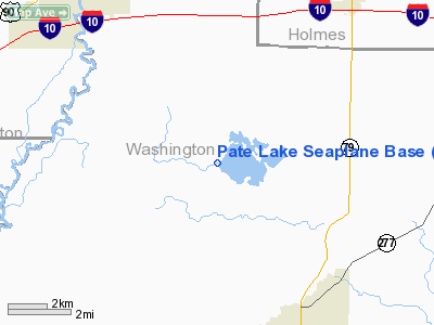
Pate Lake Seaplane Base
Address:
Washington County, FL
Tel:
Images
and information placed above are from
http://www.airport-data.com/airport/FL04/
We
thank them for the data!
| General
Info |
| Country |
United
States |
| State |
FLORIDA
|
| FAA ID |
FL04
|
| Latitude |
30-41-31.686N
|
| Longitude |
085-45-24.753W
|
| Elevation |
90 feet
|
| Near City |
CARYVILLE
|
We don't guarantee the information is fresh and accurate. The data may
be wrong or outdated.
For more up-to-date information please refer to other sources.
|
|


