 |
|
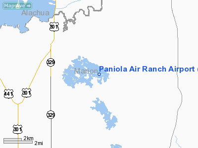
Paniola Air Ranch Airport |
Location
& QuickFacts
|
FAA Information Effective: |
2007-01-18 |
|
Airport
Identifier: |
FD14 |
|
Airport
Status: |
Operational |
|
Longitude/Latitude: |
082-03-29.3270W/29-22-30.9020N
-82.058146/29.375251 (Estimated) |
|
Elevation: |
140 ft / 42.67 m (Estimated) |
|
Land: |
5 acres |
|
From
nearest city: |
4 nautical miles SE of Citra, FL |
|
Location: |
Marion County, FL |
|
Magnetic Variation: |
03W (1985) |
Owner
& Manager
|
Ownership: |
Privately owned |
|
Owner: |
Psr Of Central Florida |
|
Address: |
6301 E Hwy 316
Citra, FL 32113 |
|
Phone number: |
954-522-2821 |
|
Manager: |
Wolfgang Dierschke |
|
Address: |
6301 E Hwy 316
Citra, FL 32113 |
|
Phone number: |
954-522-2821 |
Airport
Operations and Facilities
|
Airport Use: |
Private |
|
Wind
indicator: |
Yes |
|
Segmented
Circle: |
No |
|
Control
Tower: |
No |
|
Landing
fee charge: |
No |
|
Sectional
chart: |
Jacksonville |
|
Region: |
ASO - Southern |
|
Boundary
ARTCC: |
ZJX - Jacksonville |
|
Tie-in
FSS: |
GNV - Gainesville |
|
FSS
on Airport: |
No |
|
FSS
Phone: |
850-377-3291 |
|
FSS
Toll Free: |
1-800-WX-BRIEF |
|
Runway Information
Runway 01/19
|
Dimension: |
3000 x 100 ft / 914.4 x 30.5 m |
|
Surface: |
TURF, |
|
|
Runway 01 |
Runway 19 |
|
Traffic
Pattern: |
Left |
Left |
|
Displaced
threshold: |
300.00 ft |
0.00
ft |
|
Obstruction: |
10 ft trees, 20.0 ft from runway |
|
|
Radio Navigation
Aids
|
ID |
Type |
Name |
Ch |
Freq |
Var |
Dist |
|
GN |
NDB |
Wynds |
|
269.00 |
04W |
18.7 nm |
|
IAK |
NDB |
Palatka |
|
243.00 |
05W |
21.1 nm |
|
LEE |
NDB |
Leesburg |
|
335.00 |
04W |
36.0 nm |
|
DED |
NDB |
Deland/dcmsnd |
|
201.00 |
05W |
45.1 nm |
|
OCF |
VORTAC |
Ocala |
084X |
113.70 |
00E |
14.8 nm |
|
GNV |
VORTAC |
Gators |
109X |
116.20 |
04W |
22.1 nm |
|
OMN |
VORTAC |
Ormond Beach |
073X |
112.60 |
00E |
49.7 nm |
Remarks
Based Aircraft
|
Aircraft
based on field: |
1 |
|
Multi
Engine Airplanes: |
1 |
Paniola Air Ranch Airport
Address:
Marion County, FL
Tel:
954-522-2821
Images
and information placed above are from
http://www.airport-data.com/airport/FD14/
We
thank them for the data!
| General
Info |
| Country |
United
States |
| State |
FLORIDA
|
| FAA ID |
FD14
|
| Latitude |
29-22-30.902N
|
| Longitude |
082-03-29.327W
|
| Elevation |
140 feet
|
| Near City |
CITRA
|
We don't guarantee the information is fresh and accurate. The data may
be wrong or outdated.
For more up-to-date information please refer to other sources.
|
|


