 |
|
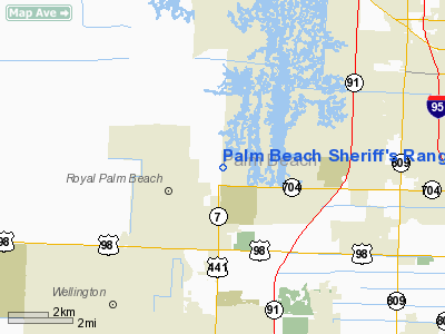
Palm Beach Sheriff's Range Heliport |
Location
& QuickFacts
|
FAA Information Effective: |
2007-01-18 |
|
Airport
Identifier: |
39FL |
|
Airport
Status: |
Operational |
|
Longitude/Latitude: |
080-11-59.1630W/26-43-01.2330N
-80.199768/26.717009 (Estimated) |
|
Elevation: |
20 ft / 6.10 m (Estimated) |
|
Land: |
0 acres |
|
From
nearest city: |
4 nautical miles W of West Palm Beach, FL |
|
Location: |
Palm Beach County, FL |
|
Magnetic Variation: |
03W (1985) |
Owner
& Manager
|
Ownership: |
Publicly owned |
|
Owner: |
Palm Beach County |
|
Address: |
3228 Gun Club Rd
West Palm Beach, FL 33416 |
|
Phone
number: |
305-793-0300 |
|
Manager: |
County Sheriff |
|
Address: |
3228 Gun Club Rd
West Palm Beach, FL 33416 |
|
Phone number: |
407-688-3660 |
Airport
Operations and Facilities
|
Airport Use: |
Private |
|
Wind
indicator: |
No |
|
Segmented
Circle: |
No |
|
Control
Tower: |
No |
|
Landing
fee charge: |
No |
|
Sectional
chart: |
Miami |
|
Region: |
ASO - Southern |
|
Boundary
ARTCC: |
ZMA - Miami |
|
Tie-in
FSS: |
MIA - Miami |
|
FSS
on Airport: |
No |
|
FSS
Phone: |
305-233-2600 |
|
FSS
Toll Free: |
1-800-WX-BRIEF |
|
Runway Information
Helipad H1
|
Dimension: |
550 x 150 ft / 167.6 x 45.7 m |
|
Surface: |
TURF, |
|
|
Runway H1 |
Runway |
|
Traffic
Pattern: |
Left |
Left |
|
Radio Navigation
Aids
|
ID |
Type |
Name |
Ch |
Freq |
Var |
Dist |
|
PB |
NDB |
Rubin |
|
356.00 |
03W |
1.8 nm |
|
UTX |
NDB |
United |
|
405.00 |
03W |
13.6 nm |
|
FX |
NDB |
Praiz |
|
221.00 |
02W |
32.4 nm |
|
PJN |
NDB |
Plantation |
|
242.00 |
03W |
35.2 nm |
|
FPR |
NDB |
Fort Pierce |
|
275.00 |
04W |
47.2 nm |
|
FLL |
VOR/DME |
Fort Lauderdale |
091X |
114.40 |
00E |
38.7 nm |
|
PBI |
VORTAC |
Palm Beach |
104X |
115.70 |
03W |
6.5 nm |
|
PHK |
VORTAC |
Pahokee |
101X |
115.40 |
00E |
26.7 nm |
|
PBI |
VOT |
Palm Beach |
|
109.00 |
|
5.5 nm |
Remarks
Palm Beach Sheriff's Range Heliport
Address:
Palm Beach County, FL
Tel:
305-793-0300,
407-688-3660
Images
and information placed above are from
http://www.airport-data.com/airport/39FL/
We
thank them for the data!
| General
Info |
| Country |
United
States |
| State |
FLORIDA
|
| FAA ID |
39FL
|
| Latitude |
26-43-01.233N
|
| Longitude |
080-11-59.163W
|
| Elevation |
20 feet
|
| Near City |
WEST PALM
BEACH |
We don't guarantee the information is fresh and accurate. The data may
be wrong or outdated.
For more up-to-date information please refer to other sources.
|
|


