 |
|
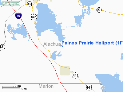
Location
& QuickFacts
|
FAA Information Effective: |
2007-01-18 |
|
Airport
Identifier: |
1FD6 |
|
Airport
Status: |
Operational |
|
Longitude/Latitude: |
082-17-14.3640W/29-32-45.8890N
-82.287323/29.546080 (Estimated) |
|
Elevation: |
75 ft / 22.86 m (Estimated) |
|
Land: |
1 acres |
|
From
nearest city: |
2 nautical miles N of Micanopy, FL |
|
Location: |
Alachua County, FL |
|
Magnetic Variation: |
02W (1985) |
Owner
& Manager
|
Ownership: |
Privately owned |
|
Owner: |
Wm. P. Murphy Jr. M D |
|
Address: |
10601 Snapper Creek Rd
Miami, FL 22156-3454 |
|
Phone number: |
305-666-8877 |
|
Manager: |
Kathy Barco |
|
Address: |
7587 Wilson Blvd
Jacksonville, FL 32210 |
|
Phone number: |
904-772-1313 |
Airport
Operations and Facilities
|
Airport Use: |
Private |
|
Segmented
Circle: |
No |
|
Control
Tower: |
No |
|
Sectional
chart: |
Jacksonville |
|
Region: |
ASO - Southern |
|
Boundary
ARTCC: |
ZJX - Jacksonville |
|
Tie-in
FSS: |
GNV - Gainesville |
|
FSS
Phone: |
850-377-3291 |
|
FSS
Toll Free: |
1-800-WX-BRIEF |
|
Runway Information
Helipad H1
|
Dimension: |
70 x 70 ft / 21.3 x 21.3 m |
|
Surface: |
CONC, |
|
|
Runway H1 |
Runway |
|
Traffic
Pattern: |
Left |
Left |
|
Radio Navigation
Aids
|
ID |
Type |
Name |
Ch |
Freq |
Var |
Dist |
|
GN |
NDB |
Wynds |
|
269.00 |
04W |
9.6 nm |
|
IAK |
NDB |
Palatka |
|
243.00 |
05W |
25.7 nm |
|
LCQ |
NDB |
Lake City |
|
204.00 |
03W |
41.3 nm |
|
NZC |
TACAN |
Cecil/dcmsnd |
088X |
|
04W |
46.0 nm |
|
VQQ |
VOR |
Cecil |
|
117.90 |
03W |
45.1 nm |
|
GNV |
VORTAC |
Gators |
109X |
116.20 |
04W |
8.8 nm |
|
OCF |
VORTAC |
Ocala |
084X |
113.70 |
00E |
22.4 nm |
|
CTY |
VORTAC |
Cross City |
057X |
112.00 |
02W |
39.9 nm |
Remarks
Based Aircraft
|
Aircraft
based on field: |
2 |
|
Single
Engine Airplanes: |
1 |
|
Helicopters: |
1 |
Paines Prairie Heliport
Address:
Alachua County, FL
Tel:
305-666-8877, 904-772-1313
Images
and information placed above are from
http://www.airport-data.com/airport/1FD6/
We
thank them for the data!
| General
Info |
| Country |
United
States |
| State |
FLORIDA
|
| FAA ID |
1FD6
|
| Latitude |
29-32-45.889N
|
| Longitude |
082-17-14.364W
|
| Elevation |
75 feet
|
| Near City |
MICANOPY
|
We don't guarantee the information is fresh and accurate. The data may
be wrong or outdated.
For more up-to-date information please refer to other sources.
|
|


