 |
|
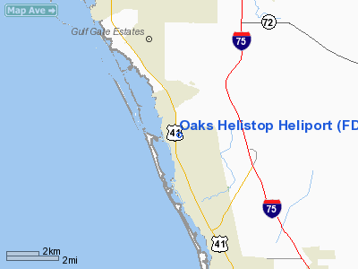
Location
& QuickFacts
|
FAA Information Effective: |
2007-01-18 |
|
Airport
Identifier: |
FD43 |
|
Airport
Status: |
Operational |
|
Longitude/Latitude: |
082-29-17.3480W/27-12-23.1840N
-82.488152/27.206440 (Estimated) |
|
Elevation: |
14 ft / 4.27 m (Estimated) |
|
Land: |
1 acres |
|
From
nearest city: |
9 nautical miles S of Venice, FL |
|
Location: |
Sarasota County, FL |
|
Magnetic Variation: |
02W (1985) |
Owner
& Manager
|
Ownership: |
Privately owned |
|
Owner: |
Oaks Club Corporation |
|
Address: |
301 Macewen Dr.
Osprey, FL 34229 |
|
Phone number: |
813-966-4808 |
|
Manager: |
James O'brien |
|
Address: |
301 Macewen Dr.
34229 |
|
Phone number: |
813-966-4808 |
Airport
Operations and Facilities
|
Airport Use: |
Private |
|
Wind
indicator: |
Yes |
|
Segmented
Circle: |
No |
|
Control
Tower: |
No |
|
Landing
fee charge: |
No |
|
Sectional
chart: |
Miami |
|
Region: |
ASO - Southern |
|
Boundary
ARTCC: |
ZMA - Miami |
|
Tie-in
FSS: |
PIE - Saint Petersburg |
|
FSS
on Airport: |
No |
|
FSS
Toll Free: |
1-800-WX-BRIEF |
|
Runway Information
Helipad H1
|
Dimension: |
80 x 80 ft / 24.4 x 24.4 m |
|
Surface: |
ASPH, |
|
|
Runway H1 |
Runway |
|
Traffic
Pattern: |
Left |
Left |
|
Radio Navigation
Aids
|
ID |
Type |
Name |
Ch |
Freq |
Var |
Dist |
|
VNC |
NDB |
Venice |
|
206.00 |
02W |
9.2 nm |
|
CHN |
NDB |
Wauchula |
|
261.00 |
04W |
37.1 nm |
|
AM |
NDB |
Picny |
|
388.00 |
02W |
39.5 nm |
|
TPF |
NDB |
Knight |
|
270.00 |
02W |
42.2 nm |
|
MCF |
TACAN |
Macdill |
047X |
|
04W |
39.4 nm |
|
PGD |
VOR |
Punta Gorda |
|
110.20 |
03W |
31.8 nm |
|
SRQ |
VORTAC |
Sarasota |
099X |
115.20 |
02W |
12.0 nm |
|
PIE |
VORTAC |
St Petersburg |
111X |
116.40 |
01E |
43.4 nm |
|
TPA |
VOT |
Tampa Intl |
|
111.00 |
|
46.2 nm |
Remarks
Oaks Helistop Heliport
Address:
Sarasota County, FL
Tel:
813-966-4808
Images
and information placed above are from
http://www.airport-data.com/airport/FD43/
We
thank them for the data!
| General
Info |
| Country |
United
States |
| State |
FLORIDA
|
| FAA ID |
FD43
|
| Latitude |
27-12-23.184N
|
| Longitude |
082-29-17.348W
|
| Elevation |
14 feet
|
| Near City |
VENICE
|
We don't guarantee the information is fresh and accurate. The data may
be wrong or outdated.
For more up-to-date information please refer to other sources.
|
|


