 |
|
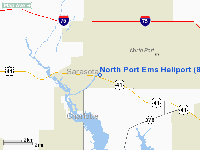
Location
& QuickFacts
|
FAA Information Effective: |
2007-01-18 |
|
Airport
Identifier: |
84FD |
|
Airport
Status: |
Operational |
|
Longitude/Latitude: |
082-14-10.6600W/27-02-45.7900N
-82.236294/27.046053 (Estimated) |
|
Elevation: |
14 ft / 4.27 m (Estimated) |
|
Land: |
0 acres |
|
From
nearest city: |
0 nautical miles N of North Port, FL |
|
Location: |
Sarasota County, FL |
|
Magnetic Variation: |
03W (1995) |
Owner
& Manager
|
Ownership: |
Publicly owned |
|
Owner: |
North Port Fire Rescue Dist. |
|
Address: |
5700 North Port Blvd.
North Port, FL 34287 |
|
Phone
number: |
941-423-3156 |
|
Manager: |
Michael J. Auclair |
|
Address: |
5700 North Port Blvd.
North Port, FL 34287 |
|
Phone number: |
941-423-3156 |
Airport
Operations and Facilities
|
Airport Use: |
Private
MEDICAL USE. |
|
Wind
indicator: |
Yes |
|
Segmented
Circle: |
No |
|
Control
Tower: |
No |
|
Sectional
chart: |
Miami |
|
Region: |
ASO - Southern |
|
Boundary
ARTCC: |
ZMA - Miami |
|
Tie-in
FSS: |
PIE - Saint Petersburg |
|
FSS
on Airport: |
No |
|
FSS
Toll Free: |
1-800-WX-BRIEF |
|
Runway Information
Helipad H1
|
Dimension: |
25
x 25 ft / 7.6 x 7.6 m |
|
Surface: |
CONC, |
|
|
Runway H1 |
Runway |
|
Traffic
Pattern: |
Left |
Left |
|
Radio Navigation
Aids
|
ID |
Type |
Name |
Ch |
Freq |
Var |
Dist |
|
VNC |
NDB |
Venice |
|
206.00 |
02W |
10.4 nm |
|
CHN |
NDB |
Wauchula |
|
261.00 |
04W |
33.7 nm |
|
PGD |
VOR |
Punta Gorda |
|
110.20 |
03W |
15.3 nm |
|
SRQ |
VORTAC |
Sarasota |
099X |
115.20 |
02W |
27.1 nm |
|
RSW |
VORTAC |
Lee County |
055X |
111.80 |
02W |
39.7 nm |
|
LBV |
VORTAC |
La Belle |
041X |
110.40 |
01E |
47.1 nm |
Remarks
- PRVDD
VFR/PVT USE; APCH/DEP 180 CLKWS 280 FROM PAD CNTR; AREA MKD; WIND INDICATOR
MAINTAINED.
North Port Ems Heliport
Address:
Sarasota County, FL
Tel:
941-423-3156
Images
and information placed above are from
http://www.airport-data.com/airport/84FD/
We
thank them for the data!
| General
Info |
| Country |
United
States |
| State |
FLORIDA
|
| FAA ID |
84FD
|
| Latitude |
27-02-45.790N
|
| Longitude |
082-14-10.660W
|
| Elevation |
14 feet
|
| Near City |
NORTH
PORT |
We don't guarantee the information is fresh and accurate. The data may
be wrong or outdated.
For more up-to-date information please refer to other sources.
|
|


