 |
|
Coordinates: 26°00′04″N 080°14′27″W / 26.00111°N 80.24083°W / 26.00111; -80.24083
| North Perry Airport |
| IATA: HWO – ICAO: KHWO – FAA LID: HWO |
| Summary |
| Airport type |
Public |
| Owner |
Broward County Aviation Department |
| Serves |
Hollywood, Florida |
| Location |
Hollywood, Florida |
| Elevation AMSL |
8 ft / 2 m |
| Website |
www.broward.org/airport/... |
| Runways |
| Direction |
Length |
Surface |
| ft |
m |
| 9L/27R |
3,241 |
988 |
Asphalt |
| 9R/27L |
3,255 |
992 |
Asphalt |
| 18L/36R |
3,260 |
994 |
Asphalt |
| 18R/36L |
3,350 |
1,021 |
Asphalt |
| Statistics (2002) |
| Aircraft operations |
172,744 |
| Based aircraft |
325 |
| Source: Federal Aviation Administration |
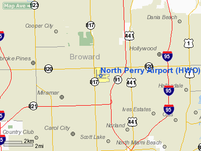
North Perry Airport (IATA: HWO, ICAO: KHWO, FAA LID: HWO) is a public airport located in the City of Pembroke Pines, five miles (8 km) west of the central business district of Hollywood, in Broward County, Florida, United States. The airport is owned by the Broward County Aviation Department. It is a general aviation airport devoted exclusively to private and business light-plane activity. History
On December 19, 1939, the HMS Orion, a British light cruiser chased the “Aracua”, a German freighter, into Port Everglades in Florida. The Aracua stayed there until 1941 when it was seized by the military at the start of World War II. During the week of May 4, 1942, German submarines torpedoed seven ships in the area. In response to the nearby attacks, many training bases were set up by the United States military.
In 1943, Henry D. Perry, a dairy farmer, sold 640 acres (2.6 km) of land to the U.S. Navy for a flight-training field between Hollywood Boulevard and Pembroke Road. It became known as North Perry Field, and functioned as a training facility for the main base of Naval Air Station Miami (NAS Miami).
It remained inactive after the war, until 1950 when it was acquired by Broward County to become a civilian airport. It was then upgraded for small plane use, as a station for advertising blimps, and for United States Coast Guard helicopters practicing search and rescue skills. The facility suffered minor damage during Hurricane Wilma in 2005.
In 2007, North Perry Airport was named the 2008 "General Aviation Airport of the Year" by the Florida Department of Transportation.
Facilities and aircraft
North Perry Airport covers an area of 536 acres (217 ha) which contains four runways:
- Runway 9L/27R: 3,241 x 100 ft (988 x 30 m), Surface: Asphalt
- Runway 9R/27L: 3,255 x 100 ft (992 x 30 m), Surface: Asphalt
- Runway 18L/36R: 3,260 x 100 ft (994 x 30 m), Surface: Asphalt
- Runway 18R/36L: 3,350 x 100 ft (1,021 x 30 m), Surface: Asphalt
Other information:
- Runways 9R/27L and 18R/36L are lit for 24 hour operation
- There are 164 T-Hangars for aircraft storage
- The Air Traffic Control Tower is operational from 7:00am - 9:00pm
- There is extensive flight training activity at the airport.
For the 12-month period ending June 21, 2002, the airport had 172,744 aircraft operations, an average of 473 per day: 99.8% general aviation, 0.2% military, <0.1% air taxi and <0.1% scheduled commercial. There are 325 aircraft based at this airport: 82% single-engine, 14% multi-engine, 4% helicopter and <1% jet.
The above content comes from Wikipedia and is published under free licenses – click here to read more.
Location
& QuickFacts
|
FAA Information Effective: |
2007-01-18 |
|
Airport
Identifier: |
HWO |
|
Airport
Status: |
Operational |
|
Longitude/Latitude: |
080-14-26.6000W/26-00-04.4000N
-80.240722/26.001222 (Estimated) |
|
Elevation: |
8 ft / 2.44 m (Surveyed) |
|
Land: |
536 acres |
|
From
nearest city: |
5 nautical miles W of Hollywood, FL |
|
Location: |
Broward County, FL |
|
Magnetic Variation: |
04W (1995) |
Owner
& Manager
|
Ownership: |
Publicly owned |
|
Owner: |
Broward County Aviation Dept |
|
Address: |
320 Terminal Drive
Ft. Lauderdale, FL 33315 |
|
Phone
number: |
954-359-1032 |
|
Manager: |
Nina B. Demeo |
|
Address: |
101 Sw 77th Way
Pembroke Pines, FL 33023 |
|
Phone number: |
954-359-1016 |
Airport
Operations and Facilities
|
Airport Use: |
Open to public |
|
Wind
indicator: |
Yes |
|
Segmented
Circle: |
Yes |
|
Control
Tower: |
Yes |
|
Lighting
Schedule: |
DUSK-DAWN
WHEN ATCT CLSD ACTVT MIRL RYS 09R/27L & 18R/36L - CTAF. |
|
Beacon
Color: |
Clear-Green (lighted land airport) |
|
Landing
fee charge: |
No |
|
Sectional
chart: |
Miami |
|
Region: |
ASO - Southern |
|
Traffic
Pattern Alt: |
800 ft |
|
Boundary
ARTCC: |
ZMA - Miami |
|
Tie-in
FSS: |
MIA - Miami |
|
FSS
on Airport: |
No |
|
FSS
Phone: |
305-233-2600 |
|
FSS
Toll Free: |
1-800-WX-BRIEF |
|
NOTAMs
Facility: |
HWO (NOTAM-d service avaliable) |
|
Federal Agreements: |
NGPY |
Airport
Communications
|
CTAF: |
132.100 |
|
Unicom: |
122.950 |
Airport
Services
|
Fuel available: |
100LLA |
|
Airframe Repair: |
MAJOR |
|
Power Plant Repair: |
MAJOR |
|
Bottled
Oxygen: |
NONE |
|
Bulk
Oxygen: |
NONE |
|
Runway Information
Runway 09L/27R
|
Dimension: |
3241 x 100 ft / 987.9 x 30.5 m |
|
Surface: |
ASPH, Good Condition |
|
Weight
Limit: |
Single wheel: 17000 lbs. |
|
|
Runway 09L |
Runway 27R |
|
Longitude: |
080-14-41.2165W |
080-14-05.7001W |
|
Latitude: |
26-00-08.1566N |
26-00-07.9739N |
|
Elevation: |
7.00
ft |
7.00
ft |
|
Alignment: |
90 |
127 |
|
Traffic
Pattern: |
Left |
Right |
|
Markings: |
Basic, Good Condition |
Basic, Good Condition |
|
Crossing
Height: |
40.00 ft |
43.00 ft |
|
Displaced
threshold: |
181.00 ft |
60.00 ft |
|
VASI: |
2-light PAPI on left side |
2-light PAPI on left side
RY 27R PAPI UNUSBL BYD 8.0 DEGS LEFT OF CNTRLN. |
|
Visual
Glide Angle: |
3.50� |
3.50� |
|
Runway
End Identifier: |
No |
No |
|
Centerline
Lights: |
No |
No |
|
Touchdown
Lights: |
No |
No |
|
Obstruction: |
31 ft trees, 1650.0 ft from runway, 125 ft
left of centerline, 25:1 slope to clear |
33 ft trees, 1040.0 ft from runway, 20:1 slope
to clear |
|
Runway 09R/27L
|
Dimension: |
3255 x 100 ft / 992.1 x 30.5 m |
|
Surface: |
ASPH, Good Condition |
|
Weight
Limit: |
Single wheel: 17000 lbs. |
|
Edge
Lights: |
Medium |
|
|
Runway 09R |
Runway 27L |
|
Longitude: |
080-14-39.2119W |
080-14-03.5390W |
|
Latitude: |
25-59-53.6257N |
25-59-53.4357N |
|
Elevation: |
7.00
ft |
8.00
ft |
|
Alignment: |
90 |
127 |
|
Traffic
Pattern: |
Right |
Left |
|
Markings: |
Basic, Good Condition |
Basic, Good Condition |
|
Crossing
Height: |
45.00 ft |
36.00 ft |
|
Displaced
threshold: |
255.00 ft |
210.00 ft |
|
VASI: |
4-light PAPI on left side |
2-light PAPI on left side
RY 27L PAPI UNUSBL BYD 4.0 DEGS LEFT OF CNTRLN. |
|
Visual
Glide Angle: |
3.50� |
3.50� |
|
Runway
End Identifier: |
Yes |
|
|
Centerline
Lights: |
No |
No |
|
Touchdown
Lights: |
No |
No |
|
Obstruction: |
49 ft trees, 1425.0 ft from runway, 300 ft
right of centerline, 26:1 slope to clear |
49 ft tree, 1290.0 ft from runway, 125 ft right
of centerline, 22:1 slope to clear |
|
Runway 18L/36R
|
Dimension: |
3260 x 100 ft / 993.6 x 30.5 m |
|
Surface: |
ASPH, Good Condition |
|
Weight
Limit: |
Single wheel: 17000 lbs. |
|
|
Runway 18L |
Runway 36R |
|
Longitude: |
080-14-22.5698W |
080-14-22.7901W |
|
Latitude: |
26-00-23.3967N |
25-59-51.1121N |
|
Elevation: |
6.00
ft |
7.00
ft |
|
Alignment: |
127 |
0 |
|
Traffic
Pattern: |
Left |
Right |
|
Markings: |
Basic, Good Condition |
Basic, Good Condition |
|
Crossing
Height: |
40.00 ft |
40.00 ft |
|
Displaced
threshold: |
110.00 ft |
185.00 ft |
|
VASI: |
2-light PAPI on left side |
2-light PAPI on left side |
|
Visual
Glide Angle: |
3.50� |
3.50� |
|
Runway
End Identifier: |
No |
No |
|
Centerline
Lights: |
No |
No |
|
Touchdown
Lights: |
No |
No |
|
Obstruction: |
25 ft trees, 1056.0 ft from runway, 300 ft
right of centerline, 22:1 slope to clear |
36 ft trees, 1404.0 ft from runway, 22:1 slope
to clear |
|
Runway 18R/36L
|
Dimension: |
3350 x 100 ft / 1021.1 x 30.5 m |
|
Surface: |
ASPH, Good Condition |
|
Weight
Limit: |
Single wheel: 17000 lbs. |
|
Edge
Lights: |
Medium |
|
|
Runway 18R |
Runway 36L |
|
Longitude: |
080-14-38.4573W |
080-14-38.6773W |
|
Latitude: |
26-00-25.3692N |
25-59-52.1892N |
|
Elevation: |
7.00
ft |
8.00
ft |
|
Alignment: |
127 |
0 |
|
Traffic
Pattern: |
Right |
Left |
|
Markings: |
Basic, Good Condition |
Basic, Good Condition |
|
Crossing
Height: |
40.00 ft |
40.00 ft |
|
Displaced
threshold: |
350.00 ft |
350.00 ft |
|
VASI: |
2-light PAPI on left side |
2-light PAPI on left side |
|
Visual
Glide Angle: |
3.50� |
3.50� |
|
Runway
End Identifier: |
No |
No |
|
Centerline
Lights: |
No |
No |
|
Touchdown
Lights: |
No |
No |
|
Obstruction: |
50 ft tree, 1200.0 ft from runway, 50 ft right
of centerline, 20:1 slope to clear |
, 50:1 slope to clear |
|
Radio Navigation
Aids
|
ID |
Type |
Name |
Ch |
Freq |
Var |
Dist |
|
PJN |
NDB |
Plantation |
|
242.00 |
03W |
8.0 nm |
|
FX |
NDB |
Praiz |
|
221.00 |
02W |
11.5 nm |
|
PB |
NDB |
Rubin |
|
356.00 |
03W |
41.3 nm |
|
HST |
TACAN |
Homestead |
019X |
|
03W |
31.7 nm |
|
FLL |
VOR/DME |
Fort Lauderdale |
091X |
114.40 |
00E |
6.5 nm |
|
VKZ |
VOR/DME |
Virginia Key |
118X |
117.10 |
04W |
15.7 nm |
|
DHP |
VORTAC |
Dolphin |
086X |
113.90 |
04W |
13.4 nm |
|
PBI |
VORTAC |
Palm Beach |
104X |
115.70 |
03W |
41.6 nm |
|
MIA |
VOT |
Miami Intl |
|
112.00 |
|
12.6 nm |
|
PBI |
VOT |
Palm Beach |
|
109.00 |
|
41.9 nm |
Remarks
- ARPT
CLSD TO ACFT OVER 12500 LBS MAX CERTD TOG.
- NUMEROUS
TALL TOWERS SE OF ARPT CAUSE RADIO INTFC.
- HIGH
VOL OF BANNER TOWING AND STUDENT FLT INVOF ARPT.
- BIRD
ACTIVITY ON & INVOF AIRPORT.
- RY
18L/36R SAFTEY AREA UNDER CONSTRUCTION.
- 90
FT CRANE 2000 FT W RY 09L/27R INDEFLY.
- CRANE
70 FT MSL 500 FT E AER 18R & 1700 FT N RY 09L.
- TWY
J EXIT SIGN REMOVED FROM RY 09R INDEFLY.
- VFR
OPERS ONLY
Based Aircraft
|
Aircraft
based on field: |
325 |
|
Single
Engine Airplanes: |
266 |
|
Multi
Engine Airplanes: |
44 |
|
Jet Engine
Airplanes: |
1 |
|
Helicopters: |
14 |
Operational Statistics
Time Period: 2001-06-22
- 2002-06-21
|
Aircraft
Operations: |
474/Day |
|
Commerical: |
0.0% |
|
Air Taxi: |
0.0% |
|
General
Aviation Local: |
66.7% |
|
General
Aviation Itinerant: |
33.0% |
|
Military: |
0.2% |
North Perry Airport
Address:
Broward County, FL
Tel:
954-359-1032,
954-359-1016
Images
and information placed above are from
http://www.airport-data.com/airport/HWO/
We
thank them for the data!
| General
Info |
| Country |
United
States |
| State |
FLORIDA
|
| FAA ID |
HWO
|
| Latitude |
26-00-05.127N
|
| Longitude |
080-14-25.874W
|
| Elevation |
9 feet
|
| Near City |
HOLLYWOOD
|
We don't guarantee the information is fresh and accurate. The data may
be wrong or outdated.
For more up-to-date information please refer to other sources.
|
|


