 |
|
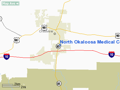
North Okaloosa Medical Center Heliport |
Location
& QuickFacts
|
FAA Information Effective: |
2007-01-18 |
|
Airport
Identifier: |
11FD |
|
Airport
Status: |
Operational |
|
Longitude/Latitude: |
086-33-45.8290W/30-44-08.6800N
-86.562730/30.735744 (Estimated) |
|
Elevation: |
230 ft / 70.10 m (Estimated) |
|
Land: |
0 acres |
|
From
nearest city: |
1 nautical miles N of Crestview, FL |
|
Location: |
Okaloosa County, FL |
|
Magnetic Variation: |
01E (1985) |
Owner
& Manager
|
Ownership: |
Privately owned |
|
Owner: |
North Okaloosa Medical Center |
|
Address: |
151 Redstone Ave
Crestview, FL 32536 |
|
Phone number: |
904-682-9731 |
|
Manager: |
Rodney Smith
ADMINISTRATOR. |
|
Address: |
151 Redstone Ave
Crestview, FL 32536 |
|
Phone number: |
904-682-9731 |
Airport
Operations and Facilities
|
Airport Use: |
Private
MEDICAL USE. |
|
Wind
indicator: |
Yes |
|
Segmented
Circle: |
No |
|
Control
Tower: |
No |
|
Sectional
chart: |
New Orleans |
|
Region: |
ASO - Southern |
|
Boundary
ARTCC: |
ZJX - Jacksonville |
|
Tie-in
FSS: |
GNV - Gainesville |
|
FSS
on Airport: |
No |
|
FSS
Phone: |
850-377-3291 |
|
FSS
Toll Free: |
1-800-WX-BRIEF |
|
Runway Information
Helipad H1
|
Dimension: |
30
x 22 ft / 9.1 x 6.7 m |
|
Surface: |
ASPH, Good Condition |
|
|
Runway H1 |
Runway |
|
Traffic
Pattern: |
Left |
Left |
|
Radio Navigation
Aids
|
ID |
Type |
Name |
Ch |
Freq |
Var |
Dist |
|
DTS |
NDB |
Destin |
|
254.00 |
01W |
20.4 nm |
|
JUY |
NDB |
Judd |
|
264.00 |
02W |
35.3 nm |
|
PKZ |
NDB |
Pickens |
|
326.00 |
01E |
36.6 nm |
|
BVG |
NDB |
Boll Weevil |
|
352.00 |
03E |
46.9 nm |
|
OZ |
NDB |
Ruckr |
|
212.00 |
00E |
48.5 nm |
|
DWG |
TACAN |
Warrington |
002X |
|
00E |
15.6 nm |
|
HRT |
TACAN |
Hurlburt |
045X |
|
00E |
19.6 nm |
|
NGS |
TACAN |
Santa Rosa |
063X |
|
01E |
20.7 nm |
|
NSE |
TACAN |
Whiting |
070X |
|
01E |
23.5 nm |
|
NPA |
TACAN |
Pensacola |
119X |
|
01E |
45.1 nm |
|
UIA |
VOR |
Andalusia |
|
110.20 |
00E |
35.6 nm |
|
NUN |
VOR |
Saufley |
|
108.80 |
01E |
43.0 nm |
|
EDN |
VOR |
Enterprise |
|
116.60 |
03W |
47.8 nm |
|
FYL |
VOR |
Tri County |
|
108.40 |
08W |
49.7 nm |
|
CEW |
VORTAC |
Crestview |
106X |
115.90 |
03E |
8.1 nm |
Remarks
- PRVDD
VFR/PVT USE; ALL APCH/DEP ARE FROM 330 DEG CLKWS TO 90 DEG AND 180 DEG
CLKWS TO 270 DEG; TKOF/LNDG ARE MARKED; WIND INDICATOR MAINTAINED.
North Okaloosa Medical Center Heliport
Address:
Okaloosa County, FL
Tel:
904-682-9731
Images
and information placed above are from
http://www.airport-data.com/airport/11FD/
We
thank them for the data!
| General
Info |
| Country |
United
States |
| State |
FLORIDA
|
| FAA ID |
11FD
|
| Latitude |
30-44-08.680N
|
| Longitude |
086-33-45.829W
|
| Elevation |
230 feet
|
| Near City |
CRESTVIEW
|
We don't guarantee the information is fresh and accurate. The data may
be wrong or outdated.
For more up-to-date information please refer to other sources.
|
|


