 |
|
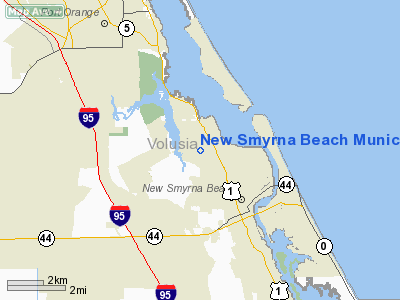
New Smyrna Beach Municipal Airport |
Coordinates: 29°03′20″N 080°56′56″W / 29.05556°N 80.94889°W / 29.05556; -80.94889
New Smyrna Beach Municipal Airport
Jack Bolt Field |
 |
| IATA: none – ICAO: KEVB – FAA LID: EVB |
| Summary |
| Airport type |
Public |
| Owner |
City of New Smyrna Beach |
| Serves |
New Smyrna Beach, Florida |
| Elevation AMSL |
10 ft / 3 m |
| Website |
www.cityofnsb.com/... |
| Runways |
| Direction |
Length |
Surface |
| ft |
m |
| 2/20 |
4,000 |
1,219 |
Asphalt |
| 7/25 |
5,000 |
1,524 |
Asphalt |
| 11/29 |
4,319 |
1,316 |
Asphalt |
| Statistics (2002) |
| Aircraft operations |
140,554 |
| Based aircraft |
159 |
| Source: FAA, airport website |
New Smyrna Beach Municipal Airport (ICAO: KEVB, FAA LID: EVB), also known as Jack Bolt Field, is a public airport located three miles (5 km) northwest of the central business district of New Smyrna Beach, a city in Volusia County, Florida, United States. It is owned by the City of New Smyrna Beach. The fixed base operator on field, Epic Aviation, offers flight training.
Although most U.S. airports use the same three-letter location identifier for the FAA and IATA, New Smyrna Beach Municipal is assigned EVB by the FAA but has no designation from the IATA. History
Prior to World War II, the present airport site was home to both a golf course and a grass airstrip. In 1942, the site was taken over by the U.S. Navy and the present paved runway complex constructed. Designated as Outlying Field New Smyrna Beach, it operated as a auxiliary field to advanced naval flight training operations being conducted at nearby Naval Air Station Daytona Beach, NAS Sanford and NAS DeLand. In 1947, OLF New Smyrna Beach was decommissioned and the facility conveyed back to the City of New Smryna Beach for use as a civilian airport.
Facilities and aircraft
New Smyrna Beach Municipal Airport covers an area of 769 acres (311 ha) which contains three asphalt paved runways:
- Runway 2/20: 4,003 x 100 ft (1,220 x 30 m)
- Runway 7/25: 5,000 x 75 ft (1,524 x 23 m), Lighted without PAPI
- Runway 11/29: 4,300 x 100 ft (1,310 x 30 m), Lighted with PAPI
For the 12-month period ending May 7, 2002, the airport had 140,554 aircraft operations, an average of 385 per day: 99.6% general aviation, 0.3% air taxi and <0.1% military. There are 159 aircraft based at this airport: 86% single-engine, 13% multi-engine and 2% helicopter.
Accidents and incidents
On 1 August 1980, Douglas R4D N45864 crashed at New Smyrna Beach, Florida shortly after take-off on a ferry flight to Queen Beatrix International Airport, Aruba. The unqualified pilot, who had been drinking, was killed.
The above content comes from Wikipedia and is published under free licenses – click here to read more.
Location
& QuickFacts
|
FAA Information Effective: |
2007-01-18 |
|
Airport
Identifier: |
EVB |
|
Airport
Status: |
Operational |
|
Longitude/Latitude: |
080-56-56.1000W/29-03-20.5000N
-80.948917/29.055694 (Estimated) |
|
Elevation: |
10 ft / 3.05 m (Surveyed) |
|
Land: |
769 acres |
|
From
nearest city: |
3 nautical miles NW of New Smyrna Beach,
FL |
|
Location: |
Volusia County, FL |
|
Magnetic Variation: |
04W (1990) |
Owner
& Manager
|
Ownership: |
Publicly owned |
|
Owner: |
City Of New Smyrna Beach |
|
Address: |
210 Sams Avenue
New Smyrna Beach, FL 32168 |
|
Phone
number: |
384-424-2199 |
|
Manager: |
Ron K Wilsbach |
|
Address: |
210 Sams Avenue
New Smyrna Beach, FL 32168 |
|
Phone number: |
386-424-2199 |
Airport
Operations and Facilities
|
Airport Use: |
Open to public |
|
Wind
indicator: |
Yes |
|
Segmented
Circle: |
Yes |
|
Control
Tower: |
Yes |
|
Lighting
Schedule: |
DUSK-DAWN
ACTVT PAPI RY 29 AFTER 0000, ACTVT MIRL RY 11/29 - CTAF. |
|
Beacon
Color: |
Clear-Green (lighted land airport) |
|
Landing
fee charge: |
No |
|
Sectional
chart: |
Jacksonville |
|
Region: |
ASO - Southern |
|
Boundary
ARTCC: |
ZJX - Jacksonville |
|
Tie-in
FSS: |
PIE - Saint Petersburg |
|
FSS
on Airport: |
No |
|
FSS
Toll Free: |
1-800-WX-BRIEF |
|
NOTAMs
Facility: |
EVB (NOTAM-d service avaliable) |
|
Federal Agreements: |
NGRY3 |
Airport
Communications
|
CTAF: |
119.675 |
|
Unicom: |
122.950 |
Airport
Services
|
Fuel available: |
100LLA |
|
Airframe Repair: |
MAJOR |
|
Power Plant Repair: |
MAJOR |
|
Bottled
Oxygen: |
NONE |
|
Bulk
Oxygen: |
NONE |
|
Runway Information
Runway 02/20
|
Dimension: |
4000 x 100 ft / 1219.2 x 30.5 m |
|
Surface: |
ASPH, Fair Condition |
|
Weight
Limit: |
Single wheel: 55000 lbs. |
|
|
Runway 02 |
Runway 20 |
|
Longitude: |
080-56-59.0160W |
080-56-46.1372W |
|
Latitude: |
29-02-56.2848N |
29-03-34.2345N |
|
Elevation: |
8.00
ft |
9.00
ft |
|
Alignment: |
17 |
127 |
|
Traffic
Pattern: |
Left |
Left |
|
Markings: |
Basic, Poor Condition
RY 02/20 MARKINGS FADED. |
Basic, Poor Condition |
|
Displaced
threshold: |
785.00 ft |
0.00
ft |
|
Obstruction: |
25 ft rr, 330.0 ft from runway, 5:1 slope to
clear
RY 02 APCH RATIO 25:1 AT DSPLCD THLD DUE TO 87 FT TREES AT
2188 FT FROM DSPLCD THLD, 0B. |
52 ft trees, 1500.0 ft from runway, 250 ft
right of centerline, 25:1 slope to clear |
|
Runway 07/25
|
Dimension: |
5000 x 75 ft / 1524.0 x 22.9 m |
|
Surface: |
ASPH, Good Condition |
|
Weight
Limit: |
Single wheel: 55000 lbs. |
|
|
Runway 07 |
Runway 25 |
|
Longitude: |
080-57-28.7919W |
080-56-39.2329W |
|
Latitude: |
29-03-17.5582N |
29-03-41.0960N |
|
Elevation: |
7.00
ft |
10.00
ft |
|
Alignment: |
62 |
127 |
|
Traffic
Pattern: |
Left |
Left |
|
Markings: |
Basic, Fair Condition |
Basic, Fair Condition |
|
Displaced
threshold: |
335.00 ft |
300.00 ft |
|
Obstruction: |
15 ft road, 120.0 ft from runway, 1:1 slope
to clear
RY 06 APCH RATIO 30:1 AT DSPLCD THLD.
RY
06 15 FT ROAD 120 FT FROM AER, 0B. |
15 ft road, 210.0 ft from runway
RY 24 APCH RATIO 33:1 AT DSPLCD THLD DUE TO 45 FT POLES 1505
FT FROM DSPLCD THLD, 0B.. |
|
Runway 11/29
|
Dimension: |
4319 x 100 ft / 1316.4 x 30.5 m |
|
Surface: |
ASPH, Good Condition |
|
Weight
Limit: |
Single wheel: 55000 lbs. |
|
Edge
Lights: |
Medium |
|
|
Runway 11 |
Runway 29 |
|
Longitude: |
080-57-13.4622W |
080-56-26.8267W |
|
Latitude: |
29-03-21.2562N |
29-03-09.0279N |
|
Elevation: |
8.00
ft |
10.00
ft |
|
Alignment: |
107 |
127 |
|
Traffic
Pattern: |
Left |
Left |
|
Markings: |
Non-precision instrument, Poor Condition
RY 11/29 MARKINGS FADED. |
Non-precision instrument, Poor Condition |
|
Crossing
Height: |
0.00
ft |
32.00 ft |
|
VASI: |
4-light PAPI on left side |
4-light PAPI on left side |
|
Visual
Glide Angle: |
0.00� |
3.00� |
|
Obstruction: |
45 ft trees, 1100.0 ft from runway, 200 ft
left of centerline, 20:1 slope to clear |
30 ft trees, 741.0 ft from runway, 130 ft right
of centerline, 18:1 slope to clear |
|
Radio Navigation
Aids
|
ID |
Type |
Name |
Ch |
Freq |
Var |
Dist |
|
EVB |
NDB |
New Smyrna Beach |
|
417.00 |
04W |
0.4 nm |
|
DED |
NDB |
Deland/dcmsnd |
|
201.00 |
05W |
17.1 nm |
|
SFB |
NDB |
Sanford |
|
408.00 |
05W |
22.5 nm |
|
GGL |
NDB |
Geiger Lake |
|
375.00 |
05W |
28.7 nm |
|
COI |
NDB |
Merritt Island |
|
247.00 |
05W |
45.1 nm |
|
LEE |
NDB |
Leesburg |
|
335.00 |
04W |
47.4 nm |
|
TTS |
TACAN |
Kennedy Space Center |
059Y |
|
00E |
29.1 nm |
|
OMN |
VORTAC |
Ormond Beach |
073X |
112.60 |
00E |
17.2 nm |
|
ORL |
VORTAC |
Orlando |
059X |
112.20 |
00E |
36.9 nm |
|
DAB |
VOT |
Daytona Beach |
|
111.00 |
|
9.4 nm |
Remarks
- RWY
02/20 AND TWY CRACKING WITH GRASS.
- NOISE
ABATEMENT: NO TURNS BLO PATTERN ALT DEPG RYS 11 & 20 ; REDUCE POWER
WHEN PRACTICABLE.
- BIRDS
ON & INVOF ARPT.
- ARPT
CLSD FOR ULTRALIGHTS EXCEPT PPR 407-847-4600.
Based Aircraft
|
Aircraft
based on field: |
159 |
|
Single
Engine Airplanes: |
136 |
|
Multi
Engine Airplanes: |
20 |
|
Helicopters: |
3 |
Operational Statistics
Time Period: 2001-05-08
- 2002-05-07
|
Aircraft
Operations: |
386/Day |
|
Air Taxi: |
0.4% |
|
General
Aviation Local: |
34.9% |
|
General
Aviation Itinerant: |
64.7% |
|
Military: |
0.0% |
New Smyrna Beach Municipal Airport
Address:
Volusia County, FL
Tel:
384-424-2199
Images
and information placed above are from
http://www.airport-data.com/airport/EVB/
We
thank them for the data!
| General
Info |
| Country |
United
States |
| State |
FLORIDA
|
| FAA ID |
EVB
|
| Latitude |
29-03-20.900N
|
| Longitude |
080-56-54.100W
|
| Elevation |
10 feet
|
| Near City |
NEW SMYRNA
BEACH |
We don't guarantee the information is fresh and accurate. The data may
be wrong or outdated.
For more up-to-date information please refer to other sources.
|
|


