 |
|
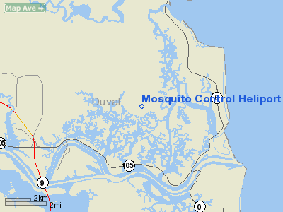
Mosquito Control Heliport |
|
|
Location
& QuickFacts
|
FAA Information Effective: |
2007-01-18 |
|
Airport
Identifier: |
FA41 |
|
Airport
Status: |
Operational |
|
Longitude/Latitude: |
081-28-38.3200W/30-26-27.8610N
-81.477311/30.441073 (Estimated) |
|
Elevation: |
20 ft / 6.10 m (Estimated) |
|
Land: |
12 acres |
|
From
nearest city: |
0 nautical miles NE of Jacksonville, FL |
|
Location: |
Duval County, FL |
|
Magnetic Variation: |
03W (1985) |
Owner
& Manager
|
Ownership: |
Privately owned |
|
Owner: |
City Of Jacksonville
MOSQUITO CONTROL DIVISION. |
|
Address: |
1321 Eastport Rd
Jacksonville, FL 32218 |
|
Phone number: |
904-696-4374 |
|
Manager: |
Richard Smith, Division Chief |
|
Address: |
1321 Eastport Rd
Jacksonville, FL 32218 |
|
Phone number: |
904-696-4374 |
Airport
Operations and Facilities
|
Airport Use: |
Private |
|
Wind indicator: |
Yes |
|
Segmented Circle: |
No |
|
Control Tower: |
No |
|
Landing fee charge: |
No |
|
Sectional chart: |
Jacksonville |
|
Region: |
ASO - Southern |
|
Boundary ARTCC: |
ZJX - Jacksonville |
|
Tie-in FSS: |
GNV - Gainesville |
|
FSS on Airport: |
No |
|
FSS Phone: |
850-377-3291 |
|
FSS Toll Free: |
1-800-WX-BRIEF |
Airport
Communications
|
Unicom: |
123.050
MULTICOM 122.900. |
Airport
Services
|
Fuel available: |
100LL |
|
Airframe Repair: |
NONE |
|
Power Plant Repair: |
NONE |
|
Runway Information
Helipad H1
|
Dimension: |
30
x 20 ft / 9.1 x 6.1 m |
|
Surface: |
CONC, |
|
|
Runway H1 |
Runway |
|
Traffic
Pattern: |
Left |
Left |
|
Radio Navigation
Aids
|
ID |
Type |
Name |
Ch |
Freq |
Var |
Dist |
|
EYA |
NDB |
Eastport |
|
357.00 |
03W |
6.9 nm |
|
JA |
NDB |
Dinns |
|
344.00 |
03W |
16.9 nm |
|
HEG |
NDB |
Herlong |
|
332.00 |
02W |
19.8 nm |
|
JUK |
NDB |
Mc Kinnon |
|
353.00 |
05W |
43.1 nm |
|
NRB |
TACAN |
Mayport |
051X |
|
03W |
4.2 nm |
|
NIP |
TACAN |
Jacksonville |
19X |
|
04W |
16.1 nm |
|
NZC |
TACAN |
Cecil/dcmsnd |
088X |
|
04W |
24.4 nm |
|
VQQ |
VOR |
Cecil |
|
117.90 |
03W |
25.5 nm |
|
SGJ |
VOR/DME |
St Augustine |
031X |
109.40 |
06W |
30.1 nm |
|
CRG |
VORTAC |
Craig |
092X |
114.50 |
03W |
6.4 nm |
|
SSI |
VORTAC |
Brunswick |
035X |
109.80 |
04W |
36.7 nm |
|
JAX |
VOT |
Jacksonville Intl |
|
111.00 |
|
11.4 nm |
Remarks
Based Aircraft
|
Aircraft
based on field: |
3 |
|
Helicopters: |
3 |
Mosquito Control Heliport
Address:
Duval County, FL
Tel:
904-696-4374
Images
and information placed above are from
http://www.airport-data.com/airport/FA41/
We
thank them for the data!
| General
Info |
| Country |
United
States |
| State |
FLORIDA
|
| FAA ID |
FA41
|
| Latitude |
30-26-27.861N
|
| Longitude |
081-28-38.320W
|
| Elevation |
20 feet
|
| Near City |
JACKSONVILLE
|
We don't guarantee the information is fresh and accurate. The data may
be wrong or outdated.
For more up-to-date information please refer to other sources.
|
|


