 |
|
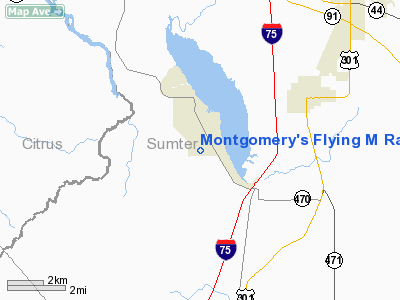
Montgomery's Flying M Ranch Airport |
Location
& QuickFacts
|
FAA Information Effective: |
2007-01-18 |
|
Airport
Identifier: |
FD49 |
|
Airport
Status: |
Operational |
|
Longitude/Latitude: |
082-07-49.3130W/28-46-24.9580N
-82.130365/28.773599 (Estimated) |
|
Elevation: |
70 ft / 21.34 m (Estimated) |
|
Land: |
200 acres |
|
From
nearest city: |
1 nautical miles S of Lake Panasoffkee, FL |
|
Location: |
Sumter County, FL |
|
Magnetic Variation: |
02W (1985) |
Owner
& Manager
|
Ownership: |
Privately owned |
|
Owner: |
S. E. Montgomery |
|
Address: |
Po Box 6
Coleman, FL 33521 |
|
Phone number: |
904-793-6439 |
|
Manager: |
S. E. Montgomery |
|
Address: |
Po Box 6
Coleman, FL 33521 |
|
Phone number: |
904-793-6439 |
Airport
Operations and Facilities
|
Airport Use: |
Private |
|
Wind
indicator: |
Yes |
|
Segmented
Circle: |
No |
|
Control
Tower: |
No |
|
Landing
fee charge: |
No |
|
Sectional
chart: |
Jacksonville |
|
Region: |
ASO - Southern |
|
Boundary
ARTCC: |
ZJX - Jacksonville |
|
Tie-in
FSS: |
PIE - Saint Petersburg |
|
FSS
on Airport: |
No |
|
FSS
Toll Free: |
1-800-WX-BRIEF |
|
Runway
Information
Runway E/W
|
Dimension: |
4000 x 100 ft / 1219.2 x 30.5 m |
|
Surface: |
GRAVEL, |
|
|
Runway E |
Runway W |
|
Traffic
Pattern: |
Left |
Left |
|
Radio Navigation
Aids
|
ID |
Type |
Name |
Ch |
Freq |
Var |
Dist |
|
LEE |
NDB |
Leesburg |
|
335.00 |
04W |
17.2 nm |
|
RHZ |
NDB |
Zephyrhills |
|
253.00 |
03W |
32.9 nm |
|
PCM |
NDB |
Plant City |
|
346.00 |
02W |
46.4 nm |
|
SFB |
NDB |
Sanford |
|
408.00 |
05W |
46.7 nm |
|
ISM |
NDB |
Kissimmee |
|
329.00 |
05W |
46.9 nm |
|
DED |
NDB |
Deland/dcmsnd |
|
201.00 |
05W |
48.4 nm |
|
OCF |
VORTAC |
Ocala |
084X |
113.70 |
00E |
24.8 nm |
|
ORL |
VORTAC |
Orlando |
059X |
112.20 |
00E |
44.2 nm |
|
LAL |
VORTAC |
Lakeland |
107X |
116.00 |
01E |
47.7 nm |
Remarks
Based Aircraft
|
Aircraft
based on field: |
3 |
|
Single Engine Airplanes: |
3 |
Montgomery's Flying M Ranch Airport
Address:
Sumter County, FL
Tel:
904-793-6439
Images
and information placed above are from
http://www.airport-data.com/airport/FD49/
We
thank them for the data!
| General
Info |
| Country |
United
States |
| State |
FLORIDA
|
| FAA ID |
FD49
|
| Latitude |
28-46-24.958N
|
| Longitude |
082-07-49.313W
|
| Elevation |
70 feet
|
| Near City |
LAKE PANASOFFKEE
|
We don't guarantee the information is fresh and accurate. The data may
be wrong or outdated.
For more up-to-date information please refer to other sources.
|
|


