|
|
Melbourne International Airport |
| Melbourne International Airport |
 |
| IATA: MLB – ICAO: KMLB – FAA LID: MLB |
| Summary |
| Airport type |
Public |
| Owner |
City of Melbourne, Florida |
| Serves |
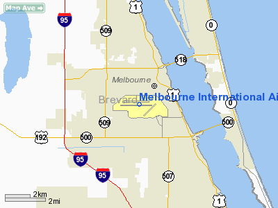
Melbourne, Florida |
| Location |
One Air Terminal Parkway
Melbourne, Florida |
| Elevation AMSL |
33 ft / 10 m |
| Coordinates |
28°06′10″N 080°38′43″W / 28.10278°N 80.64528°W / 28.10278; -80.64528 |
| Website |
www.MLBair.com |
| Runways |
| Direction |
Length |
Surface |
| ft |
m |
| 9R/27L |
10,181 |
3,103 |
Asphalt |
| 9L/27R |
6,000 |
1,829 |
Asphalt |
| 5/23 |
3,001 |
915 |
Asphalt |
| Statistics (2008) |
| Aircraft operations |
163,867 |
| Based aircraft |
262 |
| Source: Federal Aviation Administration |
Melbourne International Airport (IATA: MLB, ICAO: KMLB, FAA LID: MLB) is a public airport located 1 1/2 miles northwest of the downtown business district of Melbourne, a city in Brevard County, Florida, United States. Located on central Florida's Space Coast, the airport is accessed via NASA Boulevard (State Road 508). It is governed by a seven-member board which is appointed by the Melbourne City Council and the private sector. The airport budget is contained within the Melbourne municipal budget. The airport receives no local tax dollars. The projected expenses for 2010 is $14.1 million. History
Melbourne International Airport began in 1928 when a Pitcairn Aircraft landed on a cow pasture strip north of Kissimmee Highway.
Airmail service commenced in late 1928 when the airport was designated a fueling stop. In 1933, the City of Melbourne acquired 160 acres (65 ha) west of Indian River Bluff to develop as a new location for the airport, which was further developed and operated as Naval Air Station Melbourne during World War II.
Returned to the city as a Surplus Property Airport after the War, Melbourne Airport was deeded to the city in 1947. It was operated as a municipal airport until 1967 at which time the city created the Melbourne Airport Authority to plan, operate, maintain, and develop the airport.
In the early 1980s, filmmaker Jim Jarmusch shot some ending scenes for his award-winning film Stranger Than Paradise in the Melbourne area. This included several important plot scenes shot at the "Melbourne Regional Airport" (as listed in the credits).
The Authority operated a recreational vehicle site, "Port O' Call." This was closed and the tenants evicted in 2003. The intent was to use the property for commercial development.
The Melbourne Airport Authority operates Tropical Haven (formerly Trailer Haven), a 759-site manufactured home park. As of 2010, the airport has non-stop service to Atlanta via Delta Air Lines and its regional partner Atlantic Southeast Airlines, as well as non-stop service to Charlotte Douglas International Airport via US Airways and its regional partner PSA Airlines. In the past, Delta has flown non-stop from Melbourne to its hubs in Cincinnati, New York-JFK and New York-La Guardia, as well as point-to-point routes to Washington-Dulles and Washington-Reagan; all of this service was discontinued. USA3000 Airlines also briefly served Melbourne with flights to Baltimore/Washington, American Airlines also serviced Melbourne with flights to Raleigh-Durham, and Continental serviced Melbourne as well with service to Newark-Liberty.
Statistics
Monthly passengers were at a seasonal low in September 2007 at 14,083. A high was experienced in March 2010 of 41,725. Total enplaned and deplaned passengers for 2008 numbered about 286,000.
229,000 used the airport in 2009, a 24% drop from the prior year.
Facilities and aircraft
 | |
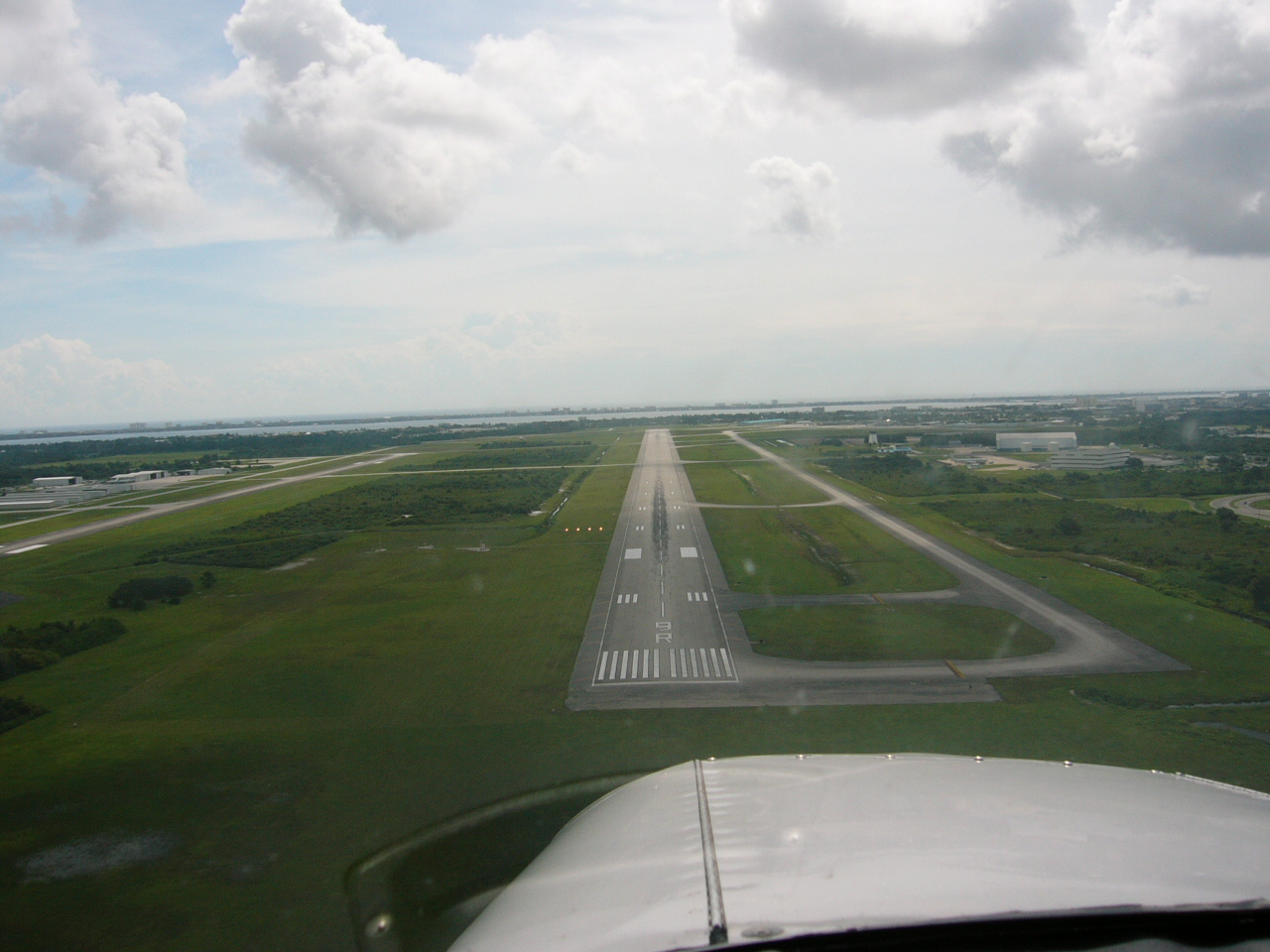
Runway 9R |
Melbourne International Airport covers an area of 2,450 acres (992 ha) which contains three asphalt paved runways: 9R/27L measuring 10,181 x 150 ft (3,103 x 46 m), 9L/27R measuring 6,000 x 150 ft (1,829 x 46 m) and 5/23 measuring 3,001 x 75 ft (915 x 23 m).
For the 12-month period ending June 20, 2008, the airport had 163,867 aircraft operations, an average of 448 per day: 95% general aviation, 2% scheduled commercial, 2% air taxi and <1% military. There are 262 aircraft based at this airport: 79% single-engine, 16% multi-engine, 3% jet, 2% helicopter and <1% military.
The Airport Museum is located inside the terminal building.
The Florida Institute of Technology Research, Science and Technology Park is located on approximately 100 acres (40 ha) surrounded by Airport tenants such as Northrop Grumman Joint Stars, G.E Railway, Rockwell Collins, DRS, L-3 and leases property to two hospitals and one hotel. A new Embraer Business Jet Assembly Facility is currently under construction.
Scheduled Airlines
| Airlines |
Destinations |
| Baer Air |
Freeport |
| Delta Air Lines |
Atlanta |
| Delta Connection operated by Atlantic Southeast Airlines |
Atlanta |
| Direct Air |
Niagara Falls, Punta Gorda |
| US Airways Express operated by PSA Airlines |
Charlotte |
Cargo carriers
| Airlines |
Destinations |
| Air Transport International |
Antigua |
Flight schools
- F.I.T. Aviation Flight School owned by Florida Institute of Technology for the College of Aeronautics. Offers flight training for fixed wing aircraft for the FAA Private Pilot Certification, Instrument Rating, Commercial Pilot Certification, Multi-Engine and Advanced Aircraft Training. In 1999, in order to match a grant for a new engineering building, Florida Tech sold nearly a third of its training fleet.
- Co-located with F.I.T Aviation School, The Pilot Training College (PTC) offers European flight training for fixed wing aircraft for the JAA Commercial Pilot Certification, Multi-Engine and Advanced Aircraft Training. PTC offers JAA flight training to airline transport pilot level either by integrated or modular training mode - as well as offering a full-time BSc. degree program in airline transport operations that includes a JAA commercial pilots license.
Gallery
The above content comes from Wikipedia and is published under free licenses – click here to read more.
Location
& QuickFacts
|
FAA Information Effective: |
2007-01-18 |
|
Airport
Identifier: |
MLB |
|
Airport
Status: |
Operational |
|
Longitude/Latitude: |
080-38-42.9250W/28-06-09.9100N
-80.645257/28.102753 (Estimated) |
|
Elevation: |
33 ft / 10.06 m (Surveyed) |
|
Land: |
2800 acres |
|
From
nearest city: |
2 nautical miles NW of Melbourne, FL |
|
Location: |
Brevard County, FL |
|
Magnetic Variation: |
03W (1985) |
Owner
& Manager
|
Ownership: |
Publicly owned |
|
Owner: |
City Of Melbourne |
|
Address: |
1 Air Terminal Pkwy/suite 220
Melbourne, FL 32901 |
|
Phone
number: |
321-723-6227 |
|
Manager: |
Richard A. Ennis
DIRECTOR OF AVIATION MELBOURNE ARPT AUTH. |
|
Address: |
1 Air Trml Pkwy, Suite 220
Melbourne, FL 32901 |
|
Phone number: |
321-723-6227 |
Airport
Operations and Facilities
|
Airport Use: |
Open to public |
|
Wind
indicator: |
Yes |
|
Segmented
Circle: |
Yes |
|
Control
Tower: |
Yes |
|
Lighting
Schedule: |
DUSK-DAWN
WHEN ATCT CLSD ACTVT PRESELECTED RY LGTS (NORMALLY RY 09R/27L),
MALSR RY 09R & REIL RY 27L - CTAF. |
|
Beacon
Color: |
Clear-Green (lighted land airport) |
|
Landing
fee charge: |
No |
|
Sectional
chart: |
Jacksonville |
|
Region: |
ASO - Southern |
|
Boundary
ARTCC: |
ZMA - Miami |
|
Responsible
ARTCC: |
ZJX - Jacksonville |
|
Tie-in
FSS: |
PIE - Saint Petersburg |
|
FSS
on Airport: |
No |
|
FSS
Toll Free: |
1-800-WX-BRIEF |
|
NOTAMs
Facility: |
MLB (NOTAM-d service avaliable) |
|
Certification type/date: |
I C S 05/1973 |
|
Federal Agreements: |
NGPRY3 |
Airport
Communications
|
CTAF: |
118.200 |
|
Unicom: |
122.950 |
Airport
Services
|
Fuel available: |
100LLA |
|
Airframe Repair: |
MAJOR |
|
Power Plant Repair: |
MAJOR |
|
Bottled
Oxygen: |
NONE |
|
Runway Information
Runway 05/23
|
Dimension: |
3001 x 75 ft / 914.7 x 22.9 m |
|
Surface: |
ASPH, Good Condition |
|
Weight
Limit: |
Single wheel: 26000 lbs. |
|
Edge
Lights: |
Medium |
|
|
Runway 05 |
Runway 23 |
|
Longitude: |
080-38-14.6120W |
080-37-52.1410W |
|
Latitude: |
28-05-45.2520N |
28-06-07.3000N |
|
Elevation: |
25.00 ft |
21.00
ft |
|
Alignment: |
42 |
127 |
|
Traffic
Pattern: |
Left |
Left |
|
Markings: |
Basic, Good Condition |
Basic, Good Condition |
|
Crossing
Height: |
21.00
ft |
21.00
ft |
|
VASI: |
2-light PAPI on left side |
2-light PAPI on left side |
|
Visual
Glide Angle: |
3.00� |
3.00� |
|
Obstruction: |
36 ft , 1400.0 ft from runway, 200 ft right
of centerline, 33:1 slope to clear |
51 ft , 1700.0 ft from runway, 100 ft right
of centerline, 29:1 slope to clear |
|
Decleard
distances: |
Take off run available 3000.00 ft
Take off distance available 3000.00 ft
Actual stop distance available 3000.00 ft
Landing distance available 3000.00 ft |
Take off run available 3000.00 ft
Take off distance available 3000.00 ft
Actual stop distance available 3000.00 ft
Landing distance available 3000.00 ft |
|
Runway 09L/27R
|
Dimension: |
6000 x 150 ft / 1828.8 x 45.7 m |
|
Surface: |
ASPH, Good Condition |
|
Weight
Limit: |
Single wheel: 60000 lbs.
Dual wheel: 60000 lbs. |
|
Edge
Lights: |
Medium |
|
|
Runway 09L |
Runway 27R |
|
Longitude: |
080-39-35.4930W |
080-38-28.5980W |
|
Latitude: |
28-06-19.4590N |
28-06-22.6920N |
|
Elevation: |
30.00 ft |
26.00 ft |
|
Alignment: |
87 |
127 |
|
Traffic
Pattern: |
Left |
Left |
|
Markings: |
Basic, Good Condition |
Basic, Good Condition |
|
Crossing
Height: |
37.00 ft |
37.00 ft |
|
VASI: |
4-light PAPI on left side |
4-light PAPI on left side |
|
Visual
Glide Angle: |
3.00� |
3.00� |
|
Decleard
distances: |
Take off run available 6000.00 ft
Take off distance available 6000.00 ft
Actual stop distance available 6000.00 ft
Landing distance available 6000.00 ft |
Take off run available 6000.00 ft
Take off distance available 6000.00 ft
Actual stop distance available 6000.00 ft
Landing distance available 6000.00 ft |
|
Runway 09R/27L
|
Dimension: |
10181 x 150 ft / 3103.2 x 45.7 m |
|
Surface: |
ASPH, Good Condition |
|
Surface
Treatment: |
Saw-cut or plastic Grooved |
|
Weight
Limit: |
Single wheel: 100000 lbs.
Dual wheel: 165000 lbs.
Dual
tandem wheel: 300000 lbs. |
|
Edge
Lights: |
High |
|
|
Runway 09R |
Runway 27L |
|
Longitude: |
080-39-40.0750W |
080-37-46.5600W |
|
Latitude: |
28-06-04.6130N |
28-06-10.1000N |
|
Elevation: |
32.00 ft |
22.00
ft |
|
Alignment: |
87 |
127 |
|
ILS
Type: |
ILS |
|
|
Traffic
Pattern: |
Left |
Left |
|
Markings: |
Precision instrument, Good Condition |
Nonstandard, |
|
Crossing
Height: |
76.00 ft |
52.00 ft |
|
Displaced
threshold: |
0.00
ft |
700.00 ft |
|
VASI: |
4-light PAPI on left side |
4-light PAPI on left side |
|
Visual
Glide Angle: |
3.00� |
3.00� |
|
RVR
Equipment: |
touchdown
RVR UNAVBL 0000-0600. |
|
|
Approach
lights: |
MALSR |
|
|
Runway
End Identifier: |
|
Yes |
|
Centerline
Lights: |
Yes |
Yes |
|
Touchdown
Lights: |
Yes |
|
|
Decleard
distances: |
Take off run available 10181.00 ft
Take off distance available 10181.00 ft
Actual stop distance available 10181.00 ft
Landing distance available 10181.00 ft |
Take off run available 10181.00 ft
Take off distance available 10181.00 ft
Actual stop distance available 10181.00 ft
Landing distance available 9481.00 ft |
|
Radio Navigation
Aids
|
ID |
Type |
Name |
Ch |
Freq |
Var |
Dist |
|
SQT |
NDB |
Satellite |
|
257.00 |
03W |
3.0 nm |
|
COI |
NDB |
Merritt Island |
|
247.00 |
05W |
14.5 nm |
|
VEP |
NDB |
Vero Beach |
|
392.00 |
04W |
29.0 nm |
|
GGL |
NDB |
Geiger Lake |
|
375.00 |
05W |
30.8 nm |
|
FPR |
NDB |
Fort Pierce |
|
275.00 |
04W |
39.8 nm |
|
ISM |
NDB |
Kissimmee |
|
329.00 |
05W |
43.3 nm |
|
COF |
TACAN |
Patrick |
097X |
|
04W |
8.3 nm |
|
TTS |
TACAN |
Kennedy Space Center |
059Y |
|
00E |
31.6 nm |
|
MLB |
VOR/DME |
Melbourne |
037X |
110.00 |
02W |
0.5 nm |
|
VRB |
VORTAC |
Vero Beach |
120X |
117.30 |
04W |
26.8 nm |
|
ORL |
VORTAC |
Orlando |
059X |
112.20 |
00E |
45.1 nm |
|
VRB |
VOT |
Vero Beach |
|
111.00 |
|
29.6 nm |
Remarks
- TRNG
OPERS BY LARGE ACFT OVER 12500 LBS OR TURBO JET ACFT (ALL CATEGORIES)
PROHIBITED; EXCEPT BY PRIOR WRITTEN PERMISSION FROM THE OFFICE OF THE
DIRECTOR OF AVIATION.
- TOUCH
& GO OPNS RSTRD AFTER 2100 OR 2 HRS AFTER SS (WHICHEVER IS LATEST).
Based Aircraft
|
Aircraft
based on field: |
181 |
|
Single
Engine Airplanes: |
135 |
|
Multi
Engine Airplanes: |
33 |
|
Jet Engine
Airplanes: |
9 |
|
Helicopters: |
3 |
|
Military: |
1 |
Major Carriers
Serving This Airport
| Delta Air Lines Inc. |
51.1% |
| Atlantic Southeast Airlines |
44.0% |
| Comair Inc. |
5.0% |
Most Popular Destinations
|
Hartsfield
- Jackson Atlanta Intl (ATL) |
84.8% |
|
Ronald Reagan Washington National (DCA) |
15.2% |
Most Popular Aircraft
|
N843AS |
1.6% |
| N856AS |
1.6% |
|
N900EV |
1.2% |
| N867AS |
1.2% |
|
N719EV |
1.2% |
| N827AS |
1.2% |
|
N927DA |
1.2% |
| N931DL |
1.2% |
|
N952DL |
1.2% |
| N826AS |
1.0% |
Operational Statistics
Time Period: 2004-03-01
- 2005-02-28
|
Aircraft
Operations: |
437/Day |
|
Commerical: |
3.4% |
|
Air Taxi: |
2.4% |
|
General
Aviation Local: |
44.4% |
|
General
Aviation Itinerant: |
49.6% |
|
Military: |
0.3% |
Melbourne International Airport
Address:
Brevard County, FL
Tel:
321-723-6227
Images
and information placed above are from
http://www.airport-data.com/airport/MLB/
We
thank them for the data!
| General
Info |
| Country |
United
States |
| State |
FLORIDA
|
| FAA ID |
MLB
|
| Latitude |
28-06-09.910N
|
| Longitude |
080-38-42.925W
|
| Elevation |
33 feet
|
| Near City |
MELBOURNE
|
We don't guarantee the information is fresh and accurate. The data may
be wrong or outdated.
For more up-to-date information please refer to other sources.
|
|