 |
|
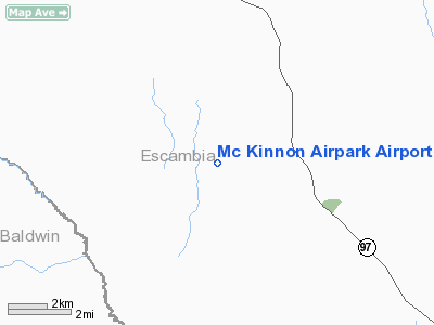
Mc Kinnon Airpark Airport |
Location
& QuickFacts
|
FAA Information Effective: |
2007-01-18 |
|
Airport
Identifier: |
48FL |
|
Airport
Status: |
Operational |
|
Longitude/Latitude: |
087-28-29.9340W/30-48-50.6740N
-87.474982/30.814076 (Estimated) |
|
Elevation: |
227 ft / 69.19 m (Estimated) |
|
Land: |
50 acres |
|
From
nearest city: |
5 nautical miles SE of Walnut Hill, FL |
|
Location: |
Escambia County, FL |
|
Magnetic Variation: |
01E (1985) |
Owner
& Manager
|
Ownership: |
Privately owned |
|
Owner: |
Thomas F Simard |
|
Address: |
6001 S Hwy 99
Walnut Hill, FL 32568 |
|
Phone number: |
904-327-6240 |
|
Manager: |
Thomas F Simard |
|
Address: |
6001 S Hwy 99
Walnut Hillfl 32568 |
|
Phone number: |
904-327-6240 |
Airport
Operations and Facilities
|
Airport Use: |
Private |
|
Segmented Circle: |
No |
|
Control Tower: |
No |
|
Sectional chart: |
New Orleans |
|
Region: |
ASO - Southern |
|
Boundary ARTCC: |
ZJX - Jacksonville |
|
Tie-in FSS: |
GNV - Gainesville |
|
FSS Phone: |
850-377-3291 |
|
FSS Toll Free: |
1-800-WX-BRIEF |
Airport
Communications
|
Runway Information
Runway 18/36
|
Dimension: |
2380 x 100 ft / 725.4 x 30.5 m |
|
Surface: |
TURF, |
|
|
Runway 18 |
Runway 36 |
|
Traffic
Pattern: |
Left |
Left |
|
Displaced
threshold: |
600.00 ft |
0.00
ft |
|
Obstruction: |
40 ft pline, 800.0 ft from runway |
|
|
Radio Navigation
Aids
|
ID |
Type |
Name |
Ch |
Freq |
Var |
Dist |
|
ESU |
NDB |
Summerdale |
|
204.00 |
01E |
22.9 nm |
|
PKZ |
NDB |
Pickens |
|
326.00 |
01E |
27.4 nm |
|
MO |
NDB |
Wisle |
|
248.00 |
02E |
42.9 nm |
|
NSE |
TACAN |
Whiting |
070X |
|
01E |
24.2 nm |
|
NPA |
TACAN |
Pensacola |
119X |
|
01E |
28.6 nm |
|
NGS |
TACAN |
Santa Rosa |
063X |
|
01E |
30.2 nm |
|
HRT |
TACAN |
Hurlburt |
045X |
|
00E |
46.8 nm |
|
NUN |
VOR |
Saufley |
|
108.80 |
01E |
21.8 nm |
|
BFM |
VORTAC |
Brookley |
075X |
112.80 |
04E |
32.3 nm |
|
MVC |
VORTAC |
Monroeville |
115X |
116.80 |
04E |
39.4 nm |
|
CEW |
VORTAC |
Crestview |
106X |
115.90 |
03E |
41.1 nm |
|
SJI |
VORTAC |
Semmes |
100X |
115.30 |
05E |
46.0 nm |
Remarks
- PRVDD
ALL OPS VFR, PVT USE.
Based Aircraft
|
Aircraft
based on field: |
1 |
|
Single
Engine Airplanes: |
1 |
Mc Kinnon Airpark Airport
Address:
Escambia County, FL
Tel:
904-327-6240
Images
and information placed above are from
http://www.airport-data.com/airport/48FL/
We
thank them for the data!
| General
Info |
| Country |
United
States |
| State |
FLORIDA
|
| FAA ID |
48FL
|
| Latitude |
30-48-50.674N
|
| Longitude |
087-28-29.934W
|
| Elevation |
227 feet
|
| Near City |
WALNUT
HILL |
We don't guarantee the information is fresh and accurate. The data may
be wrong or outdated.
For more up-to-date information please refer to other sources.
|
|


