 |
|
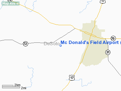
Mc Donald's Field Airport |
Location
& QuickFacts
|
FAA Information Effective: |
2007-01-18 |
|
Airport
Identifier: |
8FL1 |
|
Airport
Status: |
Operational |
|
Longitude/Latitude: |
081-54-56.3030W/27-11-49.1800N
-81.915640/27.196994 (Estimated) |
|
Elevation: |
54 ft / 16.46 m (Estimated) |
|
Land: |
12 acres |
|
From
nearest city: |
3 nautical miles SW of Arcadia, FL |
|
Location: |
De Soto County, FL |
|
Magnetic Variation: |
02W (1985) |
Owner
& Manager
|
Ownership: |
Privately owned |
|
Owner: |
Katherine S. Mc Donald |
|
Address: |
Po Box 302
Arcadia, FL 33821 |
|
Phone number: |
813-494-0761 |
|
Manager: |
Ronald B. Mc Donald |
|
Address: |
Po Box 302
Arcadia, FL 33821 |
|
Phone number: |
813-494-0761 |
Airport
Operations and Facilities
|
Airport Use: |
Private |
|
Wind
indicator: |
Yes |
|
Segmented
Circle: |
No |
|
Control
Tower: |
No |
|
Landing
fee charge: |
No |
|
Sectional
chart: |
Miami |
|
Region: |
ASO - Southern |
|
Boundary
ARTCC: |
ZMA - Miami |
|
Tie-in
FSS: |
PIE - Saint Petersburg |
|
FSS
on Airport: |
No |
|
FSS
Toll Free: |
1-800-WX-BRIEF |
|
Runway Information
Runway 04/22
|
Dimension: |
2800 x 100 ft / 853.4 x 30.5 m |
|
Surface: |
TURF, |
|
|
Runway 04 |
Runway 22 |
|
Traffic
Pattern: |
Left |
Left |
|
Obstruction: |
8 ft trees, 1000.0 ft from runway |
|
|
Radio Navigation
Aids
|
ID |
Type |
Name |
Ch |
Freq |
Var |
Dist |
|
CHN |
NDB |
Wauchula |
|
261.00 |
04W |
18.9 nm |
|
VNC |
NDB |
Venice |
|
206.00 |
02W |
28.7 nm |
|
PGD |
VOR |
Punta Gorda |
|
110.20 |
03W |
17.3 nm |
|
LBV |
VORTAC |
La Belle |
041X |
110.40 |
01E |
35.8 nm |
|
SRQ |
VORTAC |
Sarasota |
099X |
115.20 |
02W |
36.2 nm |
|
RSW |
VORTAC |
Lee County |
055X |
111.80 |
02W |
40.8 nm |
|
LAL |
VORTAC |
Lakeland |
107X |
116.00 |
01E |
47.7 nm |
Remarks
- E111:
PROVIDED ARPT LIMITED TO PRIVATE USE; VFR OPERATIONS.
Based Aircraft
|
Aircraft
based on field: |
2 |
|
Single
Engine Airplanes: |
2 |
Mc Donald's Field Airport
Address:
De Soto County, FL
Tel:
813-494-0761
Images
and information placed above are from
http://www.airport-data.com/airport/8FL1/
We
thank them for the data!
| General
Info |
| Country |
United
States |
| State |
FLORIDA
|
| FAA ID |
8FL1
|
| Latitude |
27-11-49.180N
|
| Longitude |
081-54-56.303W
|
| Elevation |
54 feet
|
| Near City |
ARCADIA
|
We don't guarantee the information is fresh and accurate. The data may
be wrong or outdated.
For more up-to-date information please refer to other sources.
|
|


