 |
|
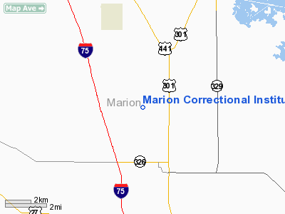
Marion Correctional Institution Heliport |
Location
& QuickFacts
|
FAA Information Effective: |
2007-01-18 |
|
Airport
Identifier: |
33FL |
|
Airport
Status: |
Operational |
|
Longitude/Latitude: |
082-10-21.3400W/29-18-18.9050N
-82.172594/29.305251 (Estimated) |
|
Elevation: |
85 ft / 25.91 m (Estimated) |
|
Land: |
696 acres |
|
From
nearest city: |
2 nautical miles NW of Lowell, FL |
|
Location: |
Marion County, FL |
|
Magnetic Variation: |
02W (1990) |
Owner
& Manager
|
Ownership: |
Publicly owned |
|
Owner: |
Florida Dept Of Corrections |
|
Address: |
Po Box 158
Lowell, FL 32663 |
|
Phone number: |
904-867-8133 |
|
Manager: |
Don Moreland |
|
Address: |
Po Box 1987
Ocala, FL 32678 |
|
Phone number: |
904-732-8181 |
Airport
Operations and Facilities
|
Airport Use: |
Private |
|
Wind
indicator: |
Yes |
|
Segmented
Circle: |
No |
|
Control
Tower: |
No |
|
Sectional
chart: |
Jacksonville |
|
Region: |
ASO - Southern |
|
Boundary
ARTCC: |
ZJX - Jacksonville |
|
Tie-in
FSS: |
GNV - Gainesville |
|
FSS
Phone: |
850-377-3291 |
|
FSS
Toll Free: |
1-800-WX-BRIEF |
|
Runway Information
Helipad H1
|
Dimension: |
300 x 300 ft / 91.4 x 91.4 m |
|
Surface: |
TURF, |
|
|
Runway H1 |
Runway |
|
Traffic
Pattern: |
Left |
Left |
|
Radio Navigation
Aids
|
ID |
Type |
Name |
Ch |
Freq |
Var |
Dist |
|
GN |
NDB |
Wynds |
|
269.00 |
04W |
21.9 nm |
|
IAK |
NDB |
Palatka |
|
243.00 |
05W |
28.2 nm |
|
LEE |
NDB |
Leesburg |
|
335.00 |
04W |
35.0 nm |
|
DED |
NDB |
Deland/dcmsnd |
|
201.00 |
05W |
49.3 nm |
|
OCF |
VORTAC |
Ocala |
084X |
113.70 |
00E |
8.2 nm |
|
GNV |
VORTAC |
Gators |
109X |
116.20 |
04W |
23.8 nm |
|
CTY |
VORTAC |
Cross City |
057X |
112.00 |
02W |
49.1 nm |
Remarks
- HELIPORT
IS FOR THE EXCLUSIVE USE OF MARION COUNTY SHERIFF'S OFFICE.
- PRVDD
VFR/PVT USE; AREA IS MKD; WIND INDICATOR IS MAINTAINED; OPNS CONDUCTED
FROM 080-180 DEGS.
Based Aircraft
|
Aircraft
based on field: |
1 |
|
Helicopters: |
1 |
Marion Correctional Institution Heliport
Address:
Marion County, FL
Tel:
904-867-8133, 904-732-8181
Images
and information placed above are from
http://www.airport-data.com/airport/33FL/
We
thank them for the data!
| General
Info |
| Country |
United
States |
| State |
FLORIDA
|
| FAA ID |
33FL
|
| Latitude |
29-18-18.905N
|
| Longitude |
082-10-21.340W
|
| Elevation |
85 feet
|
| Near City |
LOWELL
|
We don't guarantee the information is fresh and accurate. The data may
be wrong or outdated.
For more up-to-date information please refer to other sources.
|
|


