 |
|
Marco Island Airport
Marco Island Executive Airport |
| IATA: MRK – ICAO: KMKY – FAA LID: MKY |
| Summary |
| Airport type |
Public |
| Owner |
Collier County Arpt. Auth. |
| Serves |
Marco Island, Florida |
| Location |
Naples, Florida |
| Elevation AMSL |
5 ft / 2 m |
| Coordinates |
25°59′42″N 081°40′21″W / 25.995°N 81.6725°W / 25.995; -81.6725 |
| Runways |
| Direction |
Length |
Surface |
| ft |
m |
| 17/35 |
5,000 |
1,524 |
Asphalt |
| Statistics (1998) |
| Aircraft operations |
14,580 |
| Based aircraft |
36 |
| Source: FAA and airport website |
Marco Island Airport (IATA: MRK, ICAO: KMKY, FAA LID: MKY), also known as Marco Island Executive Airport, is a public airport located in the city of Naples in Collier County, Florida, four miles (6 km) northeast of the central business district of Marco Island. This airport is publicly owned by Collier County.
Although most U.S. airports use the same three-letter location identifier for the FAA and IATA, Marco Island Airport is assigned MKY by the FAA and MRK by the IATA (which assigned MKY to Mackay Airport in Mackay, Queensland, Australia). The airport's ICAO identifier is KMKY.
Facilities and aircraft
Marco Island Airport covers an area of 140 acres (57 ha) and contains one asphalt runway (17/35): 5,000 x 100 ft (1,524 x 30 m).
For 12-month period ending August 25, 1998, the airport had 14,580 aircraft operations, an average of 39 per day: 99% general aviation (14,560) and 1% military (20). There are 36 aircraft based at this airport: 83% single engine (30), 8% multi engine (3), 6% jet aircraft (2) and 3% helicopters (1).
The above content comes from Wikipedia and is published under free licenses – click here to read more.
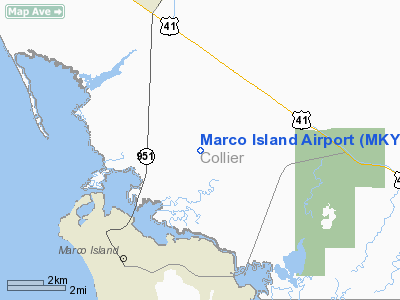
Location
& QuickFacts
|
FAA Information Effective: |
2007-01-18 |
|
Airport
Identifier: |
MKY |
|
Airport
Status: |
Operational |
|
Longitude/Latitude: |
081-40-21.1000W/25-59-42.1000N
-81.672528/25.995028 (Estimated) |
|
Elevation: |
5 ft / 1.52 m (Surveyed) |
|
Land: |
140 acres |
|
From
nearest city: |
4 nautical miles NE of Marco Island, FL |
|
Location: |
Collier County, FL |
|
Magnetic Variation: |
03W (1995) |
Owner
& Manager
|
Ownership: |
Publicly owned |
|
Owner: |
Collier County |
|
Address: |
2003 Mainsail Drive
Naples, FL 34114 |
|
Phone number: |
239-642-7878 |
|
Manager: |
Bob Tweedie |
|
Address: |
2003 Mainsail Drive
Naples, FL 34114 |
|
Phone number: |
239-394-3355 |
Airport
Operations and Facilities
|
Airport Use: |
Open to public |
|
Wind
indicator: |
Yes |
|
Segmented
Circle: |
No |
|
Control
Tower: |
No |
|
Lighting
Schedule: |
DUSK-DAWN
MIRL RY 17/35 PRESET LOW INTST; TO INCR INTST & ACTVT
PAPI RYS 17 & 35 1900-0700 - CTAF. |
|
Beacon
Color: |
Clear-Green (lighted land airport) |
|
Landing
fee charge: |
Yes
PARKING FEE. |
|
Sectional
chart: |
Miami |
|
Region: |
ASO - Southern |
|
Boundary
ARTCC: |
ZMA - Miami |
|
Tie-in
FSS: |
MIA - Miami |
|
FSS
on Airport: |
No |
|
FSS
Phone: |
305-233-2600 |
|
FSS
Toll Free: |
1-800-WX-BRIEF |
|
NOTAMs
Facility: |
MIA (NOTAM-d service avaliable) |
|
Federal Agreements: |
N |
Airport
Communications
|
CTAF: |
122.800 |
|
Unicom: |
122.800 |
Airport
Services
|
Fuel available: |
100LLA |
|
Bottled
Oxygen: |
NONE |
|
Bulk
Oxygen: |
NONE |
|
Runway Information
Runway 17/35
|
Dimension: |
5000 x 100 ft / 1524.0 x 30.5 m |
|
Surface: |
ASPH, Poor Condition
GRASS GROWING THRU CRACKS. |
|
Weight
Limit: |
Dual wheel: 100000 lbs. |
|
Edge
Lights: |
Medium |
|
|
Runway 17 |
Runway 35 |
|
Longitude: |
081-40-26.9380W |
081-40-15.2700W |
|
Latitude: |
26-00-06.3390N |
25-59-17.9500N |
|
Elevation: |
4.00
ft |
4.00
ft |
|
Alignment: |
127 |
127 |
|
ILS
Type: |
LOC/DME |
|
|
Traffic
Pattern: |
Left |
Right |
|
Markings: |
Non-precision instrument, Fair Condition |
Basic, Fair Condition |
|
Crossing
Height: |
31.00 ft |
31.00 ft |
|
VASI: |
4-light PAPI on left side |
4-light PAPI on left side |
|
Visual
Glide Angle: |
3.00� |
3.00� |
|
Obstruction: |
28 ft trees, 341.0 ft from runway, 5:1 slope
to clear
APCH RATIO 20:1 TO RWY END. |
22 ft trees, 759.0 ft from runway, 34:1 slope
to clear |
|
Radio Navigation
Aids
|
ID |
Type |
Name |
Ch |
Freq |
Var |
Dist |
|
APF |
NDB |
Naples |
|
201.00 |
03W |
11.1 nm |
|
CYY |
VOR/DME |
Cypress |
023X |
108.60 |
03W |
11.1 nm |
|
RSW |
VORTAC |
Lee County |
055X |
111.80 |
02W |
32.6 nm |
Remarks
- LNDG
& SERVICE FEES FOR COML FLTS.
- FOR
SVC AFT HRS CALL (941-394-3355).
- NUMEROUS
CRANES OPERATE 1 MILE W OF FIELD 180 FT LIGHTED AND UNLGTD.
- ARPT
VSBY UNRELIABLE.
Based Aircraft
|
Aircraft
based on field: |
36 |
|
Single
Engine Airplanes: |
30 |
|
Multi
Engine Airplanes: |
3 |
|
Jet Engine
Airplanes: |
2 |
|
Helicopters: |
1 |
Operational Statistics
Time Period: 1997-08-26
- 1998-08-25
|
Aircraft
Operations: |
281/Week |
|
General
Aviation Local: |
28.5% |
|
General
Aviation Itinerant: |
71.3% |
|
Military: |
0.1% |
Marco Island Airport
Address:
Collier County, FL
Tel:
239-642-7878, 239-394-3355
Images
and information placed above are from
http://www.airport-data.com/airport/MKY/
We
thank them for the data!
| General
Info |
| Country |
United
States |
| State |
FLORIDA
|
| FAA ID |
MKY
|
| Latitude |
25-59-42.100N
|
| Longitude |
081-40-21.100W
|
| Elevation |
5 feet
|
| Near City |
MARCO
ISLAND |
We don't guarantee the information is fresh and accurate. The data may
be wrong or outdated.
For more up-to-date information please refer to other sources.
|
|


