 |
|
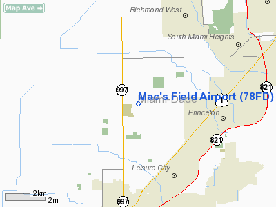
Location
& QuickFacts
|
FAA Information Effective: |
2007-01-18 |
|
Airport
Identifier: |
78FD |
|
Airport
Status: |
Operational |
|
Longitude/Latitude: |
080-27-56.2020W/25-32-47.3900N
-80.465612/25.546497 (Estimated) |
|
Elevation: |
16 ft / 4.88 m (Estimated) |
|
Land: |
0 acres |
|
From
nearest city: |
9 nautical miles S of Homestead, FL |
|
Location: |
Dade County, FL |
|
Magnetic Variation: |
03W (1990) |
Owner
& Manager
|
Ownership: |
Privately owned |
|
Owner: |
Charles Munz |
|
Address: |
23799 Sw 167 Ave
Homestead, FL 33031 |
|
Phone number: |
305-247-3226 |
|
Manager: |
Charles Munz |
|
Address: |
23799 Sw 167 Ave
Homestead, FL 33031 |
|
Phone number: |
305-247-3226 |
Airport
Operations and Facilities
|
Airport Use: |
Private |
|
Wind
indicator: |
Yes |
|
Segmented
Circle: |
No |
|
Control
Tower: |
No |
|
Sectional
chart: |
Miami |
|
Region: |
ASO - Southern |
|
Boundary
ARTCC: |
ZMA - Miami |
|
Tie-in
FSS: |
MIA - Miami |
|
FSS
Phone: |
305-233-2600 |
|
FSS
Toll Free: |
1-800-WX-BRIEF |
|
Runway Information
Runway 08/26
|
Dimension: |
2000 x 100 ft / 609.6 x 30.5 m |
|
Surface: |
TURF, |
|
|
Runway 08 |
Runway 26 |
|
Traffic
Pattern: |
Left |
Left |
|
Obstruction: |
|
30 ft plines, 20.0 ft from runway |
|
Radio Navigation
Aids
|
ID |
Type |
Name |
Ch |
Freq |
Var |
Dist |
|
PJN |
NDB |
Plantation |
|
242.00 |
03W |
37.7 nm |
|
FX |
NDB |
Praiz |
|
221.00 |
02W |
39.5 nm |
|
HST |
TACAN |
Homestead |
019X |
|
03W |
5.8 nm |
|
VKZ |
VOR/DME |
Virginia Key |
118X |
117.10 |
04W |
20.9 nm |
|
FLL |
VOR/DME |
Fort Lauderdale |
091X |
114.40 |
00E |
36.0 nm |
|
DHP |
VORTAC |
Dolphin |
086X |
113.90 |
04W |
16.5 nm |
|
MIA |
VOT |
Miami Intl |
|
112.00 |
|
18.0 nm |
Remarks
Based Aircraft
|
Aircraft
based on field: |
3 |
|
Single
Engine Airplanes: |
3 |
Mac's Field Airport
Address:
Dade County, FL
Tel:
305-247-3226
Images
and information placed above are from
http://www.airport-data.com/airport/78FD/
We
thank them for the data!
| General
Info |
| Country |
United
States |
| State |
FLORIDA
|
| FAA ID |
78FD
|
| Latitude |
25-32-47.390N
|
| Longitude |
080-27-56.202W
|
| Elevation |
16 feet
|
| Near City |
HOMESTEAD
|
We don't guarantee the information is fresh and accurate. The data may
be wrong or outdated.
For more up-to-date information please refer to other sources.
|
|


