 |
|
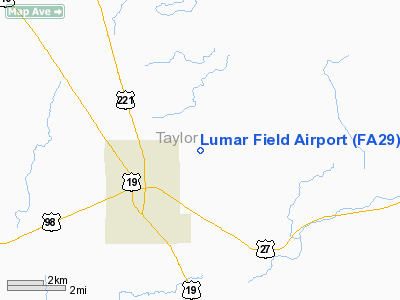
Location
& QuickFacts
|
FAA Information Effective: |
2007-01-18 |
|
Airport
Identifier: |
FA29 |
|
Airport
Status: |
Operational |
|
Longitude/Latitude: |
083-32-58.0000W/30-07-51.0000N
-83.549444/30.130833 (Estimated) |
|
Elevation: |
65 ft / 19.81 m (Estimated) |
|
Land: |
10 acres |
|
From
nearest city: |
2 nautical miles NE of Perry, FL |
|
Location: |
Taylor County, FL |
|
Magnetic Variation: |
03W (1995) |
Owner
& Manager
|
Ownership: |
Privately owned |
|
Owner: |
Luther Turner |
|
Address: |
Rt 4 Box 39a
Perry, FL 32347 |
|
Phone
number: |
850-584-8867 |
|
Manager: |
Luther Turner |
|
Address: |
Rt 4 Box 39a
Perry, FL 32347 |
|
Phone number: |
850-584-8867 |
Airport
Operations and Facilities
|
Airport Use: |
Private |
|
Wind
indicator: |
Yes |
|
Segmented
Circle: |
No |
|
Control
Tower: |
No |
|
Sectional
chart: |
Jacksonville |
|
Region: |
ASO - Southern |
|
Boundary
ARTCC: |
ZJX - Jacksonville |
|
Tie-in
FSS: |
GNV - Gainesville |
|
FSS
on Airport: |
No |
|
FSS
Phone: |
850-377-3291 |
|
FSS
Toll Free: |
1-800-WX-BRIEF |
|
Runway Information
Runway 03/21
|
Dimension: |
2350 x 100 ft / 716.3 x 30.5 m |
|
Surface: |
TURF, |
|
|
Runway 03 |
Runway 21 |
|
Traffic
Pattern: |
Left |
Left |
|
Radio Navigation
Aids
|
ID |
Type |
Name |
Ch |
Freq |
Var |
Dist |
|
FPY |
NDB |
Foley |
|
254.00 |
03W |
8.3 nm |
|
TL |
NDB |
Wakul |
|
379.00 |
01W |
43.6 nm |
|
OTK |
VOR/DME |
Valdosta |
095X |
114.80 |
02W |
41.5 nm |
|
GEF |
VORTAC |
Greenville |
027X |
109.00 |
01E |
28.0 nm |
|
CTY |
VORTAC |
Cross City |
057X |
112.00 |
02W |
41.3 nm |
|
SZW |
VORTAC |
Seminole |
122X |
117.50 |
02E |
49.8 nm |
|
TLH |
VOT |
Tallahassee Muni |
|
111.00 |
|
44.9 nm |
Remarks
- VFR;
PVT USE; LOA WITH PERRY FOLEY ARPT.
Based Aircraft
|
Aircraft
based on field: |
1 |
|
Single
Engine Airplanes: |
1 |
Lumar Field Airport
Address:
Taylor County, FL
Tel:
850-584-8867
Images
and information placed above are from
http://www.airport-data.com/airport/FA29/
We
thank them for the data!
| General
Info |
| Country |
United
States |
| State |
FLORIDA
|
| FAA ID |
FA29
|
| Latitude |
30-07-51.000N
|
| Longitude |
083-32-58.000W
|
| Elevation |
51 feet
|
| Near City |
PERRY
|
We don't guarantee the information is fresh and accurate. The data may
be wrong or outdated.
For more up-to-date information please refer to other sources.
|
|


