 |
|
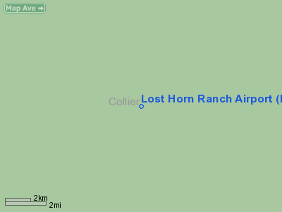
Location
& QuickFacts
|
FAA Information Effective: |
2007-01-18 |
|
Airport
Identifier: |
FA80 |
|
Airport
Status: |
Operational |
|
Longitude/Latitude: |
081-04-53.2550W/25-58-05.3400N
-81.081460/25.968150 (Estimated) |
|
Elevation: |
12 ft / 3.66 m (Surveyed) |
|
Land: |
0 acres |
|
From
nearest city: |
12 nautical miles NE of Ochopee, FL |
|
Location: |
Collier County, FL |
|
Magnetic Variation: |
02W (1985) |
Owner
& Manager
|
Ownership: |
Privately owned |
|
Owner: |
A. E. Rhoads |
|
Address: |
32 Diamond Bay Dr
Lake Placid, FL 33852 |
|
Phone
number: |
813-465-2484 |
|
Manager: |
A. E. Rhoads |
|
Address: |
32 Diamond Bay Dr
Lake Placid, FL 33852 |
|
Phone number: |
813-465-2484 |
Airport
Operations and Facilities
|
Airport Use: |
Private |
|
Wind
indicator: |
Yes |
|
Segmented
Circle: |
No |
|
Control
Tower: |
No |
|
Lighting
Schedule: |
PHONE REQ
FOR LIRL RWY 12/30 CALL 813-465-2484. |
|
Landing
fee charge: |
No |
|
Sectional
chart: |
Miami |
|
Region: |
ASO - Southern |
|
Boundary
ARTCC: |
ZMA - Miami |
|
Tie-in
FSS: |
MIA - Miami |
|
FSS
on Airport: |
No |
|
FSS
Phone: |
305-233-2600 |
|
FSS
Toll Free: |
1-800-WX-BRIEF |
|
Runway Information
Runway 12/30
|
Dimension: |
2110 x 61 ft / 643.1 x 18.6 m |
|
Surface: |
TURF, |
|
Edge
Lights: |
Low |
|
|
Runway 12 |
Runway 30 |
|
Traffic
Pattern: |
Left |
Left |
|
Radio Navigation
Aids
|
ID |
Type |
Name |
Ch |
Freq |
Var |
Dist |
|
APF |
NDB |
Naples |
|
201.00 |
03W |
39.1 nm |
|
FX |
NDB |
Praiz |
|
221.00 |
02W |
44.2 nm |
|
PJN |
NDB |
Plantation |
|
242.00 |
03W |
47.6 nm |
|
HST |
TACAN |
Homestead |
019X |
|
03W |
47.7 nm |
|
CYY |
VOR/DME |
Cypress |
023X |
108.60 |
03W |
39.2 nm |
|
DHP |
VORTAC |
Dolphin |
086X |
113.90 |
04W |
40.9 nm |
|
MIA |
VOT |
Miami Intl |
|
112.00 |
|
44.6 nm |
Remarks
- VFR
WX CONDS ONLY; PRIVATE USE. ALL FLIGHT OPERATIONS ARE ESTAB & MAINT
COMPATIBLE W/GRIMY GULCH & ROMOR RANCHES ARPT.
Based Aircraft
|
Aircraft
based on field: |
6 |
|
Single
Engine Airplanes: |
6 |
Lost Horn Ranch Airport
Address:
Collier County, FL
Tel:
813-465-2484
Images
and information placed above are from
http://www.airport-data.com/airport/FA80/
We
thank them for the data!
| General
Info |
| Country |
United
States |
| State |
FLORIDA
|
| FAA ID |
FA80
|
| Latitude |
25-58-05.340N
|
| Longitude |
081-04-53.255W
|
| Elevation |
12 feet
|
| Near City |
OCHOPEE
|
We don't guarantee the information is fresh and accurate. The data may
be wrong or outdated.
For more up-to-date information please refer to other sources.
|
|


