 |
|
|
|
Location
& QuickFacts
|
FAA Information Effective: |
2007-01-18 |
|
Airport
Identifier: |
FD73 |
|
Airport
Status: |
Operational |
|
Longitude/Latitude: |
080-08-19.1600W/26-07-07.3100N
-80.138656/26.118697 (Estimated) |
|
Elevation: |
198 ft / 60.35 m (Estimated) |
|
Land: |
0 acres |
|
From
nearest city: |
0 nautical miles N of Fort Lauderdale, FL |
|
Location: |
Broward County, FL |
|
Magnetic Variation: |
04W (1995) |
Owner
& Manager
|
Ownership: |
Privately owned |
|
Owner: |
Huizenga Holdings Inc |
|
Address: |
350 Sw 34th St
Ft Lauderdale, FL 33315 |
|
Phone
number: |
954-627-5000 |
|
Manager: |
David L. Linnemeier |
|
Address: |
350 Sw 34th St
Ft Lauderdale, FL 33315 |
|
Phone number: |
954-627-5000 |
Airport
Operations and Facilities
|
Airport Use: |
Private |
|
Wind
indicator: |
Yes |
|
Segmented
Circle: |
No |
|
Control
Tower: |
No |
|
Lighting
Schedule: |
RDO-CTL
FOR PERIMETER & FLOOD LGTS ACTVT - 123.05. |
|
Sectional
chart: |
Miami |
|
Region: |
ASO - Southern |
|
Boundary
ARTCC: |
ZMA - Miami |
|
Tie-in
FSS: |
MIA - Miami |
|
FSS
on Airport: |
No |
|
FSS
Phone: |
305-233-2600 |
|
FSS
Toll Free: |
1-800-WX-BRIEF |
|
Runway Information
Helipad H1
|
Dimension: |
50 x 50 ft / 15.2 x 15.2 m |
|
Surface: |
CONC,
ROOFTOP HELIPAD. |
|
|
Runway H1 |
Runway |
|
Traffic
Pattern: |
Left |
Left |
|
Radio Navigation
Aids
|
ID |
Type |
Name |
Ch |
Freq |
Var |
Dist |
|
PJN |
NDB |
Plantation |
|
242.00 |
03W |
4.4 nm |
|
FX |
NDB |
Praiz |
|
221.00 |
02W |
9.5 nm |
|
PB |
NDB |
Rubin |
|
356.00 |
03W |
34.4 nm |
|
UTX |
NDB |
United |
|
405.00 |
03W |
48.7 nm |
|
HST |
TACAN |
Homestead |
019X |
|
03W |
40.0 nm |
|
FLL |
VOR/DME |
Fort Lauderdale |
091X |
114.40 |
00E |
2.7 nm |
|
VKZ |
VOR/DME |
Virginia Key |
118X |
117.10 |
04W |
22.1 nm |
|
DHP |
VORTAC |
Dolphin |
086X |
113.90 |
04W |
22.3 nm |
|
PBI |
VORTAC |
Palm Beach |
104X |
115.70 |
03W |
33.9 nm |
|
PHK |
VORTAC |
Pahokee |
101X |
115.40 |
00E |
49.8 nm |
|
MIA |
VOT |
Miami Intl |
|
112.00 |
|
20.9 nm |
|
PBI |
VOT |
Palm Beach |
|
109.00 |
|
34.2 nm |
Remarks
- SEE
AIRSPACE LTR DATED 01/09/97 FOR AERONAUTICAL STUDY 96-ORL-117-NRA.
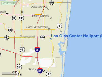
Los Olas Center Heliport
Address:
Broward County, FL
Tel:
954-627-5000
Images
and information placed above are from
http://www.airport-data.com/airport/FD73/
We
thank them for the data!
| General
Info |
| Country |
United
States |
| State |
FLORIDA
|
| FAA ID |
FD73
|
| Latitude |
26-07-07.310N
|
| Longitude |
080-08-19.160W
|
| Elevation |
198 feet
|
| Near City |
FORT LAUDERDALE
|
We don't guarantee the information is fresh and accurate. The data may
be wrong or outdated.
For more up-to-date information please refer to other sources.
|
|


