 |
|
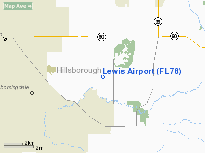
Location
& QuickFacts
|
FAA Information Effective: |
2007-01-18 |
|
Airport
Identifier: |
FL78 |
|
Airport
Status: |
Operational |
|
Longitude/Latitude: |
082-10-57.3200W/27-53-55.0900N
-82.182589/27.898636 (Estimated) |
|
Elevation: |
45 ft / 13.72 m (Estimated) |
|
Land: |
0 acres |
|
From
nearest city: |
6 nautical miles SE of Brandon, FL |
|
Location: |
Hillsborough County, FL |
|
Magnetic Variation: |
02W (1985) |
Owner
& Manager
|
Ownership: |
Privately owned |
|
Owner: |
Beverly L Lewis |
|
Address: |
6245 Yukon Rd
Dover, FL 33527 |
|
Phone number: |
813-737-4216
FAX 813-650-0776. |
|
Address: |
|
Airport
Operations and Facilities
|
Airport Use: |
Private |
|
Wind indicator: |
No |
|
Segmented Circle: |
No |
|
Control Tower: |
No |
|
Landing fee charge: |
No |
|
Sectional chart: |
Miami |
|
Region: |
ASO - Southern |
|
Boundary ARTCC: |
ZMA - Miami |
|
Tie-in FSS: |
PIE - Saint Petersburg |
|
FSS on Airport: |
No |
|
FSS Toll Free: |
1-800-WX-BRIEF |
Airport
Services
|
Airframe Repair: |
NONE |
|
Power Plant Repair: |
NONE |
|
Runway Information
Runway 09/27
|
Dimension: |
2000 x 90 ft / 609.6 x 27.4 m |
|
Surface: |
TURF, |
|
|
Runway 09 |
Runway 27 |
|
Traffic
Pattern: |
Left |
Left |
|
Radio Navigation
Aids
|
ID |
Type |
Name |
Ch |
Freq |
Var |
Dist |
|
PCM |
NDB |
Plant City |
|
346.00 |
02W |
6.4 nm |
|
TPF |
NDB |
Knight |
|
270.00 |
02W |
14.4 nm |
|
AM |
NDB |
Picny |
|
388.00 |
02W |
19.4 nm |
|
RHZ |
NDB |
Zephyrhills |
|
253.00 |
03W |
19.8 nm |
|
CHN |
NDB |
Wauchula |
|
261.00 |
04W |
28.3 nm |
|
ISM |
NDB |
Kissimmee |
|
329.00 |
05W |
46.1 nm |
|
MCF |
TACAN |
Macdill |
047X |
|
04W |
17.7 nm |
|
LAL |
VORTAC |
Lakeland |
107X |
116.00 |
01E |
10.4 nm |
|
PIE |
VORTAC |
St Petersburg |
111X |
116.40 |
01E |
26.7 nm |
|
SRQ |
VORTAC |
Sarasota |
099X |
115.20 |
02W |
36.0 nm |
|
TPA |
VOT |
Tampa Intl |
|
111.00 |
|
19.1 nm |
Remarks
Lewis Airport
Address:
Hillsborough County, FL
Tel:
813-737-4216
Fax:
813-650-0776
Images
and information placed above are from
http://www.airport-data.com/airport/FL78/
We
thank them for the data!
| General
Info |
| Country |
United
States |
| State |
FLORIDA
|
| FAA ID |
FL78
|
| Latitude |
27-53-55.090N
|
| Longitude |
082-10-57.320W
|
| Elevation |
45 feet
|
| Near City |
BRANDON
|
We don't guarantee the information is fresh and accurate. The data may
be wrong or outdated.
For more up-to-date information please refer to other sources.
|
|


