 |
|
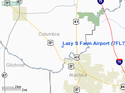
Location
& QuickFacts
|
FAA Information Effective: |
2007-01-18 |
|
Airport
Identifier: |
7FL7 |
|
Airport
Status: |
Operational |
|
Longitude/Latitude: |
082-38-04.4260W/29-52-06.8560N
-82.634563/29.868571 (Estimated) |
|
Elevation: |
80 ft / 24.38 m (Estimated) |
|
Land: |
5 acres |
|
From
nearest city: |
4 nautical miles NW of High Springs, FL |
|
Location: |
Columbia County, FL |
|
Magnetic Variation: |
02W (1985) |
Owner
& Manager
|
Ownership: |
Privately owned |
|
Owner: |
Robert F. And Susan Popiel |
|
Address: |
Rt 1 Box 246
Ft White, FL 32038 |
|
Phone number: |
904-454-2732 |
|
Address: |
|
Airport
Operations and Facilities
|
Airport Use: |
Private |
|
Wind
indicator: |
Yes |
|
Segmented
Circle: |
No |
|
Control
Tower: |
No |
|
Sectional
chart: |
Jacksonville |
|
Region: |
ASO - Southern |
|
Boundary
ARTCC: |
ZJX - Jacksonville |
|
Tie-in
FSS: |
GNV - Gainesville |
|
FSS
on Airport: |
No |
|
FSS
Phone: |
850-377-3291 |
|
FSS
Toll Free: |
1-800-WX-BRIEF |
|
Runway Information
Runway 09/27
|
Dimension: |
1825 x 100 ft / 556.3 x 30.5 m |
|
Surface: |
TURF, Good Condition |
|
|
Runway 09 |
Runway 27 |
|
Traffic
Pattern: |
Left |
Left |
|
Markings: |
Nonstandard, |
Nonstandard, |
|
Radio Navigation
Aids
|
ID |
Type |
Name |
Ch |
Freq |
Var |
Dist |
|
LCQ |
NDB |
Lake City |
|
204.00 |
03W |
19.3 nm |
|
GN |
NDB |
Wynds |
|
269.00 |
04W |
26.9 nm |
|
IAK |
NDB |
Palatka |
|
243.00 |
05W |
44.9 nm |
|
HEG |
NDB |
Herlong |
|
332.00 |
02W |
49.5 nm |
|
NZC |
TACAN |
Cecil/dcmsnd |
088X |
|
04W |
45.0 nm |
|
VQQ |
VOR |
Cecil |
|
117.90 |
03W |
43.9 nm |
|
GNV |
VORTAC |
Gators |
109X |
116.20 |
04W |
21.6 nm |
|
CTY |
VORTAC |
Cross City |
057X |
112.00 |
02W |
27.0 nm |
|
TAY |
VORTAC |
Taylor |
076X |
112.90 |
03W |
38.5 nm |
|
OCF |
VORTAC |
Ocala |
084X |
113.70 |
00E |
46.7 nm |
Remarks
- VFR/PRIVATE
USE, SEE ARSPC LTR DTD 7/2/87 FOR ADDITIONAL REMARKS.
Based Aircraft
|
Aircraft
based on field: |
2 |
|
Single
Engine Airplanes: |
2 |
Lazy S Farm Airport
Address:
Columbia County, FL
Tel:
904-454-2732
Images
and information placed above are from
http://www.airport-data.com/airport/7FL7/
We
thank them for the data!
| General
Info |
| Country |
United
States |
| State |
FLORIDA
|
| FAA ID |
7FL7
|
| Latitude |
29-52-06.856N
|
| Longitude |
082-38-04.426W
|
| Elevation |
80 feet
|
| Near City |
HIGH SPRINGS
|
We don't guarantee the information is fresh and accurate. The data may
be wrong or outdated.
For more up-to-date information please refer to other sources.
|
|


