 |
|
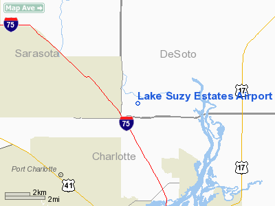
Lake Suzy Estates Airport |
Location
& QuickFacts
|
FAA Information Effective: |
2007-01-18 |
|
Airport
Identifier: |
20FL |
|
Airport
Status: |
Operational |
|
Longitude/Latitude: |
082-02-37.3160W/27-02-33.2040N
-82.043699/27.042557 (Estimated) |
|
Elevation: |
25 ft / 7.62 m (Estimated) |
|
Land: |
0 acres |
|
From
nearest city: |
5 nautical miles NE of Port Charlotte, FL |
|
Location: |
De Soto County, FL |
|
Magnetic Variation: |
02W (1985) |
Owner
& Manager
|
Ownership: |
Privately owned |
|
Owner: |
Ben Shepard |
|
Address: |
12408 Sw Sheri St
Lake Suzy, FL 33821 |
|
Phone
number: |
813-629-5007 |
|
Manager: |
David W Shepard |
|
Address: |
12408 Sw Sheri St
Lake Suzy, FL 33821 |
|
Phone number: |
813-629-5007 |
Airport
Operations and Facilities
|
Airport Use: |
Private |
|
Wind indicator: |
No |
|
Segmented Circle: |
No |
|
Control Tower: |
No |
|
Landing fee charge: |
No |
|
Sectional chart: |
Miami |
|
Region: |
ASO - Southern |
|
Boundary ARTCC: |
ZMA - Miami |
|
Tie-in FSS: |
PIE - Saint Petersburg |
|
FSS on Airport: |
No |
|
FSS Toll Free: |
1-800-WX-BRIEF |
Airport
Services
|
Airframe Repair: |
NONE |
|
Power Plant Repair: |
NONE |
|
Runway Information
Runway 12/30
|
Dimension: |
3800 x 150 ft / 1158.2 x 45.7 m |
|
Surface: |
TURF, |
|
|
Runway 12 |
Runway 30 |
|
Traffic
Pattern: |
Left |
Left |
|
Radio Navigation
Aids
|
ID |
Type |
Name |
Ch |
Freq |
Var |
Dist |
|
VNC |
NDB |
Venice |
|
206.00 |
02W |
20.7 nm |
|
CHN |
NDB |
Wauchula |
|
261.00 |
04W |
29.4 nm |
|
PGD |
VOR |
Punta Gorda |
|
110.20 |
03W |
8.1 nm |
|
RSW |
VORTAC |
Lee County |
055X |
111.80 |
02W |
34.0 nm |
|
SRQ |
VORTAC |
Sarasota |
099X |
115.20 |
02W |
34.7 nm |
|
LBV |
VORTAC |
La Belle |
041X |
110.40 |
01E |
37.3 nm |
Remarks
Based Aircraft
|
Aircraft
based on field: |
7 |
|
Single
Engine Airplanes: |
6 |
|
Multi
Engine Airplanes: |
1 |
Lake Suzy Estates Airport
Address:
De Soto County, FL
Tel:
813-629-5007
Images
and information placed above are from
http://www.airport-data.com/airport/20FL/
We
thank them for the data!
| General
Info |
| Country |
United
States |
| State |
FLORIDA
|
| FAA ID |
20FL
|
| Latitude |
27-02-33.204N
|
| Longitude |
082-02-37.316W
|
| Elevation |
25 feet
|
| Near City |
PORT CHARLOTTE
|
We don't guarantee the information is fresh and accurate. The data may
be wrong or outdated.
For more up-to-date information please refer to other sources.
|
|


