 |
|
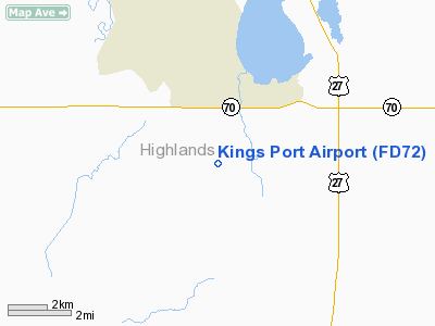
Location
& QuickFacts
|
FAA Information Effective: |
2007-01-18 |
|
Airport
Identifier: |
FD72 |
|
Airport
Status: |
Operational |
|
Longitude/Latitude: |
081-23-26.2640W/27-10-58.1760N
-81.390629/27.182827 (Estimated) |
|
Elevation: |
148 ft / 45.11 m (Estimated) |
|
Land: |
4 acres |
|
From
nearest city: |
7 nautical miles S of Lake Placid, FL |
|
Location: |
Highlands County, FL |
|
Magnetic Variation: |
02W (1985) |
Owner
& Manager
|
Ownership: |
Privately owned |
|
Owner: |
George L. Houghton, Et Al |
|
Address: |
105 Richfield Drive
Lake Placid, FL 33852 |
|
Phone
number: |
813-465-6996 |
|
Manager: |
Richard Peterson |
|
Address: |
196 Parkland Dr
Lake Placid, FL 33852 |
|
Phone number: |
813-465-0418 |
Airport
Operations and Facilities
|
Airport Use: |
Private |
|
Wind
indicator: |
Yes |
|
Segmented
Circle: |
No |
|
Control
Tower: |
No |
|
Lighting
Schedule: |
PHONE REQ
FOR LIRL RY 18/36 CALL 813-465-0418. |
|
Sectional
chart: |
Miami |
|
Region: |
ASO - Southern |
|
Boundary
ARTCC: |
ZMA - Miami |
|
Tie-in
FSS: |
PIE - Saint Petersburg |
|
FSS
on Airport: |
No |
|
FSS
Toll Free: |
1-800-WX-BRIEF |
|
Runway Information
Runway 18/36
|
Dimension: |
2500 x 75 ft / 762.0 x 22.9 m |
|
Surface: |
TURF, Good Condition |
|
Edge
Lights: |
Low
IS CURRENTLY LGTD ON THE WEST SIDE ONLY AND HAS REFLECTORS ON THE
EAST SIDE. |
|
|
Runway 18 |
Runway 36 |
|
Traffic
Pattern: |
Left |
Left |
|
Obstruction: |
4 ft fence, 20.0 ft from runway |
4 ft fence, 20.0 ft from runway |
|
Radio Navigation
Aids
|
ID |
Type |
Name |
Ch |
Freq |
Var |
Dist |
|
CHN |
NDB |
Wauchula |
|
261.00 |
04W |
32.8 nm |
|
PGD |
VOR |
Punta Gorda |
|
110.20 |
03W |
35.9 nm |
|
LBV |
VORTAC |
La Belle |
041X |
110.40 |
01E |
21.3 nm |
|
RSW |
VORTAC |
Lee County |
055X |
111.80 |
02W |
44.3 nm |
|
PHK |
VORTAC |
Pahokee |
101X |
115.40 |
00E |
44.5 nm |
Remarks
Based Aircraft
|
Aircraft
based on field: |
6 |
|
Single
Engine Airplanes: |
6 |
Kings Port Airport
Address:
Highlands County, FL
Tel:
813-465-6996,
813-465-0418
Images
and information placed above are from
http://www.airport-data.com/airport/FD72/
We
thank them for the data!
| General
Info |
| Country |
United
States |
| State |
FLORIDA
|
| FAA ID |
FD72
|
| Latitude |
27-10-58.176N
|
| Longitude |
081-23-26.264W
|
| Elevation |
148 feet
|
| Near City |
LAKE PLACID
|
We don't guarantee the information is fresh and accurate. The data may
be wrong or outdated.
For more up-to-date information please refer to other sources.
|
|


