 |
|
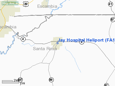
Location
& QuickFacts
|
FAA Information Effective: |
2007-01-18 |
|
Airport
Identifier: |
FA16 |
|
Airport
Status: |
Operational |
|
Longitude/Latitude: |
087-09-02.8920W/30-56-59.6600N
-87.150803/30.949906 (Estimated) |
|
Elevation: |
252 ft / 76.81 m (Estimated) |
|
Land: |
0 acres |
|
From
nearest city: |
0 nautical miles N of Jay, FL |
|
Location: |
Santa Rosa County, FL |
|
Magnetic Variation: |
00E (1990) |
Owner
& Manager
|
Ownership: |
Publicly owned |
|
Owner: |
Santa Rosa County |
|
Address: |
Po Box 397
Jay, FLORIDA 32565 |
|
Phone number: |
904-675-4532 |
|
Manager: |
Allen Foster |
|
Address: |
Po Box 397
Jay, FL 32565 |
|
Phone number: |
904-675-4532 |
Airport
Operations and Facilities
|
Airport Use: |
Private
MEDICAL USE. |
|
Wind
indicator: |
Yes |
|
Segmented
Circle: |
No |
|
Control
Tower: |
No |
|
Lighting
Schedule: |
DUSK-DAWN |
|
Sectional
chart: |
New Orleans |
|
Region: |
ASO - Southern |
|
Boundary
ARTCC: |
ZJX - Jacksonville |
|
Tie-in
FSS: |
GNV - Gainesville |
|
FSS
on Airport: |
No |
|
FSS
Phone: |
850-377-3291 |
|
FSS
Toll Free: |
1-800-WX-BRIEF |
|
Runway Information
Helipad H1
|
Dimension: |
50 x 50 ft / 15.2 x 15.2 m |
|
Surface: |
ASPH, Good Condition |
|
|
Runway H1 |
Runway |
|
Traffic
Pattern: |
Left |
Left |
|
Radio Navigation
Aids
|
ID |
Type |
Name |
Ch |
Freq |
Var |
Dist |
|
PKZ |
NDB |
Pickens |
|
326.00 |
01E |
30.9 nm |
|
ESU |
NDB |
Summerdale |
|
204.00 |
01E |
40.2 nm |
|
JUY |
NDB |
Judd |
|
264.00 |
02W |
44.5 nm |
|
DTS |
NDB |
Destin |
|
254.00 |
01W |
47.9 nm |
|
NSE |
TACAN |
Whiting |
070X |
|
01E |
15.2 nm |
|
NGS |
TACAN |
Santa Rosa |
063X |
|
01E |
23.0 nm |
|
NPA |
TACAN |
Pensacola |
119X |
|
01E |
36.6 nm |
|
HRT |
TACAN |
Hurlburt |
045X |
|
00E |
39.4 nm |
|
DWG |
TACAN |
Warrington |
002X |
|
00E |
43.2 nm |
|
NUN |
VOR |
Saufley |
|
108.80 |
01E |
30.3 nm |
|
UIA |
VOR |
Andalusia |
|
110.20 |
00E |
44.6 nm |
|
CEW |
VORTAC |
Crestview |
106X |
115.90 |
03E |
25.4 nm |
|
MVC |
VORTAC |
Monroeville |
115X |
116.80 |
04E |
32.4 nm |
Remarks
- VFR;
PRIVATE USE; OPERATIONS ARE CONDUCTED FROM 50 DEG TO 130 DEG; AREA MARKED;
WIND INDICATOR IS MAINTAINED.
Jay Hospital Heliport
Address:
Santa Rosa County, FL
Tel:
904-675-4532
Images
and information placed above are from
http://www.airport-data.com/airport/FA16/
We
thank them for the data!
| General
Info |
| Country |
United
States |
| State |
FLORIDA
|
| FAA ID |
FA16
|
| Latitude |
30-56-59.660N
|
| Longitude |
087-09-02.892W
|
| Elevation |
252 feet
|
| Near City |
JAY
|
We don't guarantee the information is fresh and accurate. The data may
be wrong or outdated.
For more up-to-date information please refer to other sources.
|
|


