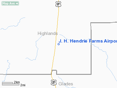
James H Hendrie Farms Airport |
Location
& QuickFacts
|
FAA Information Effective: |
2007-01-18 |
|
Airport
Identifier: |
08FL |
|
Airport
Status: |
Operational |
|
Longitude/Latitude: |
081-19-43.2600W/27-05-04.1890N
-81.328683/27.084497 (Estimated) |
|
Elevation: |
103 ft / 31.39 m (Estimated) |
|
Land: |
0 acres |
|
From
nearest city: |
17 nautical miles S of Lake Placid, FL |
|
Location: |
Highlands County, FL |
|
Magnetic Variation: |
03W (1990) |
Owner
& Manager
|
Ownership: |
Privately owned |
|
Owner: |
James H. Hendrie |
|
Address: |
Po Box 358
Venus, FL 33960 |
|
Address: |
|
Airport
Operations and Facilities
|
Airport Use: |
Private |
|
Segmented
Circle: |
No |
|
Control
Tower: |
No |
|
Sectional
chart: |
Miami |
|
Region: |
ASO - Southern |
|
Boundary
ARTCC: |
ZMA - Miami |
|
Tie-in
FSS: |
PIE - Saint Petersburg |
|
FSS
Toll Free: |
1-800-WX-BRIEF |
|
Runway Information
Runway 03/21
|
Dimension: |
2500 x 100 ft / 762.0 x 30.5 m |
|
Surface: |
TURF, |
|
|
Runway 03 |
Runway 21 |
|
Traffic
Pattern: |
Left |
Left |
|
Radio Navigation
Aids
|
ID |
Type |
Name |
Ch |
Freq |
Var |
Dist |
|
CHN |
NDB |
Wauchula |
|
261.00 |
04W |
39.1 nm |
|
PGD |
VOR |
Punta Gorda |
|
110.20 |
03W |
36.9 nm |
|
LBV |
VORTAC |
La Belle |
041X |
110.40 |
01E |
15.8 nm |
|
PHK |
VORTAC |
Pahokee |
101X |
115.40 |
00E |
38.7 nm |
|
RSW |
VORTAC |
Lee County |
055X |
111.80 |
02W |
41.1 nm |
Remarks
Based Aircraft
|
Aircraft
based on field: |
1 |
|
Single
Engine Airplanes: |
1 |
James H. Hendrie Farms Airport
Address:
Highlands County, FL
Tel:
Images
and information placed above are from
http://www.airport-data.com/airport/08FL/
We
thank them for the data!
| General
Info |
| Country |
United
States |
| State |
FLORIDA
|
| FAA ID |
08FL
|
| Latitude |
27-05-04.189N
|
| Longitude |
081-19-43.260W
|
| Elevation |
103 feet
|
| Near City |
LAKE PLACID
|
We don't guarantee the information is fresh and accurate. The data may
be wrong or outdated.
For more up-to-date information please refer to other sources.
|


