 |
|
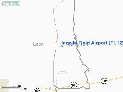
Location
& QuickFacts
|
FAA Information Effective: |
2007-01-18 |
|
Airport
Identifier: |
FL12 |
|
Airport
Status: |
Operational |
|
Longitude/Latitude: |
084-01-49.6090W/30-35-25.7170N
-84.030447/30.590477 (Estimated) |
|
Elevation: |
183 ft / 55.78 m (Surveyed) |
|
Land: |
31 acres |
|
From
nearest city: |
1 nautical miles SE of Miccosukee, FL |
|
Location: |
Leon County, FL |
|
Magnetic Variation: |
02W (1985) |
Owner
& Manager
|
Ownership: |
Privately owned |
|
Owner: |
Gem Land Co. |
|
Address: |
Rt 1, Box 80
Tallahassee, FL 32312 |
|
Manager: |
William T. Yown |
|
Address: |
Rt 7, Box 1095
Tallahassee, FL 32308 |
|
Phone number: |
904-893-1155 |
Airport
Operations and Facilities
|
Airport Use: |
Private |
|
Wind indicator: |
Yes |
|
Segmented Circle: |
No |
|
Control Tower: |
No |
|
Landing fee charge: |
No |
|
Sectional chart: |
Jacksonville |
|
Region: |
ASO - Southern |
|
Boundary ARTCC: |
ZJX - Jacksonville |
|
Tie-in FSS: |
GNV - Gainesville |
|
FSS on Airport: |
No |
|
FSS Phone: |
850-377-3291 |
|
FSS Toll Free: |
1-800-WX-BRIEF |
Airport
Services
|
Airframe Repair: |
NONE |
|
Power Plant Repair: |
NONE |
|
Runway Information
Runway 12/30
|
Dimension: |
5400 x 100 ft / 1645.9 x 30.5 m |
|
Surface: |
TURF, |
|
|
Runway 12 |
Runway 30 |
|
Traffic
Pattern: |
Left |
Left |
|
Radio Navigation
Aids
|
ID |
Type |
Name |
Ch |
Freq |
Var |
Dist |
|
CYR |
NDB |
Caidy |
|
338.00 |
01W |
19.1 nm |
|
TL |
NDB |
Wakul |
|
379.00 |
01W |
23.3 nm |
|
GTP |
NDB |
Patten |
|
245.00 |
02W |
24.4 nm |
|
LYZ |
NDB |
Willis |
|
359.00 |
01W |
34.4 nm |
|
CXU |
NDB |
Camilla |
|
369.00 |
02W |
39.0 nm |
|
FPY |
NDB |
Foley |
|
254.00 |
03W |
42.5 nm |
|
MGR |
VOR/DME |
Moultrie |
025X |
108.80 |
02W |
31.8 nm |
|
OTK |
VOR/DME |
Valdosta |
095X |
114.80 |
02W |
40.5 nm |
|
GEF |
VORTAC |
Greenville |
027X |
109.00 |
01E |
13.0 nm |
|
SZW |
VORTAC |
Seminole |
122X |
117.50 |
02E |
17.9 nm |
|
VAD |
VORTAC |
Moody |
080X |
113.30 |
03W |
48.6 nm |
|
TLH |
VOT |
Tallahassee Muni |
|
111.00 |
|
20.4 nm |
Remarks
Ingalls Field Airport
Address:
Leon County, FL
Tel:
904-893-1155
Images
and information placed above are from
http://www.airport-data.com/airport/FL12/
We
thank them for the data!
| General
Info |
| Country |
United
States |
| State |
FLORIDA
|
| FAA ID |
FL12
|
| Latitude |
30-35-25.717N
|
| Longitude |
084-01-49.609W
|
| Elevation |
183 feet
|
| Near City |
MICCOSUKEE
|
We don't guarantee the information is fresh and accurate. The data may
be wrong or outdated.
For more up-to-date information please refer to other sources.
|
|


