 |
|
|
|
|
|
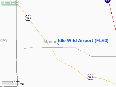
Location
& QuickFacts
|
FAA Information Effective: |
2007-01-18 |
|
Airport
Identifier: |
FL63 |
|
Airport
Status: |
Operational |
|
Longitude/Latitude: |
082-19-20.3570W/29-17-20.9010N
-82.322321/29.289139 (Estimated) |
|
Elevation: |
80 ft / 24.38 m (Estimated) |
|
Land: |
0 acres |
|
From
nearest city: |
12 nautical miles NW of Ocala, FL |
|
Location: |
Marion County, FL |
|
Magnetic Variation: |
02W (1985) |
Owner
& Manager
|
Ownership: |
Privately owned |
|
Owner: |
John A Hambleton |
|
Address: |
9420 N W 125 Ave
Ocala, FL 34482 |
|
Phone number: |
352-629-4249 |
|
Manager: |
John A Hambleton |
|
Address: |
9420 Nw 125 Ave
Ocala, FL 34482 |
|
Phone number: |
352-629-4249 |
Airport
Operations and Facilities
|
Airport Use: |
Private |
|
Wind indicator: |
Yes |
|
Segmented Circle: |
No |
|
Control Tower: |
No |
|
Landing fee charge: |
No |
|
Sectional chart: |
Jacksonville |
|
Region: |
ASO - Southern |
|
Boundary ARTCC: |
ZJX - Jacksonville |
|
Responsible ARTCC: |
ZJX - Jacksonville |
|
Tie-in FSS: |
GNV - Gainesville |
|
FSS on Airport: |
No |
|
FSS Phone: |
850-377-3291 |
|
FSS Toll Free: |
1-800-WX-BRIEF |
Airport
Services
|
Airframe Repair: |
NONE |
|
Power Plant Repair: |
NONE |
|
Runway Information
Runway 09/27
|
Dimension: |
2830 x 130 ft / 862.6 x 39.6 m |
|
Surface: |
TURF, |
|
|
Runway 09 |
Runway 27 |
|
Traffic
Pattern: |
Left |
Left |
|
Radio Navigation
Aids
|
ID |
Type |
Name |
Ch |
Freq |
Var |
Dist |
|
GN |
NDB |
Wynds |
|
269.00 |
04W |
24.2 nm |
|
IAK |
NDB |
Palatka |
|
243.00 |
05W |
34.5 nm |
|
LEE |
NDB |
Leesburg |
|
335.00 |
04W |
39.2 nm |
|
OCF |
VORTAC |
Ocala |
084X |
113.70 |
00E |
8.4 nm |
|
GNV |
VORTAC |
Gators |
109X |
116.20 |
04W |
24.4 nm |
|
CTY |
VORTAC |
Cross City |
057X |
112.00 |
02W |
42.3 nm |
Remarks
- PERSONAL
RESTRICTED ARPT. OWNER'S USE ONLY.
Based Aircraft
|
Aircraft
based on field: |
2 |
|
Single
Engine Airplanes: |
2 |
Idle Wild Airport
Address:
Marion County, FL
Tel:
352-629-4249
Images
and information placed above are from
http://www.airport-data.com/airport/FL63/
We
thank them for the data!
| General
Info |
| Country |
United
States |
| State |
FLORIDA
|
| FAA ID |
FL63
|
| Latitude |
29-17-20.901N
|
| Longitude |
082-19-20.357W
|
| Elevation |
80 feet
|
| Near City |
OCALA
|
We don't guarantee the information is fresh and accurate. The data may
be wrong or outdated.
For more up-to-date information please refer to other sources.
|
|


