 |
|
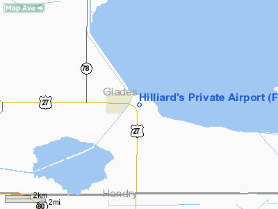
Hilliard's Private Airport |
Location
& QuickFacts
|
FAA Information Effective: |
2007-01-18 |
|
Airport
Identifier: |
FD96 |
|
Airport
Status: |
Operational |
|
Longitude/Latitude: |
081-04-48.2430W/26-49-57.2220N
-81.080067/26.832562 (Estimated) |
|
Elevation: |
13 ft / 3.96 m (Estimated) |
|
Land: |
5 acres |
|
From
nearest city: |
1 nautical miles SE of Moore Haven, FL |
|
Location: |
Glades County, FL |
|
Magnetic Variation: |
03W (1980) |
Owner
& Manager
|
Ownership: |
Privately owned |
|
Owner: |
Ernest W. Hilliard, Jr. |
|
Address: |
Daniel Road, Po Box 726
Moore Haven, FL 33471 |
|
Phone
number: |
813-946-0617 |
|
Manager: |
Ernest Hilliard, Jr. |
|
Address: |
Po Box 726
Moore Haven, FL 33471 |
|
Phone number: |
813-946-0617 |
Airport
Operations and Facilities
|
Airport Use: |
Private
PERSONAL USE. |
|
Segmented Circle: |
No |
|
Control Tower: |
No |
|
Sectional chart: |
Miami |
|
Region: |
ASO - Southern |
|
Boundary ARTCC: |
ZMA - Miami |
|
Tie-in FSS: |
MIA - Miami |
|
FSS Phone: |
305-233-2600 |
|
FSS Toll Free: |
1-800-WX-BRIEF |
Airport
Services
|
Runway Information
Runway 18/36
|
Dimension: |
1500 x 80 ft / 457.2 x 24.4 m |
|
Surface: |
TURF, |
|
|
Runway 18 |
Runway 36 |
|
Traffic
Pattern: |
Left |
Left |
|
Radio Navigation
Aids
|
ID |
Type |
Name |
Ch |
Freq |
Var |
Dist |
|
UTX |
NDB |
United |
|
405.00 |
03W |
40.2 nm |
|
PB |
NDB |
Rubin |
|
356.00 |
03W |
47.5 nm |
|
PGD |
VOR |
Punta Gorda |
|
110.20 |
03W |
49.1 nm |
|
LBV |
VORTAC |
La Belle |
041X |
110.40 |
01E |
16.7 nm |
|
PHK |
VORTAC |
Pahokee |
101X |
115.40 |
00E |
21.1 nm |
|
RSW |
VORTAC |
Lee County |
055X |
111.80 |
02W |
41.6 nm |
Remarks
- PVDD
VFR PERSONAL USE ONLY.
Based Aircraft
|
Aircraft
based on field: |
3 |
|
Single
Engine Airplanes: |
3 |
Hilliard's Private Airport
Address:
Glades County, FL
Tel:
813-946-0617
Images
and information placed above are from
http://www.airport-data.com/airport/FD96/
We
thank them for the data!
| General
Info |
| Country |
United
States |
| State |
FLORIDA
|
| FAA ID |
FD96
|
| Latitude |
26-49-57.222N
|
| Longitude |
081-04-48.243W
|
| Elevation |
13 feet
|
| Near City |
MOORE
HAVEN |
We don't guarantee the information is fresh and accurate. The data may
be wrong or outdated.
For more up-to-date information please refer to other sources.
|
|


