 |
|
Coordinates: 30°41′10.79″N 081°54′20.47″W / 30.6863306°N 81.9056861°W / 30.6863306; -81.9056861
| Hilliard Airpark |
| IATA: none – ICAO: none – FAA LID: 01J |
| Summary |
| Airport type |
Public use |
| Owner |
Town of Hilliard |
| Operator |
Jack Bailey |
| Serves |
Hilliard, Florida |
| Location |
Nassau County, Florida |
| Elevation AMSL |
59 ft / 18 m |
| Runways |
| Direction |
Length |
Surface |
| ft |
m |
| 18/36 |
3,365 |
1,026 |
Turf |
| Statistics (2002) |
| Aircraft operations |
5,001 |
| Based aircraft |
32 |
| Source: Federal Aviation Administration |
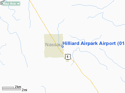
Hilliard Airpark (FAA LID: 01J) is a public-use airport located 1 mile (1.6 km) east of the central business district of the town of Hilliard in Nassau County, Florida, United States. The airport is publicly owned.
The above content comes from Wikipedia and is published under free licenses – click here to read more.
Location
& QuickFacts
|
FAA Information Effective: |
2007-01-18 |
|
Airport
Identifier: |
01J |
|
Airport
Status: |
Operational |
|
Longitude/Latitude: |
081-54-20.4700W/30-41-10.7900N
-81.905686/30.686331 (Estimated) |
|
Elevation: |
59 ft / 17.98 m (Surveyed) |
|
Land: |
30 acres |
|
From
nearest city: |
1 nautical miles E of Hilliard, FL |
|
Location: |
Nassau County, FL |
|
Magnetic Variation: |
03W (1985) |
Owner
& Manager
|
Ownership: |
Publicly owned |
|
Owner: |
Town Of Hilliard |
|
Address: |
Po Box 249
Hilliard, FL 32046 |
|
Phone number: |
904-845-3555 |
|
Manager: |
Jack Bailey |
|
Address: |
Po Box 549
Hilliard, FL 32046 |
|
Phone number: |
904-845-3929 |
Airport
Operations and Facilities
|
Airport Use: |
Open to public |
|
Wind
indicator: |
Yes |
|
Segmented
Circle: |
No |
|
Control
Tower: |
No |
|
Lighting
Schedule: |
DUSK-DAWN
ACTVT MIRL RY 18/36 - CTAF. |
|
Beacon
Color: |
Clear-Green (lighted land airport)
ROTG BCN OTS INDEFLY. |
|
Landing
fee charge: |
No |
|
Sectional
chart: |
Jacksonville |
|
Region: |
ASO - Southern |
|
Boundary
ARTCC: |
ZJX - Jacksonville |
|
Tie-in
FSS: |
GNV - Gainesville |
|
FSS
on Airport: |
No |
|
FSS
Phone: |
850-377-3291 |
|
FSS
Toll Free: |
1-800-WX-BRIEF |
|
NOTAMs
Facility: |
GNV (NOTAM-d service avaliable) |
|
Federal Agreements: |
N |
Airport
Communications
Airport
Services
|
Airframe Repair: |
NONE |
|
Power Plant Repair: |
NONE |
|
Bottled
Oxygen: |
NONE |
|
Bulk
Oxygen: |
NONE |
|
Runway Information
Runway 18/36
|
Dimension: |
3365 x 125 ft / 1025.7 x 38.1 m |
|
Surface: |
TURF, Good Condition |
|
Edge
Lights: |
Medium
MIRL OTS INDEFLY. |
|
|
Runway 18 |
Runway 36 |
|
Longitude: |
081-54-23.0100W |
081-54-17.9200W |
|
Latitude: |
30-41-27.3000N |
30-40-54.2870N |
|
Traffic
Pattern: |
Left |
Left |
|
Displaced
threshold: |
795.00 ft |
370.00 ft |
|
Obstruction: |
15 ft road, 30.0 ft from runway
RY 18 APCH RATIO 20:1 TO DSPLCD THLD FROM 56 FT TREES 333
FT FROM EOR. |
46 ft trees, 750.0 ft from runway, 16:1 slope
to clear
RY 36 APCH RATIO 24:1 TO DSPLCD THLD. |
|
Radio Navigation
Aids
|
ID |
Type |
Name |
Ch |
Freq |
Var |
Dist |
|
JA |
NDB |
Dinns |
|
344.00 |
03W |
14.3 nm |
|
EYA |
NDB |
Eastport |
|
357.00 |
03W |
22.0 nm |
|
HEG |
NDB |
Herlong |
|
332.00 |
02W |
25.1 nm |
|
JUK |
NDB |
Mc Kinnon |
|
353.00 |
05W |
38.7 nm |
|
LCQ |
NDB |
Lake City |
|
204.00 |
03W |
46.1 nm |
|
HOE |
NDB |
Homerville |
|
209.00 |
03W |
49.9 nm |
|
NZC |
TACAN |
Cecil/dcmsnd |
088X |
|
04W |
28.1 nm |
|
NIP |
TACAN |
Jacksonville |
19X |
|
04W |
29.7 nm |
|
NRB |
TACAN |
Mayport |
051X |
|
03W |
30.7 nm |
|
VQQ |
VOR |
Cecil |
|
117.90 |
03W |
28.5 nm |
|
CRG |
VORTAC |
Craig |
092X |
114.50 |
03W |
29.3 nm |
|
SSI |
VORTAC |
Brunswick |
035X |
109.80 |
04W |
32.3 nm |
|
TAY |
VORTAC |
Taylor |
076X |
112.90 |
03W |
35.2 nm |
|
AYS |
VORTAC |
Waycross |
039X |
110.20 |
00E |
48.5 nm |
|
JAX |
VOT |
Jacksonville Intl |
|
111.00 |
|
16.1 nm |
|
BQK |
VOT |
Brunswick |
|
111.00 |
|
42.1 nm |
Remarks
- ARPT
CLSD EXCP VMC & FM SS-SR.
- VFR
OPN ONLY.
Based Aircraft
|
Aircraft
based on field: |
27 |
|
Single
Engine Airplanes: |
25 |
|
Multi
Engine Airplanes: |
1 |
|
Ultralights: |
1 |
Operational Statistics
Time Period: 2001-02-01
- 2002-01-31
|
Aircraft
Operations: |
97/Week |
|
General
Aviation Local: |
62.4% |
|
General
Aviation Itinerant: |
37.6% |
Hilliard Airpark Airport
Address:
Nassau County, FL
Tel:
904-845-3555, 904-845-3929
Images
and information placed above are from
http://www.airport-data.com/airport/01J/
We
thank them for the data!
| General
Info |
| Country |
United
States |
| State |
FLORIDA
|
| FAA ID |
01J
|
| Latitude |
30-41-10.790N
|
| Longitude |
081-54-20.470W
|
| Elevation |
59 feet
|
| Near City |
HILLIARD
|
We don't guarantee the information is fresh and accurate. The data may
be wrong or outdated.
For more up-to-date information please refer to other sources.
|
|


