 |
|
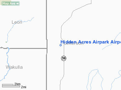
Hidden Acres Airpark Airport |
Location
& QuickFacts
|
FAA Information Effective: |
2007-01-18 |
|
Airport
Identifier: |
FD01 |
|
Airport
Status: |
Operational |
|
Longitude/Latitude: |
084-02-55.5990W/30-16-46.7350N
-84.048777/30.279649 (Estimated) |
|
Elevation: |
34 ft / 10.36 m (Estimated) |
|
Land: |
0 acres |
|
From
nearest city: |
23 nautical miles SW of Monticello, FL |
|
Location: |
Jefferson County, FL |
|
Magnetic Variation: |
01W (1985) |
Owner
& Manager
|
Ownership: |
Privately owned |
|
Owner: |
Paul G. Donaldson |
|
Address: |
Rt 3, Box 103 - R1
Monticello, FL 32344 |
|
Phone
number: |
904-997-5862 |
|
Manager: |
Paul G. Donaldson |
|
Address: |
Rt 3, Box 103 - R1
Monticello, FL 32344 |
|
Phone number: |
904-997-5862 |
Airport
Operations and Facilities
|
Airport Use: |
Private |
|
Wind
indicator: |
Yes |
|
Segmented
Circle: |
No |
|
Control
Tower: |
No |
|
Landing
fee charge: |
No |
|
Sectional
chart: |
Atlanta |
|
Region: |
ASO - Southern |
|
Boundary
ARTCC: |
ZJX - Jacksonville |
|
Tie-in
FSS: |
GNV - Gainesville |
|
FSS
on Airport: |
No |
|
FSS
Phone: |
850-377-3291 |
|
FSS
Toll Free: |
1-800-WX-BRIEF |
|
Runway Information
Runway 14/32
|
Dimension: |
2130 x 70 ft / 649.2 x 21.3 m |
|
Surface: |
TURF, |
|
|
Runway 14 |
Runway 32 |
|
Traffic
Pattern: |
Left |
Left |
|
Radio Navigation
Aids
|
ID |
Type |
Name |
Ch |
Freq |
Var |
Dist |
|
TL |
NDB |
Wakul |
|
379.00 |
01W |
16.3 nm |
|
FPY |
NDB |
Foley |
|
254.00 |
03W |
29.5 nm |
|
CYR |
NDB |
Caidy |
|
338.00 |
01W |
37.0 nm |
|
GTP |
NDB |
Patten |
|
245.00 |
02W |
42.3 nm |
|
LYZ |
NDB |
Willis |
|
359.00 |
01W |
48.4 nm |
|
MGR |
VOR/DME |
Moultrie |
025X |
108.80 |
02W |
49.9 nm |
|
OTK |
VOR/DME |
Valdosta |
095X |
114.80 |
02W |
49.9 nm |
|
GEF |
VORTAC |
Greenville |
027X |
109.00 |
01E |
21.4 nm |
|
SZW |
VORTAC |
Seminole |
122X |
117.50 |
02E |
23.7 nm |
|
TLH |
VOT |
Tallahassee Muni |
|
111.00 |
|
17.5 nm |
Remarks
Hidden Acres Airpark Airport
Address:
Jefferson County, FL
Tel:
904-997-5862
Images
and information placed above are from
http://www.airport-data.com/airport/FD01/
We
thank them for the data!
| General
Info |
| Country |
United
States |
| State |
FLORIDA
|
| FAA ID |
FD01
|
| Latitude |
30-16-46.735N
|
| Longitude |
084-02-55.599W
|
| Elevation |
34 feet
|
| Near City |
MONTICELLO
|
We don't guarantee the information is fresh and accurate. The data may
be wrong or outdated.
For more up-to-date information please refer to other sources.
|
|


