 |
|
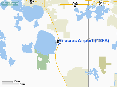
Location
& QuickFacts
|
FAA Information Effective: |
2007-01-18 |
|
Airport
Identifier: |
12FA |
|
Airport
Status: |
Operational |
|
Longitude/Latitude: |
081-42-52.2710W/28-28-43.0120N
-81.714520/28.478614 (Estimated) |
|
Elevation: |
105 ft / 32.00 m (Estimated) |
|
Land: |
0 acres |
|
From
nearest city: |
5 nautical miles SE of Clermont, FL |
|
Location: |
Lake County, FL |
|
Magnetic Variation: |
03W (1985) |
Owner
& Manager
|
Ownership: |
Privately owned |
|
Owner: |
Hi-acres Services Inc |
|
Address: |
Po Box 547853
Orlando, FL 32854-7853 |
|
Phone number: |
407-898-4449 |
|
Manager: |
Jean S Suggs |
|
Address: |
Po Box 54783
Orlando, FL 32854-7853 |
|
Phone number: |
407-898-4449 |
Airport
Operations and Facilities
|
Airport Use: |
Private |
|
Wind
indicator: |
Yes |
|
Segmented
Circle: |
No |
|
Control
Tower: |
No |
|
Landing
fee charge: |
No |
|
Sectional
chart: |
Jacksonville |
|
Region: |
ASO - Southern |
|
Boundary
ARTCC: |
ZJX - Jacksonville |
|
Responsible
ARTCC: |
ZMA - Miami |
|
Tie-in
FSS: |
PIE - Saint Petersburg |
|
FSS
on Airport: |
No |
|
FSS
Toll Free: |
1-800-WX-BRIEF |
|
Runway Information
Runway 18/36
|
Dimension: |
1800 x 80 ft / 548.6 x 24.4 m |
|
Surface: |
TURF, |
|
|
Runway 18 |
Runway 36 |
|
Traffic
Pattern: |
Left |
Left |
|
Radio Navigation
Aids
|
ID |
Type |
Name |
Ch |
Freq |
Var |
Dist |
|
ISM |
NDB |
Kissimmee |
|
329.00 |
05W |
18.7 nm |
|
LEE |
NDB |
Leesburg |
|
335.00 |
04W |
21.0 nm |
|
RHZ |
NDB |
Zephyrhills |
|
253.00 |
03W |
27.9 nm |
|
SFB |
NDB |
Sanford |
|
408.00 |
05W |
30.9 nm |
|
PCM |
NDB |
Plant City |
|
346.00 |
02W |
37.0 nm |
|
DED |
NDB |
Deland/dcmsnd |
|
201.00 |
05W |
42.3 nm |
|
GGL |
NDB |
Geiger Lake |
|
375.00 |
05W |
47.9 nm |
|
ORL |
VORTAC |
Orlando |
059X |
112.20 |
00E |
20.4 nm |
|
LAL |
VORTAC |
Lakeland |
107X |
116.00 |
01E |
33.6 nm |
|
OCF |
VORTAC |
Ocala |
084X |
113.70 |
00E |
49.9 nm |
Remarks
- PVT
USE; VFR WEATHER CONDITIONS ONLY.
Based Aircraft
|
Aircraft
based on field: |
1 |
|
Single
Engine Airplanes: |
1 |
Hi-acres Airport
Address:
Lake County, FL
Tel:
407-898-4449
Images
and information placed above are from
http://www.airport-data.com/airport/12FA/
We
thank them for the data!
| General
Info |
| Country |
United
States |
| State |
FLORIDA
|
| FAA ID |
12FA
|
| Latitude |
28-28-43.012N
|
| Longitude |
081-42-52.271W
|
| Elevation |
105 feet
|
| Near City |
CLERMONT
|
We don't guarantee the information is fresh and accurate. The data may
be wrong or outdated.
For more up-to-date information please refer to other sources.
|
|


