 |
|
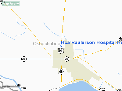
HCA Raulerson Hospital Heliport |
Location
& QuickFacts
|
FAA Information Effective: |
2007-01-18 |
|
Airport
Identifier: |
26FL |
|
Airport
Status: |
Operational |
|
Longitude/Latitude: |
080-49-49.2180W/27-15-56.1630N
-80.830338/27.265601 (Estimated) |
|
Elevation: |
34 ft / 10.36 m (Estimated) |
|
Land: |
0 acres |
|
From
nearest city: |
1 nautical miles N of Okeechobee, FL |
|
Location: |
Okeechobee County, FL |
|
Magnetic Variation: |
03W (1985) |
Owner
& Manager
|
Ownership: |
Privately owned |
|
Owner: |
Okeechobee Hospital Inc |
|
Address: |
P.o. Box 1307
Okeechobee, FL 34973-1307 |
|
Phone
number: |
813-763-2151 |
|
Manager: |
Gary Cantrell |
|
Address: |
P.o. Box 1307
Okeechobee, FL 34973-1307 |
|
Phone number: |
813-763-2151
EXTENSION 185 |
Airport
Operations and Facilities
|
Airport Use: |
Private
MEDICAL |
|
Segmented
Circle: |
No |
|
Control
Tower: |
No |
|
Lighting
Schedule: |
PHONE REQ
FOR PERIMETER LGTS CALL 813-763-2151 EXT 160. |
|
Sectional
chart: |
Miami |
|
Region: |
ASO - Southern |
|
Boundary
ARTCC: |
ZMA - Miami |
|
Tie-in
FSS: |
PIE - Saint Petersburg |
|
FSS
Toll Free: |
1-800-WX-BRIEF |
|
Runway Information
Helipad H1
|
Dimension: |
40 x 40 ft / 12.2 x 12.2 m |
|
Surface: |
CONC, |
|
|
Runway H1 |
Runway |
|
Traffic
Pattern: |
Left |
Left |
|
Radio Navigation
Aids
|
ID |
Type |
Name |
Ch |
Freq |
Var |
Dist |
|
FPR |
NDB |
Fort Pierce |
|
275.00 |
04W |
27.8 nm |
|
VEP |
NDB |
Vero Beach |
|
392.00 |
04W |
32.5 nm |
|
UTX |
NDB |
United |
|
405.00 |
03W |
34.1 nm |
|
PB |
NDB |
Rubin |
|
356.00 |
03W |
48.1 nm |
|
PHK |
VORTAC |
Pahokee |
101X |
115.40 |
00E |
30.0 nm |
|
VRB |
VORTAC |
Vero Beach |
120X |
117.30 |
04W |
30.8 nm |
|
LBV |
VORTAC |
La Belle |
041X |
110.40 |
01E |
39.9 nm |
|
VRB |
VOT |
Vero Beach |
|
111.00 |
|
32.1 nm |
Remarks
- PRVDD
VFR/PVT USE; ALL APCH/DEP ROUTE OPS ARE FROM 320TO 350 DEGREES; LANDING/TAKEOFF
AREA MARKED; WIND INDICATOR MAINTAINED.
Hca Raulerson Hospital Heliport
Address:
Okeechobee County, FL
Tel:
813-763-2151
Images
and information placed above are from
http://www.airport-data.com/airport/26FL/
We
thank them for the data!
| General
Info |
| Country |
United
States |
| State |
FLORIDA
|
| FAA ID |
26FL
|
| Latitude |
27-15-56.163N
|
| Longitude |
080-49-49.218W
|
| Elevation |
34 feet
|
| Near City |
OKEECHOBEE
|
We don't guarantee the information is fresh and accurate. The data may
be wrong or outdated.
For more up-to-date information please refer to other sources.
|
|


