 |
|
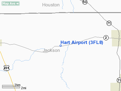
Location
& QuickFacts
|
FAA Information Effective: |
2007-01-18 |
|
Airport
Identifier: |
3FL8 |
|
Airport
Status: |
Operational |
|
Longitude/Latitude: |
085-16-25.7500W/30-56-46.6000N
-85.273819/30.946278 (Estimated) |
|
Elevation: |
125 ft / 38.10 m (Estimated) |
|
Land: |
0 acres |
|
From
nearest city: |
6 nautical miles E of Malone, FL |
|
Location: |
Jackson County, FL |
|
Magnetic Variation: |
02W (1995) |
Owner
& Manager
|
Ownership: |
Privately owned |
|
Address: |
|
|
Address: |
|
Airport
Operations and Facilities
|
Airport Use: |
Private |
|
Segmented
Circle: |
No |
|
Control
Tower: |
No |
|
Sectional
chart: |
New Orleans |
|
Region: |
ASO - Southern |
|
Boundary
ARTCC: |
ZJX - Jacksonville |
|
Tie-in
FSS: |
GNV - Gainesville |
|
FSS
Phone: |
850-377-3291 |
|
FSS
Toll Free: |
1-800-WX-BRIEF |
|
Runway Information
Runway 05/23
|
Dimension: |
2500 x 100 ft / 762.0 x 30.5 m |
|
Surface: |
TURF, |
|
|
Runway 05 |
Runway 23 |
|
Traffic
Pattern: |
Left |
Left |
|
Obstruction: |
|
15 ft pline, 500.0 ft from runway |
|
Radio Navigation
Aids
|
ID |
Type |
Name |
Ch |
Freq |
Var |
Dist |
|
SMY |
NDB |
Soyya |
|
329.00 |
02W |
5.1 nm |
|
BKK |
NDB |
Tri County |
|
275.00 |
02W |
17.8 nm |
|
HYE |
NDB |
Hanchey |
|
221.00 |
00E |
31.8 nm |
|
OZ |
NDB |
Ruckr |
|
212.00 |
00E |
32.6 nm |
|
LOR |
NDB |
Lowe |
|
269.00 |
03W |
34.7 nm |
|
IWJ |
NDB |
Blaak |
|
344.00 |
03W |
38.5 nm |
|
LYZ |
NDB |
Willis |
|
359.00 |
01W |
38.6 nm |
|
BVG |
NDB |
Boll Weevil |
|
352.00 |
03E |
43.4 nm |
|
FYL |
VOR |
Tri County |
|
108.40 |
08W |
18.4 nm |
|
HEY |
VOR |
Hanchey |
|
110.60 |
02E |
32.3 nm |
|
EDN |
VOR |
Enterprise |
|
116.60 |
03W |
38.6 nm |
|
OZR |
VOR/DME |
Cairns |
049X |
111.20 |
02E |
30.3 nm |
|
MAI |
VORTAC |
Marianna |
087X |
114.00 |
00E |
12.3 nm |
|
RRS |
VORTAC |
Wiregrass |
053X |
111.60 |
02E |
21.9 nm |
|
PFN |
VORTAC |
Panama City |
090X |
114.30 |
00W |
48.7 nm |
Remarks
Hart Airport
Address:
Jackson County, FL
Tel:
Images
and information placed above are from
http://www.airport-data.com/airport/3FL8/
We
thank them for the data!
| General
Info |
| Country |
United
States |
| State |
FLORIDA
|
| FAA ID |
3FL8
|
| Latitude |
30-56-46.600N
|
| Longitude |
085-16-25.750W
|
| Elevation |
125 feet
|
| Near City |
MALONE
|
We don't guarantee the information is fresh and accurate. The data may
be wrong or outdated.
For more up-to-date information please refer to other sources.
|
|


