 |
|
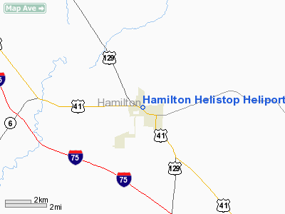
Hamilton Helistop Heliport |
Location
& QuickFacts
|
FAA Information Effective: |
2007-01-18 |
|
Airport
Identifier: |
FA15 |
|
Airport
Status: |
Operational |
|
Longitude/Latitude: |
082-57-23.4850W/30-31-23.7800N
-82.956524/30.523272 (Estimated) |
|
Elevation: |
152 ft / 46.33 m (Estimated) |
|
Land: |
0 acres |
|
From
nearest city: |
1 nautical miles N of Jasper, FL |
|
Location: |
Hamilton County, FL |
|
Magnetic Variation: |
03W (1990) |
Owner
& Manager
|
Ownership: |
Publicly owned |
|
Owner: |
Hamilton County |
|
Address: |
207 Ne 1st Rm 106
Jasper, FL 32052 |
|
Phone
number: |
904-792-1288 |
|
Manager: |
Amelia Tuten |
|
Address: |
Hamilton Co Hospital Box 1300
Jasper, FL 32052 |
|
Phone number: |
904-792-2101 |
Airport
Operations and Facilities
|
Airport Use: |
Private
MEDICAL USE. |
|
Segmented
Circle: |
No |
|
Control
Tower: |
No |
|
Sectional
chart: |
Jacksonville |
|
Region: |
ASO - Southern |
|
Boundary
ARTCC: |
ZJX - Jacksonville |
|
Tie-in
FSS: |
GNV - Gainesville |
|
FSS
on Airport: |
No |
|
FSS
Phone: |
850-377-3291 |
|
FSS
Toll Free: |
1-800-WX-BRIEF |
|
Runway Information
Helipad H1
|
Dimension: |
50 x 50 ft / 15.2 x 15.2 m |
|
Surface: |
CONC, |
|
|
Runway H1 |
Runway |
|
Traffic
Pattern: |
Left |
Left |
|
Radio Navigation
Aids
|
ID |
Type |
Name |
Ch |
Freq |
Var |
Dist |
|
LCQ |
NDB |
Lake City |
|
204.00 |
03W |
28.2 nm |
|
HOE |
NDB |
Homerville |
|
209.00 |
03W |
33.4 nm |
|
FPY |
NDB |
Foley |
|
254.00 |
03W |
45.5 nm |
|
OTK |
VOR/DME |
Valdosta |
095X |
114.80 |
02W |
22.8 nm |
|
TAY |
VORTAC |
Taylor |
076X |
112.90 |
03W |
20.9 nm |
|
VAD |
VORTAC |
Moody |
080X |
113.30 |
03W |
29.0 nm |
|
GEF |
VORTAC |
Greenville |
027X |
109.00 |
01E |
42.8 nm |
|
AYS |
VORTAC |
Waycross |
039X |
110.20 |
00E |
49.4 nm |
Remarks
- VFR;
PRIVATE USE; OPNS ARE CONDUCTED FROM 170 DEGS TO 280 DEGS; AREA IS MARKED
& WIND INDICATOR MAINTAINED.
Hamilton Helistop Heliport
Address:
Hamilton County, FL
Tel:
904-792-1288,
904-792-2101
Images
and information placed above are from
http://www.airport-data.com/airport/FA15/
We
thank them for the data!
| General
Info |
| Country |
United
States |
| State |
FLORIDA
|
| FAA ID |
FA15
|
| Latitude |
30-31-23.780N
|
| Longitude |
082-57-23.485W
|
| Elevation |
152 feet
|
| Near City |
JASPER
|
We don't guarantee the information is fresh and accurate. The data may
be wrong or outdated.
For more up-to-date information please refer to other sources.
|
|


