 |
|
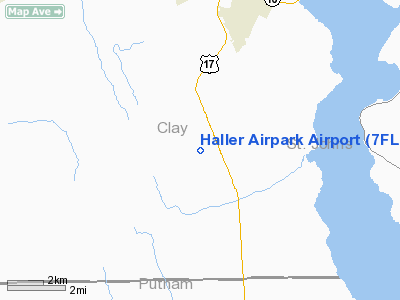
Location
& QuickFacts
|
FAA Information Effective: |
2007-01-18 |
|
Airport
Identifier: |
7FL4 |
|
Airport
Status: |
Operational |
|
Longitude/Latitude: |
081-41-09.3220W/29-54-10.8740N
-81.685923/29.903021 (Estimated) |
|
Elevation: |
75 ft / 22.86 m (Surveyed) |
|
Land: |
0 acres |
|
From
nearest city: |
5 nautical miles S of Green Cove Springs,
FL |
|
Location: |
Clay County, FL |
|
Magnetic Variation: |
03W (1985) |
Owner
& Manager
|
Ownership: |
Privately owned |
|
Owner: |
T&g Aero Inc. |
|
Address: |
5289 Airpark Loop West
Green Cove Springs, FL 32043 |
|
Phone
number: |
904-284-6915 |
|
Manager: |
Vernon Stevenson |
|
Address: |
5403 Airpark Loop W
Cove Springs, FL 32043-8926 |
|
Phone number: |
904-284-6915 |
Airport
Operations and Facilities
|
Airport Use: |
Private |
|
Wind
indicator: |
Yes |
|
Segmented
Circle: |
No |
|
Control
Tower: |
No |
|
Landing
fee charge: |
No |
|
Sectional
chart: |
Jacksonville |
|
Region: |
ASO - Southern |
|
Boundary
ARTCC: |
ZJX - Jacksonville |
|
Tie-in
FSS: |
GNV - Gainesville |
|
FSS
on Airport: |
No |
|
FSS
Phone: |
850-377-3291 |
|
FSS
Toll Free: |
1-800-WX-BRIEF |
|
Runway Information
Runway 18/36
|
Dimension: |
2600 x 72 ft / 792.5 x 21.9 m |
|
Surface: |
TURF, |
|
|
Runway 18 |
Runway 36 |
|
Traffic
Pattern: |
Left |
Left |
|
Radio Navigation
Aids
|
ID |
Type |
Name |
Ch |
Freq |
Var |
Dist |
|
IAK |
NDB |
Palatka |
|
243.00 |
05W |
16.4 nm |
|
HEG |
NDB |
Herlong |
|
332.00 |
02W |
23.4 nm |
|
GN |
NDB |
Wynds |
|
269.00 |
04W |
29.0 nm |
|
EYA |
NDB |
Eastport |
|
357.00 |
03W |
31.5 nm |
|
JA |
NDB |
Dinns |
|
344.00 |
03W |
34.3 nm |
|
LCQ |
NDB |
Lake City |
|
204.00 |
03W |
49.4 nm |
|
NIP |
TACAN |
Jacksonville |
19X |
|
04W |
20.0 nm |
|
NZC |
TACAN |
Cecil/dcmsnd |
088X |
|
04W |
21.4 nm |
|
NRB |
TACAN |
Mayport |
051X |
|
03W |
32.2 nm |
|
VQQ |
VOR |
Cecil |
|
117.90 |
03W |
21.5 nm |
|
SGJ |
VOR/DME |
St Augustine |
031X |
109.40 |
06W |
18.8 nm |
|
CRG |
VORTAC |
Craig |
092X |
114.50 |
03W |
27.7 nm |
|
GNV |
VORTAC |
Gators |
109X |
116.20 |
04W |
33.1 nm |
|
OMN |
VORTAC |
Ormond Beach |
073X |
112.60 |
00E |
46.9 nm |
|
JAX |
VOT |
Jacksonville Intl |
|
111.00 |
|
35.4 nm |
Remarks
- 660'
OVERRUNS SOUTH AND NORTH ENDS OF RWY.
- VFR
PVT USE ONLY.
Based Aircraft
|
Aircraft
based on field: |
40 |
|
Single
Engine Airplanes: |
36 |
|
Multi
Engine Airplanes: |
2 |
|
Ultralights: |
2 |
Haller Airpark Airport
Address:
Clay County, FL
Tel:
904-284-6915
Images
and information placed above are from
http://www.airport-data.com/airport/7FL4/
We
thank them for the data!
| General
Info |
| Country |
United
States |
| State |
FLORIDA
|
| FAA ID |
7FL4
|
| Latitude |
29-54-10.874N
|
| Longitude |
081-41-09.322W
|
| Elevation |
75 feet
|
| Near City |
GREEN
COVE SPRINGS |
We don't guarantee the information is fresh and accurate. The data may
be wrong or outdated.
For more up-to-date information please refer to other sources.
|
|


