 |
|
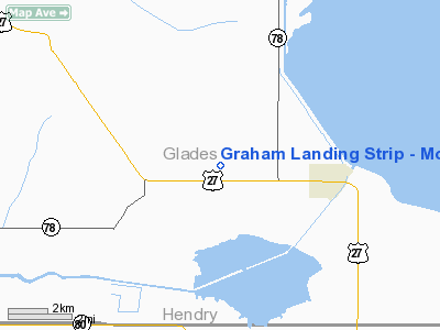
Graham Landing Strip - Moore Haven Airport |
Location
& QuickFacts
|
FAA Information Effective: |
2007-01-18 |
|
Airport
Identifier: |
FL40 |
|
Airport
Status: |
Operational |
|
Longitude/Latitude: |
081-09-06.2490W/26-50-27.2220N
-81.151736/26.840895 (Estimated) |
|
Elevation: |
18 ft / 5.49 m (Surveyed) |
|
Land: |
0 acres |
|
From
nearest city: |
3 nautical miles NW of Moore Haven, FL |
|
Location: |
Glades County, FL |
|
Magnetic Variation: |
03W (1985) |
Owner
& Manager
|
Ownership: |
Privately owned |
|
Owner: |
The Graham Company |
|
Address: |
6843 Main St
Miami Lakes, FL 33014 |
|
Phone
number: |
305-821-1130 |
|
Manager: |
Thomas N. Toms, Ii |
|
Address: |
P.o. Box 1108
Moore Haven, FL 33471 |
|
Phone number: |
813-946-1525 |
Airport
Operations and Facilities
|
Airport Use: |
Private |
|
Wind
indicator: |
Yes |
|
Segmented
Circle: |
No |
|
Control
Tower: |
No |
|
Landing
fee charge: |
No |
|
Sectional
chart: |
Miami |
|
Region: |
ASO - Southern |
|
Boundary
ARTCC: |
ZMA - Miami |
|
Tie-in
FSS: |
MIA - Miami |
|
FSS
on Airport: |
No |
|
FSS
Phone: |
305-233-2600 |
|
FSS
Toll Free: |
1-800-WX-BRIEF |
|
Runway
Information
Runway N/S
|
Dimension: |
3800 x 100 ft / 1158.2 x 30.5 m |
|
Surface: |
TURF, |
|
|
Runway N |
Runway S |
|
Traffic
Pattern: |
Left |
Left |
|
Radio Navigation
Aids
|
ID |
Type |
Name |
Ch |
Freq |
Var |
Dist |
|
UTX |
NDB |
United |
|
405.00 |
03W |
44.0 nm |
|
PGD |
VOR |
Punta Gorda |
|
110.20 |
03W |
45.2 nm |
|
LBV |
VORTAC |
La Belle |
041X |
110.40 |
01E |
12.9 nm |
|
PHK |
VORTAC |
Pahokee |
101X |
115.40 |
00E |
24.9 nm |
|
RSW |
VORTAC |
Lee County |
055X |
111.80 |
02W |
38.4 nm |
Remarks
- OWNER
REQUESTS ARPT BE DELETED FROM ALL CHARTS.
- VFR
WX CONDS; PVT USE.
Based Aircraft
|
Aircraft
based on field: |
2 |
|
Single
Engine Airplanes: |
1 |
|
Multi
Engine Airplanes: |
1 |
Graham Landing Strip - Moore Haven Airport
Address:
Glades County, FL
Tel:
305-821-1130,
813-946-1525
Images
and information placed above are from
http://www.airport-data.com/airport/FL40/
We
thank them for the data!
| General
Info |
| Country |
United
States |
| State |
FLORIDA
|
| FAA ID |
FL40
|
| Latitude |
26-50-27.222N
|
| Longitude |
081-09-06.249W
|
| Elevation |
18 feet
|
| Near City |
MOORE
HAVEN |
We don't guarantee the information is fresh and accurate. The data may
be wrong or outdated.
For more up-to-date information please refer to other sources.
|
|


