|
|
| George T. Lewis Airport |
| IATA: CDK – ICAO: KCDK – FAA LID: CDK |
| Summary |
| Airport type |
Public |
| Owner |
Levy County |
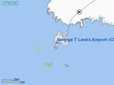
| Location |
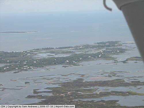
Cedar Key, Florida |
| Elevation AMSL |
11 ft / 3 m |
| Coordinates |
29°08′03″N 083°03′02″W / 29.13417°N 83.05056°W / 29.13417; -83.05056 |
| Runways |
| Direction |
Length |
Surface |
| ft |
m |
| 5/23 |
2,355 |
718 |
Asphalt |
| Statistics (2000) |
| Aircraft operations |
4,000 |
| Source: Federal Aviation Administration |
George T. Lewis Airport (IATA: CDK, ICAO: KCDK, FAA LID: CDK) is a county-owned public-use airport in Levy County, Florida, United States. It is located one nautical mile (1.85 km) west of the central business district of Cedar Key. It was opened in 1936 by the United States military, and it does not have a control tower. History
Formerly used as an air/sea rescue base during and after World War II, the facility was deeded to Levy County. It serves as a basic utility itinerant airport in Levy County for the resort and recreation activities of the City of Cedar Key. Its service area includes Cedar Key and the small communities of Rosewood, Sumner and Vista. It is one of two public airports in the county, the other being Williston Municipal Airport in Williston. It is located approximately 52 miles (84 km) southwest of Gainesville Regional Airport and 43 miles (69 km) west of Ocala International Airport-Jim Taylor Field.
A five year construction plan to improve visual aids at the airport got underway by the Department of Transportation in 1998.
Facilities and aircraft
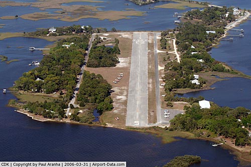
George T. Lewis Airport covers an area of 52 acres (21 ha) at an elevation of 11 feet (3 m) above mean sea level. It has one asphalt paved runway designated 5/23 which measures 2,355 by 100 feet (718 x 30 m). For the 12-month period ending June 30, 2000, the airport had 4,000 general aviation aircraft operations, an average of 10 per day.
The above content comes from Wikipedia and is published under free licenses – click here to read more.
|
 |
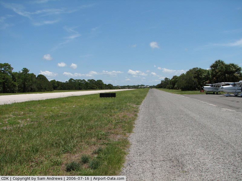
(Click on the photo to enlarge) |
|
 |
(Click on the photo to enlarge) |
|
 |
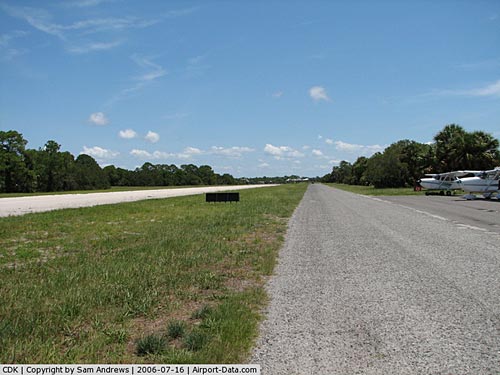
(Click on the photo to enlarge) |
Location
& QuickFacts
|
FAA Information Effective: |
2007-01-18 |
|
Airport
Identifier: |
CDK |
|
Airport
Status: |
Operational |
|
Longitude/Latitude: |
083-02-59.4370W/29-08-15.8820N
-83.049844/29.137745 (Estimated) |
|
Elevation: |
7 ft / 2.13 m (Surveyed) |
|
Land: |
40 acres |
|
From
nearest city: |
1 nautical miles W of Cedar Key, FL |
|
Location: |
Levy County, FL |
|
Magnetic Variation: |
02W (1985) |
Owner
& Manager
|
Ownership: |
Publicly owned |
|
Owner: |
County Of Levy
CTC BILLY COBB. |
|
Address: |
Po Box 306
Bronson, FL 32621 |
|
Phone
number: |
352-486-4311 |
|
Manager: |
Henry Coulter |
|
Address: |
Po Box 294
Cedar Key, FL 32625 |
|
Phone number: |
352-543-5508 |
Airport
Operations and Facilities
|
Airport Use: |
Open to public |
|
Wind
indicator: |
Yes
WINDSOCK ON NON-FRANGIBLE POLE. |
|
Segmented
Circle: |
Yes |
|
Control
Tower: |
No |
|
Lighting
Schedule: |
DUSK-DAWN
ACTVT MIRL RY 05/23 - CTAF. |
|
Beacon
Color: |
Clear-Green (lighted land airport)
ARPT BCN OTS INDEFLY. |
|
Landing
fee charge: |
No |
|
Sectional
chart: |
Jacksonville |
|
Region: |
ASO - Southern |
|
Boundary
ARTCC: |
ZJX - Jacksonville |
|
Responsible
ARTCC: |
ZJX - Jacksonville |
|
Tie-in
FSS: |
GNV - Gainesville |
|
FSS
on Airport: |
No |
|
FSS
Phone: |
850-377-3291 |
|
FSS
Toll Free: |
1-800-WX-BRIEF |
|
NOTAMs
Facility: |
GNV (NOTAM-d service avaliable) |
|
Federal Agreements: |
NGY |
Airport
Communications
Airport
Services
|
Airframe Repair: |
NONE |
|
Power Plant Repair: |
NONE |
|
Bottled
Oxygen: |
NONE |
|
Bulk
Oxygen: |
NONE |
|
Runway Information
Runway 05/23
|
Dimension: |
2355 x 100 ft / 717.8 x 30.5 m |
|
Surface: |
ASPH, Fair Condition |
|
Weight
Limit: |
Single wheel: 12500 lbs. |
|
Edge
Lights: |
Medium |
|
|
Runway 05 |
Runway 23 |
|
Traffic
Pattern: |
Left |
Left |
|
Markings: |
Basic, Poor Condition
RY 05/23 MARKINGS FADED. |
Basic, Poor Condition |
|
Displaced
threshold: |
0.00
ft |
338.00 ft |
|
Radio Navigation
Aids
|
ID |
Type |
Name |
Ch |
Freq |
Var |
Dist |
|
CTY |
VORTAC |
Cross City |
057X |
112.00 |
02W |
27.7 nm |
|
OCF |
VORTAC |
Ocala |
084X |
113.70 |
00E |
43.3 nm |
Remarks
- < ON GULLS>
- TWY
CLSD TO ACFT, USED AS PUBLIC ROAD.
- TREES
IN TRANSITION SFC ON BOTH SIDES OF RY.
- EXISTED
PRIOR TO 1959.
Based Aircraft
|
Aircraft
based on field: |
3 |
|
Single
Engine Airplanes: |
3 |
Operational Statistics
Time Period: 1999-07-02
- 2000-06-30
|
Aircraft
Operations: |
77/Week |
|
General
Aviation Local: |
25.0% |
|
General
Aviation Itinerant: |
75.0% |
George T Lewis Airport
Address:
Levy County, FL
Tel:
352-486-4311,
352-543-5508
Images
and information placed above are from
http://www.airport-data.com/airport/CDK/
We
thank them for the data!
| General
Info |
| Country |
United
States |
| State |
FLORIDA
|
| FAA ID |
CDK
|
| Latitude |
29-08-15.882N
|
| Longitude |
083-02-59.437W
|
| Elevation |
7 feet
|
| Near City |
CEDAR
KEY |
We don't guarantee the information is fresh and accurate. The data may
be wrong or outdated.
For more up-to-date information please refer to other sources.
|
|