 |
|
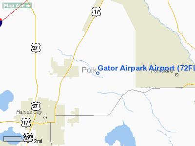
Location
& QuickFacts
|
FAA Information Effective: |
2007-01-18 |
|
Airport
Identifier: |
72FL |
|
Airport
Status: |
Operational |
|
Longitude/Latitude: |
081-34-05.2680W/28-09-27.0560N
-81.568130/28.157516 (Estimated) |
|
Elevation: |
68 ft / 20.73 m (Estimated) |
|
Land: |
0 acres |
|
From
nearest city: |
10 nautical miles SE of St Cloud, FL |
|
Location: |
Osceola County, FL |
|
Magnetic Variation: |
02W (1990) |
Owner
& Manager
|
Ownership: |
Privately owned |
|
Owner: |
Albritton Airstrip Trust |
|
Address: |
4470 Runway Ln
Saint Cloud, FL 34772 |
|
Phone
number: |
407-892-1705 |
|
Manager: |
Carlton D. Johns Trustee |
|
Address: |
4470 Runway Ln
Saint Cloud, FL 34772 |
|
Phone number: |
407-892-1705 |
Airport
Operations and Facilities
|
Airport Use: |
Private |
|
Segmented
Circle: |
No |
|
Control
Tower: |
No |
|
Sectional
chart: |
Jacksonville |
|
Region: |
ASO - Southern |
|
Boundary
ARTCC: |
ZMA - Miami |
|
Tie-in
FSS: |
PIE - Saint Petersburg |
|
FSS
Toll Free: |
1-800-WX-BRIEF |
|
Runway Information
Runway 09/27
|
Dimension: |
2000 x 200 ft / 609.6 x 61.0 m |
|
Surface: |
TURF, |
|
|
Runway 09 |
Runway 27 |
|
Traffic
Pattern: |
Left |
Left |
|
Radio Navigation
Aids
|
ID |
Type |
Name |
Ch |
Freq |
Var |
Dist |
|
ISM |
NDB |
Kissimmee |
|
329.00 |
05W |
10.6 nm |
|
RHZ |
NDB |
Zephyrhills |
|
253.00 |
03W |
31.5 nm |
|
PCM |
NDB |
Plant City |
|
346.00 |
02W |
32.6 nm |
|
SFB |
NDB |
Sanford |
|
408.00 |
05W |
41.4 nm |
|
LEE |
NDB |
Leesburg |
|
335.00 |
04W |
41.7 nm |
|
CHN |
NDB |
Wauchula |
|
261.00 |
04W |
42.4 nm |
|
SQT |
NDB |
Satellite |
|
257.00 |
03W |
46.1 nm |
|
GGL |
NDB |
Geiger Lake |
|
375.00 |
05W |
47.6 nm |
|
COI |
NDB |
Merritt Island |
|
247.00 |
05W |
47.9 nm |
|
TPF |
NDB |
Knight |
|
270.00 |
02W |
49.3 nm |
|
MLB |
VOR/DME |
Melbourne |
037X |
110.00 |
02W |
49.5 nm |
|
LAL |
VORTAC |
Lakeland |
107X |
116.00 |
01E |
25.8 nm |
|
ORL |
VORTAC |
Orlando |
059X |
112.20 |
00E |
26.2 nm |
Remarks
- PRVDD
VFR; PR USE; & LLOA WITH GENTRY APT.
Based Aircraft
|
Aircraft
based on field: |
6 |
|
Single
Engine Airplanes: |
6 |
Gator Airpark Airport
Address:
Osceola County, FL
Tel:
407-892-1705
Images
and information placed above are from
http://www.airport-data.com/airport/72FL/
We
thank them for the data!
| General
Info |
| Country |
United
States |
| State |
FLORIDA
|
| FAA ID |
72FL
|
| Latitude |
28-09-27.056N
|
| Longitude |
081-34-05.268W
|
| Elevation |
68 feet
|
| Near City |
ST CLOUD
|
We don't guarantee the information is fresh and accurate. The data may
be wrong or outdated.
For more up-to-date information please refer to other sources.
|
|


