 |
|
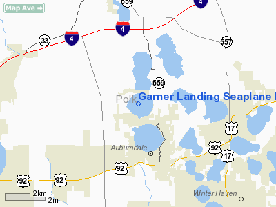
Garner Landing Seaplane Base |
Location
& QuickFacts
|
FAA Information Effective: |
2007-01-18 |
|
Airport
Identifier: |
1FL0 |
|
Airport
Status: |
Operational |
|
Longitude/Latitude: |
081-48-21.2800W/28-06-13.0600N
-81.805911/28.103628 (Estimated) |
|
Elevation: |
147 ft / 44.81 m (Estimated) |
|
Land: |
0 acres |
|
From
nearest city: |
3 nautical miles S of Auburndale, FL |
|
Location: |
Polk County, FL |
|
Magnetic Variation: |
04W (1995) |
Owner
& Manager
|
Ownership: |
Privately owned |
|
Owner: |
Russell T. & Louise A. Garner |
|
Address: |
817 Arietta Drive
Auburndale, FL 33823 |
|
Phone
number: |
941-968-9898 |
|
Manager: |
Russell T. & Louise A. Garner |
|
Address: |
817 Arietta Drive
Auburndale, FL 33823 |
|
Phone number: |
941-968-9898 |
Airport
Operations and Facilities
|
Airport Use: |
Private |
|
Segmented
Circle: |
No |
|
Control
Tower: |
No |
|
Sectional
chart: |
Jacksonville |
|
Region: |
ASO - Southern |
|
Boundary
ARTCC: |
ZMA - Miami |
|
Tie-in
FSS: |
PIE - Saint Petersburg |
|
FSS
Toll Free: |
1-800-WX-BRIEF |
|
Runway Information
Runway 04W/22W
|
Dimension: |
5250 x 100 ft / 1600.2 x 30.5 m |
|
Surface: |
WATER, |
|
|
Runway 04W |
Runway 22W |
|
Traffic
Pattern: |
Left |
Left |
|
Runway 11W/29W
|
Dimension: |
5250 x 100 ft / 1600.2 x 30.5 m |
|
Surface: |
WATER, |
|
|
Runway 11W |
Runway 29W |
|
Traffic
Pattern: |
Left |
Left |
|
Radio Navigation
Aids
|
ID |
Type |
Name |
Ch |
Freq |
Var |
Dist |
|
PCM |
NDB |
Plant City |
|
346.00 |
02W |
19.6 nm |
|
RHZ |
NDB |
Zephyrhills |
|
253.00 |
03W |
20.0 nm |
|
ISM |
NDB |
Kissimmee |
|
329.00 |
05W |
22.6 nm |
|
CHN |
NDB |
Wauchula |
|
261.00 |
04W |
35.9 nm |
|
TPF |
NDB |
Knight |
|
270.00 |
02W |
36.4 nm |
|
AM |
NDB |
Picny |
|
388.00 |
02W |
41.9 nm |
|
LEE |
NDB |
Leesburg |
|
335.00 |
04W |
43.0 nm |
|
MCF |
TACAN |
Macdill |
047X |
|
04W |
40.3 nm |
|
LAL |
VORTAC |
Lakeland |
107X |
116.00 |
01E |
13.1 nm |
|
ORL |
VORTAC |
Orlando |
059X |
112.20 |
00E |
36.3 nm |
|
PIE |
VORTAC |
St Petersburg |
111X |
116.40 |
01E |
48.1 nm |
|
TPA |
VOT |
Tampa Intl |
|
111.00 |
|
39.3 nm |
Remarks
- 295
FT AGL (667 FT MSL) TOWER 1 NM NORTHWEST & 310 FT AGL (475 FT MSL)
TOWER 1.5 NM SOUTHWEST OF SEAPLANE BASE.
- PRVDD
VFR, PVT USE.
Garner Landing Seaplane Base
Address:
Polk County, FL
Tel:
941-968-9898
Images
and information placed above are from
http://www.airport-data.com/airport/1FL0/
We
thank them for the data!
| General
Info |
| Country |
United
States |
| State |
FLORIDA
|
| FAA ID |
1FL0
|
| Latitude |
28-06-13.060N
|
| Longitude |
081-48-21.280W
|
| Elevation |
147 feet
|
| Near City |
AUBURNDALE
|
We don't guarantee the information is fresh and accurate. The data may
be wrong or outdated.
For more up-to-date information please refer to other sources.
|
|


