 |
|
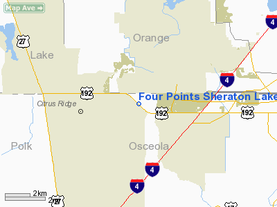
Four Points Sheraton Lakeside Heliport |
Location
& QuickFacts
|
FAA Information Effective: |
2007-01-18 |
|
Airport
Identifier: |
FA48 |
|
Airport
Status: |
Operational |
|
Longitude/Latitude: |
081-35-43.2660W/28-20-22.0330N
-81.595352/28.339454 (Estimated) |
|
Elevation: |
110 ft / 33.53 m (Estimated) |
|
Land: |
0 acres |
|
From
nearest city: |
12 nautical miles NW of Kissimmee, FL |
|
Location: |
Osceola County, FL |
|
Magnetic Variation: |
03W (1990) |
Owner
& Manager
|
Ownership: |
Privately owned |
|
Owner: |
Four Points Sheraton Lakeside |
|
Address: |
7769 W. Irlo Bronson Meml Hwy
Kissimmee, FL 34747 |
|
Phone number: |
407-396-2222 |
|
Manager: |
Michael Webb |
|
Address: |
820 Woodmeade Court
Orlando, FL 32828 |
|
Phone number: |
407-282-5397 |
Airport
Operations and Facilities
|
Airport Use: |
Private |
|
Segmented
Circle: |
No |
|
Control
Tower: |
No |
|
Sectional
chart: |
Jacksonville |
|
Region: |
ASO - Southern |
|
Boundary
ARTCC: |
ZJX - Jacksonville |
|
Tie-in
FSS: |
PIE - Saint Petersburg |
|
FSS
Toll Free: |
1-800-WX-BRIEF |
|
Runway Information
Helipad H1
|
Dimension: |
36 x 36 ft / 11.0 x 11.0 m |
|
Surface: |
CONC, |
|
|
Runway H1 |
Runway |
|
Traffic
Pattern: |
Left |
Left |
|
Radio Navigation
Aids
|
ID |
Type |
Name |
Ch |
Freq |
Var |
Dist |
|
ISM |
NDB |
Kissimmee |
|
329.00 |
05W |
9.0 nm |
|
RHZ |
NDB |
Zephyrhills |
|
253.00 |
03W |
30.5 nm |
|
LEE |
NDB |
Leesburg |
|
335.00 |
04W |
30.9 nm |
|
SFB |
NDB |
Sanford |
|
408.00 |
05W |
32.6 nm |
|
PCM |
NDB |
Plant City |
|
346.00 |
02W |
36.0 nm |
|
GGL |
NDB |
Geiger Lake |
|
375.00 |
05W |
43.9 nm |
|
DED |
NDB |
Deland/dcmsnd |
|
201.00 |
05W |
46.9 nm |
|
COI |
NDB |
Merritt Island |
|
247.00 |
05W |
48.0 nm |
|
SQT |
NDB |
Satellite |
|
257.00 |
03W |
49.5 nm |
|
ORL |
VORTAC |
Orlando |
059X |
112.20 |
00E |
18.4 nm |
|
LAL |
VORTAC |
Lakeland |
107X |
116.00 |
01E |
30.7 nm |
Remarks
- PRVDD
PR USE; APCH/DEP RTE OPS FM 150 TO 170 & FM 290 TO 310; LDG/TKOF
AREA MKD; & WIND INDICATOR MAINTAINED.
Four Points Sheraton Lakeside Heliport
Address:
Osceola County, FL
Tel:
407-396-2222, 407-282-5397
Images
and information placed above are from
http://www.airport-data.com/airport/FA48/
We
thank them for the data!
| General
Info |
| Country |
United
States |
| State |
FLORIDA
|
| FAA ID |
FA48
|
| Latitude |
28-20-22.033N
|
| Longitude |
081-35-43.266W
|
| Elevation |
110 feet
|
| Near City |
KISSIMMEE
|
We don't guarantee the information is fresh and accurate. The data may
be wrong or outdated.
For more up-to-date information please refer to other sources.
|
|


