 |
|
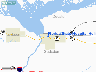
Florida State Hospital Heliport |
Location
& QuickFacts
|
FAA
Information Effective: |
2007-01-18 |
|
Airport
Identifier: |
31FD |
|
Airport
Status: |
Operational |
|
Longitude/Latitude: |
084-50-32.7130W/30-42-22.6890N
-84.842420/30.706302 (Estimated) |
|
Elevation: |
235 ft / 71.63 m (Estimated) |
|
Land: |
1 acres |
|
From
nearest city: |
0 nautical miles N of Chattahoochee, FL |
|
Location: |
Gadsden County, FL |
|
Magnetic Variation: |
01W (1985) |
Owner & Manager
|
Ownership: |
Publicly owned |
|
Owner: |
Florida State Hospital |
|
Address: |
Po Box 1000
Chattahoochee, FL 32324 |
|
Phone number: |
904-663-7536 |
|
Manager: |
Gordon Lewis |
|
Address: |
Po Box 1000
Chattahoochee, FL 32324 |
|
Phone number: |
904-663-7108 |
Airport
Operations and Facilities
|
Airport
Use: |
Private
MEDICAL USE. |
|
Wind
indicator: |
Yes |
|
Segmented Circle: |
No |
|
Control
Tower: |
No |
|
Sectional chart: |
Jacksonville |
|
Region: |
ASO - Southern |
|
Boundary
ARTCC: |
ZJX - Jacksonville |
|
Tie-in
FSS: |
GNV - Gainesville |
|
FSS
on Airport: |
No |
|
FSS
Phone: |
850-377-3291 |
|
FSS
Toll Free: |
1-800-WX-BRIEF |
|
Runway Information
Helipad H1
|
Dimension: |
20
x 20 ft / 6.1 x 6.1 m |
|
Surface: |
TURF, |
|
|
Runway H1 |
Runway |
|
Traffic
Pattern: |
Left |
Left |
|
Radio Navigation
Aids
|
ID |
Type |
Name |
Ch |
Freq |
Var |
Dist |
|
SMY |
NDB |
Soyya |
|
329.00 |
02W |
22.1 nm |
|
LYZ |
NDB |
Willis |
|
359.00 |
01W |
22.9 nm |
|
TL |
NDB |
Wakul |
|
379.00 |
01W |
33.9 nm |
|
CYR |
NDB |
Caidy |
|
338.00 |
01W |
36.9 nm |
|
BKK |
NDB |
Tri County |
|
275.00 |
02W |
40.2 nm |
|
CXU |
NDB |
Camilla |
|
369.00 |
02W |
43.7 nm |
|
IWJ |
NDB |
Blaak |
|
344.00 |
03W |
45.1 nm |
|
FYL |
VOR |
Tri County |
|
108.40 |
08W |
40.4 nm |
|
MAI |
VORTAC |
Marianna |
087X |
114.00 |
00E |
15.3 nm |
|
SZW |
VORTAC |
Seminole |
122X |
117.50 |
02E |
25.9 nm |
|
RRS |
VORTAC |
Wiregrass |
053X |
111.60 |
02E |
46.1 nm |
|
TLH |
VOT |
Tallahassee Muni |
|
111.00 |
|
31.2 nm |
Remarks
- PRVDD
OPNS ARE CONDUCTED IN VFR WX CONDS; LNDGS ARE PVT USE; APCH/DEP ROUTE
HELICOPTER OPNS CONDUCTED IN AN AREA FM 310 DEGREE CLOCKWISE TO 100
DEGREE USING THE TOUCHDOWN PAD AS THE CNTR OF THE COMPASS ROSE; WIND
INDICATOR IS MAINTAINED.
Florida State Hospital Heliport
Address:
Gadsden County, FL
Tel:
904-663-7536, 904-663-7108
Images
and information placed above are from
http://www.airport-data.com/airport/31FD/
We
thank them for the data!
| General
Info |
| Country |
United
States |
| State |
FLORIDA
|
| FAA ID |
31FD
|
| Latitude |
30-42-22.689N
|
| Longitude |
084-50-32.713W
|
| Elevation |
235 feet
|
| Near City |
CHATTAHOOCHEE
|
We don't guarantee the information is fresh and accurate. The data may
be wrong or outdated.
For more up-to-date information please refer to other sources.
|
|


